Viewpoints · Central Scotland
Dryhope Tower
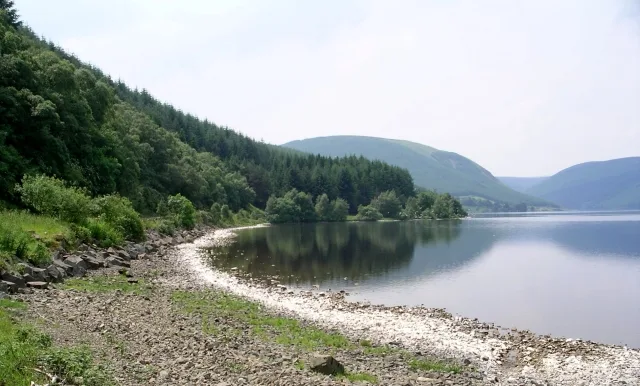
Dryhope Tower is a viewpoint in the United Kingdom.

Mary and Angus Hogg — CC BY-SA 2.0 via Wikimedia Commons licence
Plan your visit
- Typical visit
- 20 min–45 min
- Best time of year
- Clear days year-round
- Free entry
- Dog-friendly
About
Dryhope Tower is a named viewpoint in the United Kingdom. Coordinates: 55.5108°, -3.1616°. This entry is part of The Great Britain Guide, a free, ad-free, open-data tourist directory.
Photo gallery
From the Wikipedia article
Dryhope Tower is a ruined Scottish peel tower in the valley of the Yarrow Water, in the historic county of Selkirkshire, now part of the Scottish Borders. It lies approximately equidistant between the burghs of Moffat and Selkirk, and defended the north eastern end of St Mary's Loch. The site itself was protected on two sides, to the east by the Dryhope Burn and to the west by the Kirkstead Burn.
Excerpt from Wikipedia under CC BY-SA 4.0. See the source article linked in Sources below.
Background
History
The tower was likely to have been raised according to a statute of the Parliament of Scotland in 1535, that required large landholders in the Borderlands to build barmkins of stone and lime, sixty square feet in area and with walls of one ell thickness and six ells in height for the resett and defense of him, his tennents, and his gudis in troublous tyme. The castle belonged to the Scotts of Dryhope, and a daughter of the House, Mary Scott was known as the "Flower of Yarrow" and was also an ancestor of Sir Walter Scott. Mary was given in marriage to Wat Scott of Kirkhope, a notorious Border Reiver. The property passed to Wat Scott's family, the Scotts of Harden, and Scott took possession of…
Architecture
Built of local stone, Dryhope Tower was originally a four storey building, with the first two storeys of vaulted construction. The tower rests within the remains of a barmkin which also contained other buildings.
Sourced from Wikipedia under CC BY-SA 4.0.
- Coordinates
- 55.5108, -3.1616
- District
- Scottish Borders
- Postcode
- TD7 5LF
- Parliamentary constituency
- Berwickshire, Roxburgh and Selkirk
Sources
- osm: n9813163740 (ODbL)
- wikipedia: Dryhope Tower (CC BY-SA 4.0)
Other places nearby
Loading nearby places…
Nearby
 📷 3
📷 3Historic churches · Central Scotland
St Marys Kirk Yard
St Marys Kirk Yard — a other in scotland-central, United Kingdom.
 📷 3
📷 3Natural landmarks · Scottish Lowlands
St Mary's Loch
St Mary's Loch — lake in Scottish Borders, Scotland, UK, outflows to Yarrow Water.
B&Bs · Scottish Lowlands
Capperkirk
Capperkirk — a bed-and-breakfast in scotland lowlands.
 📷 3
📷 3Public art & sculpture · Scottish Lowlands
Shinglehook
Shinglehook — a public art in scotland-lowlands, United Kingdom.
 📷 5
📷 5Historic bridges · Central Scotland
Mountbenger Bridge
Mountbenger Bridge — category C listed building-listed bridge in scotland-central, United Kingdom.
Campsites · Scottish Lowlands
Tibbie Shiels
Tibbie Shiels — a campsite in scotland lowlands.
More viewpoints in this region
 📷 3
📷 3Viewpoints · Central Scotland
1745 Battlefield Viewpoint
1745 Battlefield Viewpoint is a viewpoint in the United Kingdom.
 📷 3
📷 3Viewpoints · Central Scotland
Aidans Brae Viewpoint
Aidans Brae Viewpoint is a viewpoint in the United Kingdom.
 📷 3
📷 3Viewpoints · Central Scotland
Alloa Dock
Alloa Dock is a viewpoint in the United Kingdom.
 📷 3
📷 3Viewpoints · Central Scotland
Altarstanes
Altarstanes is a viewpoint in the United Kingdom.
Frequently asked questions
- Where is Dryhope Tower?
- Dryhope Tower is in central Scotland, United Kingdom (postcode TD7 5LF).
- Is Dryhope Tower free to visit?
- Yes, Dryhope Tower is free to enter.
- How do I get to Dryhope Tower?
- Drivers can navigate to postcode TD7 5LF. It sits within the Berwickshire, Roxburgh and Selkirk parliamentary constituency.