Quarries · Mid Wales
Dolgoch quarry
Dolgoch quarry — former minor slate quarry in Mid-Wales.

Wikimedia Commons contributors — see linked file page for photographer and licence licence
Plan your visit
- Typical visit
- 45 min–1.5 h
- Nearest railway station
- Dolgoch · 0.2 km
About
Dolgoch quarry is a quarry in the United Kingdom. Wikidata describes it as: "former minor slate quarry in Mid-Wales". Coordinates: 52.6201°, -3.9943°.
Photo gallery
From the Wikipedia article
Dolgoch slate quarry (also spelt Dol-goch slate quarry or Dol-gôch slate quarry) was a slate quarry in Mid Wales, approximately halfway between Bryn-crug and Abergynolwyn (4 miles (6.4 km) away from each of them). The quarry was named after a nearby stream, the Nant Dolgoch (then known as the Nant Dol-gôch). 'Dol goch' is Welsh for 'red meadow'. The slate at Dolgoch is described as silver-grey in colour; this is very similar to the slate from Bryn Eglwys quarry and the quarries around Corris. Although the quarry had favourable transportation arrangements compared to many quarries in the area, it was never worked on a significant scale, and was short-lived – opening in 1877 and closing in 1884.
Excerpt from Wikipedia under CC BY-SA 4.0. See the source article linked in Sources below.
Background
Description
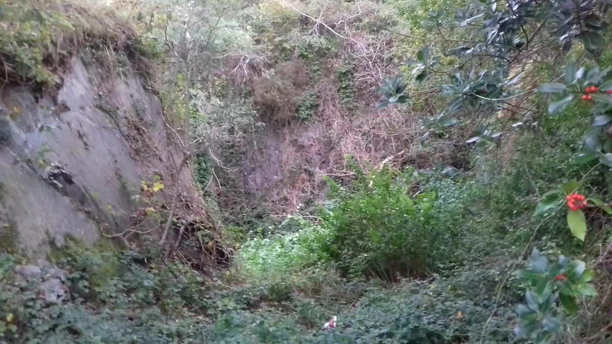
There are four adits at Dolgoch; they are located between SH652044 and SH655043. Adit 1 is located close to the Lower Dolgoch Falls. It is approximately 100 ft long and dog-legs to the right slightly, ending at a chamber that is open to the sky, but fenced off for safety. The other three adits are on the level above the Lower Falls, and along the walkway to the Middle Dolgoch Falls. Adit 2 is very wet for most of its length, although it gets drier towards the end. It is approximately 314 feet long and bends towards the left slightly as you go in. Adit 3 is the shortest, as it is only 52 feet long. Adit 4 is the longest and most complexly-shaped. It twists and turns mostly to the left until,…
Sourced from Wikipedia under CC BY-SA 4.0.
- Coordinates
- 52.6201, -3.9943
- District
- Gwynedd
- Parish
- Bryn-crug
- Postcode
- LL36 9UW
- Parliamentary constituency
- Dwyfor Meirionnydd
- Nearest railway station
- Dolgoch — 0.2 km
Sources
- wikidata: Q85757314 (CC0)
- wikipedia: Dolgoch quarry, Gwynedd (CC BY-SA 4.0)
- commons: Adit, Dolgoch - geograph.org.uk - 1317299.jpg (CC BY-SA 4.0)
Other places nearby
Loading nearby places…
Nearby
 📷 3
📷 3Heritage railways · Mid Wales
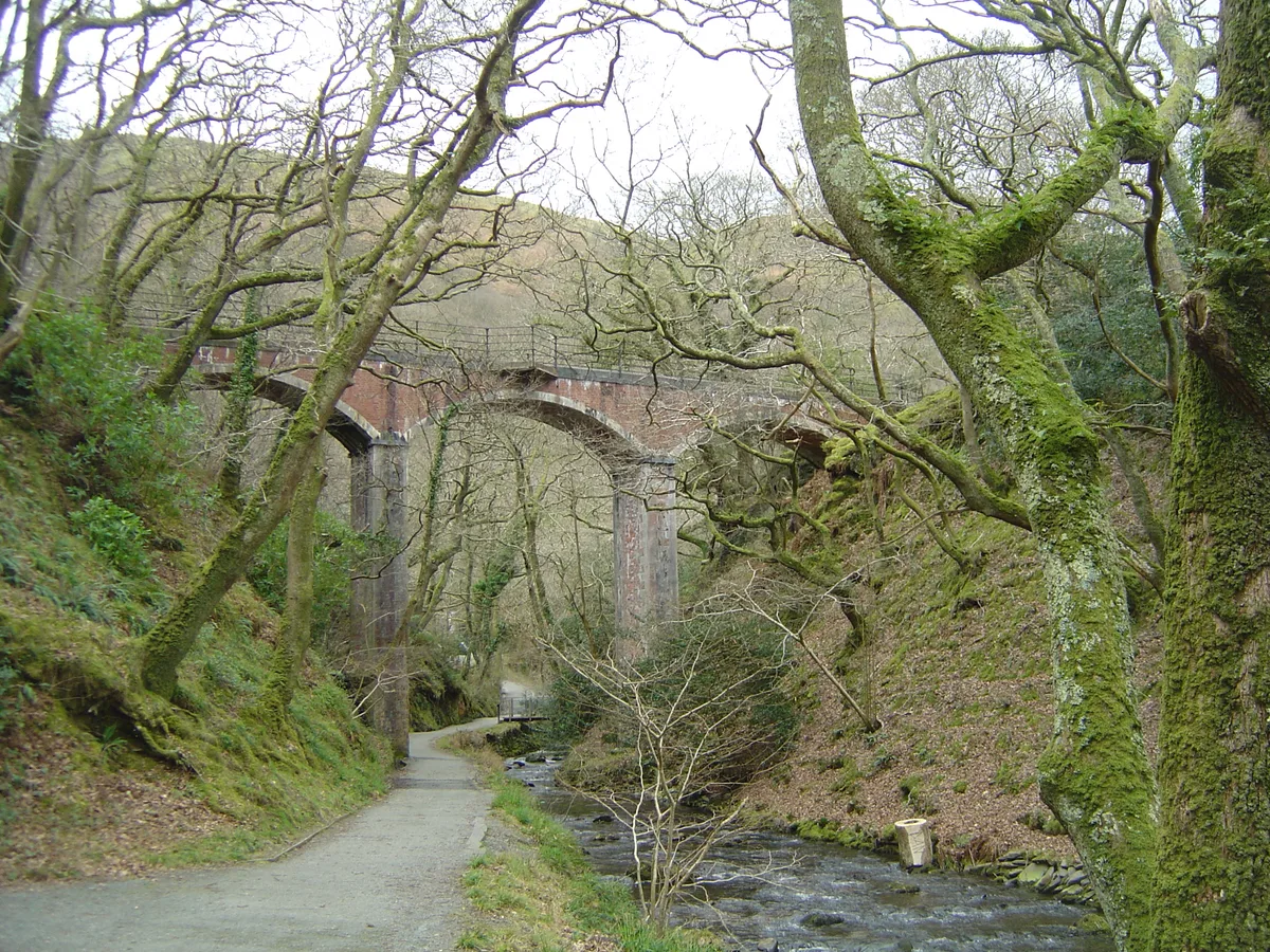
Dolgoch Viaduct
Dolgoch Viaduct is a heritage railway in the United Kingdom.
 📷 4
📷 4Historic bridges · Mid Wales
Dolgoch railway station
Dolgoch railway station in Wales Mid, United Kingdom.
 📷 5
📷 5Caves · Mid Wales
Dolgoch Falls
Dolgoch Falls in Wales Mid, United Kingdom.
 📷 3
📷 3Natural landmarks · Mid Wales
Quarry Siding Halt
Quarry Siding Halt in Wales Mid, United Kingdom.
 📷 5
📷 5Mountains & hills · Mid Wales
Pen Coed-y-gof
Pen Coed-y-gof — a mountain in wales-mid, United Kingdom, 217 m.
 📷 3
📷 3Mountains & hills · Mid Wales
Pen Trum-gŵr
Pen Trum-gŵr — Named summit at 512 m.
More places in this region
 📷 3
📷 3Quarries · Mid Wales
Frongoch quarry
Frongoch quarry — Disused slate quarry near Aberdyfi, in Mid-Wales, UK.
_-_geograph.org.uk_-_1166941.jpg?width=1200) 📷 3
📷 3Quarries · Mid Wales
Abercwmeiddaw quarry
Abercwmeiddaw quarry — former Welsh slate quarry.
 📷 3
📷 3Quarries · Mid Wales
Allt Goch quarry
Allt Goch quarry — Slate quarry near Cwrt-Newydd, Ceredigion (formerly Cardiganshire), Wales, United Kingdom.
 📷 3
📷 3Quarries · Mid Wales
Braichgoch Slate Mine
Braichgoch Slate Mine — mine in the United Kingdom.
Frequently asked questions
- Where is Dolgoch quarry?
- Dolgoch quarry is in Mid Wales, in the United Kingdom — coordinates 52.6201°, -3.9943°. The nearest railway station is Dolgoch, around 0.2 km away.