Towns & cities · North Wales
Dolbenmaen
Dolbenmaen — village and community in Gwynedd, Wales.

Wikimedia Commons contributors — see linked file page for photographer and licence licence
Plan your visit
- Typical visit
- 3 h–6 h
- Nearest railway station
- Criccieth · 5.6 km
- Free entry
- Family-friendly
- Dog-friendly
About
Dolbenmaen is a town, city, village or settlement in the United Kingdom. Recent population estimates put it at around 1,267 people. Heritage designation: National Monuments of Wales. Address: LL51. Wikidata describes it as: "village and community in Gwynedd, Wales". Coordinates: 52.9680°, -4.2280°.
Photo gallery
From the Wikipedia article
Dolbenmaen () is a village and community in the Welsh county of Gwynedd, located in Eifionydd, of which it was the administrative centre until 1239. The community includes the villages of Bryncir (), Bwlch-derwin, Cenin, Garndolbenmaen, (the largest settlement) Golan, Llanfihangel-y-Pennant, Penmorfa (), Pentrefelin, Wern, Glan-dwyfach, and the hamlet of Prenteg. It has a population of 1,300, increasing slightly to 1,343 at the 2011 Census. The summit of Moel Hebog is shared between Beddgelert and Dolbenmaen. It is a sparsely populated area and covers nearly 100 square kilometres. A castle motte is located to the south of the village which is thought to have been the residence of Llywelyn the Great until the 1230s, when the court moved to a new castle at Criccieth. The castle guarded a ford on the Afon Dwyfor which may have been on the Pen Llystyn (Tremadog) to Segontium Roman road. The parish church of St Mary's is a grade II* listed building. South of Pentrefelin is St Cynhaearn's Church, Ynyscynhaearn.
Excerpt from Wikipedia under CC BY-SA 4.0. See the source article linked in Sources below.
- Coordinates
- 52.9680, -4.2280
- District
- Gwynedd
- Parish
- Dolbenmaen
- Postcode
- LL51
- Parliamentary constituency
- Dwyfor Meirionnydd
- Population
- 1,267
- Nearest railway station
- Criccieth — 5.6 km
Sources
- wikidata: Q990100 (CC0)
- wikipedia: Dolbenmaen (CC BY-SA 4.0)
- commons: Bod Hyfryd - Traditional Welsh Cottage - geograph.org.uk - 257770.jpg (CC BY-SA 4.0)
Other places nearby
Loading nearby places…
Nearby
 📷 3
📷 3Archaeological sites · North Wales
Dolbenmaen Motte
Dolbenmaen Motte — a archaeological in wales-north, United Kingdom.
 📷 5
📷 5Historic houses · North Wales
Castell Caerau
Castell Caerau — a historic house in wales-north, United Kingdom.
📷 5Historic bridges · North Wales
Pont Dolbenmaen
Pont Dolbenmaen — Grade II listed building-listed bridge in wales-north, United Kingdom.
Vineyards · North Wales
Castell Caerau Camp, Gyrn Goch
Castell Caerau Camp, Gyrn Goch — a UK vineyard in wales north, producing English or Welsh wine from cool-climate grape varieties.
Vineyards · North Wales
Craig-y-Tyddyn Camp
Craig-y-Tyddyn Camp — a UK vineyard in wales north, producing English or Welsh wine from cool-climate grape varieties.
 📷 5
📷 5Historic churches · North Wales
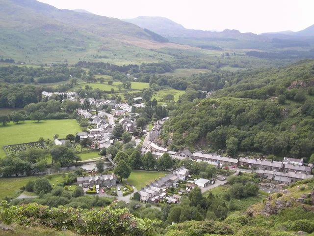
Garndolbenmaen
Garndolbenmaen (nicknamed Garn) is a village in the county of Gwynedd, Wales. It lies near the A487, approximately 6 miles (10 km) north west of Porthmadog, in the community of Dolbenmaen, which has a
More towns in this region
 📷 5
📷 5Towns & cities · North Wales
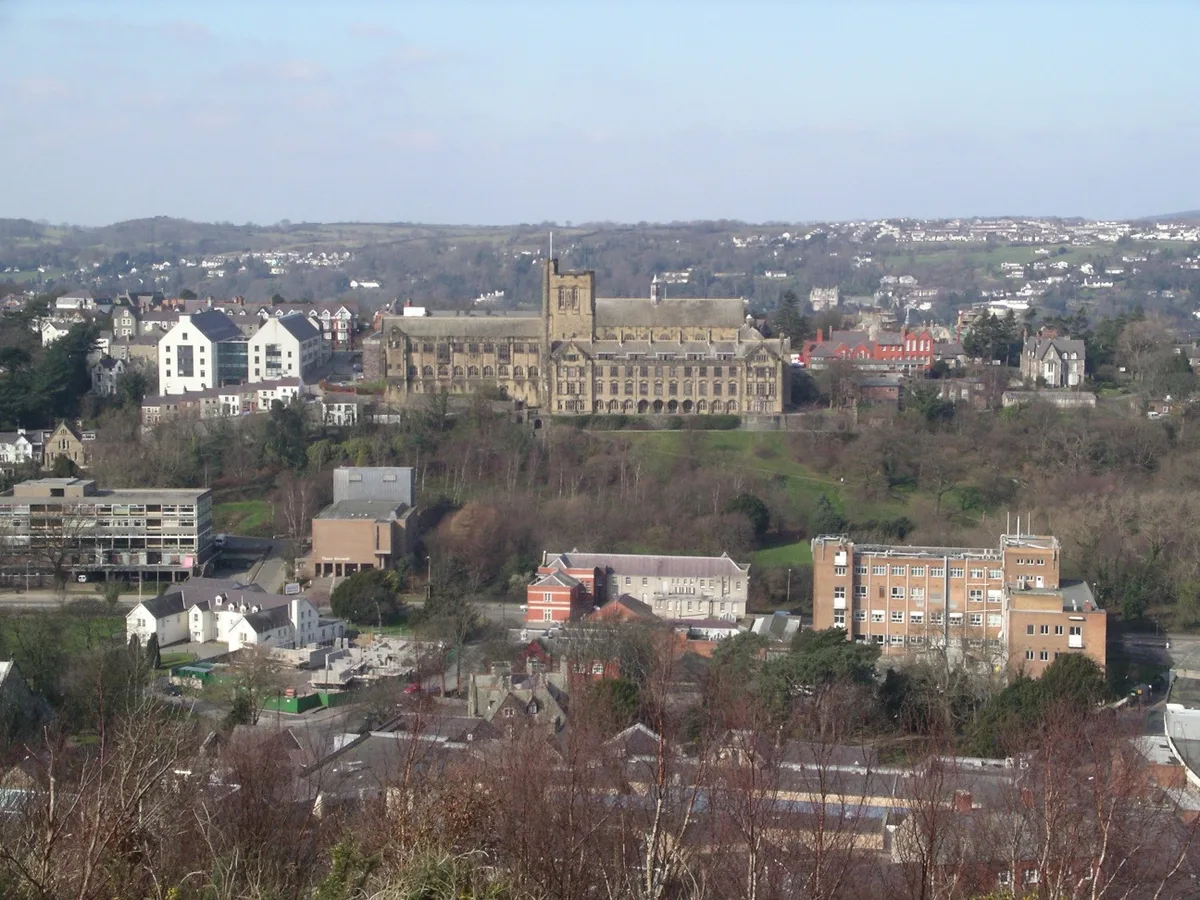
Bangor
Bangor — city in Gwynedd, Wales.
 Flagship📷 3
Towns & cities · North Wales
Beddgelert
Beddgelert — village and community in Gwynedd, Wales.
 Flagship📷 5
Towns & cities · North Wales
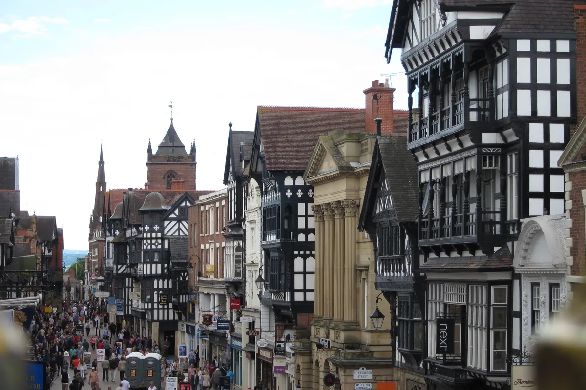
Chester
Chester — city in Cheshire, England.
 Flagship📷 3
Towns & cities · North Wales
Liverpool
Liverpool — city in Merseyside, England, United Kingdom.
Frequently asked questions
- Where is Dolbenmaen?
- Dolbenmaen is in North Wales, United Kingdom (postcode LL51), in the parish of Dolbenmaen.
- Is Dolbenmaen a listed building?
- Dolbenmaen is officially recognised as National Monuments of Wales listed.
- Is Dolbenmaen free to visit?
- Yes, Dolbenmaen is free to enter.
- How do I get to Dolbenmaen?
- The nearest railway station is Criccieth, about 5.6 km away. Drivers can navigate to postcode LL51.