Natural landmarks · North West England
Dodd Fell
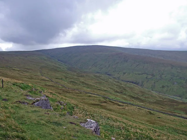
Dodd Fell — hill in North Yorkshire, United Kingdom.

Wikimedia Commons contributors — see linked file page for photographer and licence licence
Plan your visit
- Typical visit
- 1 h–2 h
- Nearest railway station
- Dent · 8.2 km
- Free entry
- Dog-friendly
About
Dodd Fell is a named natural landmark in the United Kingdom. Wikidata describes it as: "hill in North Yorkshire, United Kingdom". Coordinates: 54.2564°, -2.2463°.
Photo gallery
From the Wikipedia article
Dodd Fell Hill is a hill in the Yorkshire Dales, in North Yorkshire, England. It is classed as a Marilyn (a hill with topographic prominence of at least 150 metres (490 ft)) and its summit is at 668 metres (2,192 ft). The flat summit, known as Dodd Fell Hill, is marked by a concrete trig-point. The hill has a lower summit known as Ten End, which is 1.6-kilometre (1 mi) to the north, and slightly lower at 580 metres (1,910 ft) above sea level. The name of Dodd Fell is derived from the Middle English Dodde, and the Old Norse Fjall, meaning the hill with the rounded top. Water flowing off the hill to the north-east forms Duerley Beck, and runs down Sleddale and becomes a tributary of the River Ure. Water flowing to the north runs through Snaizeholme, a side dale of Widdale, and the high ridge between the summit of Dodd Fell and Snaizeholme is traversed by the Pennine Way.
Excerpt from Wikipedia under CC BY-SA 4.0. See the source article linked in Sources below.
- Coordinates
- 54.2564, -2.2463
- Address
- North Yorkshire, England
- Nearest railway station
- Dent — 8.2 km
Sources
- wikidata: Q5287729 (CC0)
- wikipedia: Dodd Fell Hill (CC BY-SA 4.0)
- commons: DoddFell.jpg (CC BY-SA 4.0)
Other places nearby
Loading nearby places…
Nearby
 📷 3
📷 3Mountains & hills · North West England
Dodd Fell Hill
Dodd Fell Hill — Named summit at 668 m.
 📷 3
📷 3Archaeological sites · North West England
Old Coal Pits
Old Coal Pits — a archaeological in england-north-west, United Kingdom.
 📷 3
📷 3Viewpoints · North West England
Red Squirrel viewpoint
Red Squirrel viewpoint is a viewpoint in the United Kingdom.
 📷 3
📷 3Archaeological sites · North West England
possible mine workings?
possible mine workings? — a archaeological in england-north-west, United Kingdom.
 📷 3
📷 3Archaeological sites · North West England
mine workings?
mine workings? — a archaeological in england-north-west, United Kingdom.
 📷 3
📷 3Archaeological sites · North West England
Turgill House
Turgill House — a archaeological in england-north-west, United Kingdom.
More natural landmarks in this region
 ★ Iconic📷 4
Natural landmarks · North West England
Coniston Water
Lake District lake — Swallows and Amazons setting and Donald Campbell water-speed history.
 📷 3
📷 3Natural landmarks · North West England
Elter Water
Elter Water — lake in the United Kingdom.
 📷 3
📷 3Natural landmarks · North West England
Esthwaite Water
Esthwaite Water — lake in the United Kingdom.
 Flagship📷 5
Natural landmarks · North West England
Semerwater
Semerwater — lake in North Yorkshire, England, UK.
Frequently asked questions
- Where is Dodd Fell?
- Dodd Fell is in North West England, in the United Kingdom — coordinates 54.2564°, -2.2463°. The nearest railway station is Dent, around 8.2 km away.
- Is Dodd Fell free to visit?
- Yes — admission to Dodd Fell is free.