Historic churches · South West England
Dobwalls and Trewidland
Dobwalls and Trewidland (Cornish: Fos an Mogh & Trewydhlann) was a civil parish in south-east Cornwall, England, United Kingdom between 1974 and 2021. The parish was bounded to the north by St Neot an

Paul Barnett — CC BY-SA 2.0 via Wikimedia Commons licence
Plan your visit
- Typical visit
- 30 min–1 h
- Free entry
About
Dobwalls and Trewidland (Cornish: Fos an Mogh & Trewydhlann) was a civil parish in south-east Cornwall, England, United Kingdom between 1974 and 2021. The parish was bounded to the north by St Neot and St Cleer parishes, to the east by Liskeard and Menheniot parishes, to the south by Morval parish, to the west by the East Looe River and the parishes of St Pinnock and St Keyne, and to the south-west by Duloe parish. The two largest villages in the parish were Dobwalls and Doublebois, both in the north of the parish. There were several smaller villages in the south of the parish including Trewidland and Horningtops, and the hamlet of Boduel to the north. The hamlets of Coombe, East Tuelmenna, Treburgie and Twelvewoods were also in the parish.
Photo gallery
From the Wikipedia article
Dobwalls and Trewidland (Cornish: Fos an Mogh & Trewydhlann) was a civil parish in south-east Cornwall, England, United Kingdom between 1974 and 2021. The parish was bounded to the north by St Neot and St Cleer parishes, to the east by Liskeard and Menheniot parishes, to the south by Morval parish, to the west by the East Looe River and the parishes of St Pinnock and St Keyne, and to the south-west by Duloe parish. The two largest villages in the parish were Dobwalls and Doublebois, both in the north of the parish. There were several smaller villages in the south of the parish including Trewidland and Horningtops, and the hamlet of Boduel to the north. The hamlets of Coombe, East Tuelmenna, Treburgie and Twelvewoods were also in the parish.
Excerpt from Wikipedia under CC BY-SA 4.0. See the source article linked in Sources below.
Background
History
The parish had its origins in the ancient parish of Liskeard, which covered the town itself and areas to the south and west of it. The municipal borough of Liskeard covered the town, but large parts of the wider parish of Liskeard were outside the borough boundaries. Under the Local Government Act 1894 parishes could no longer straddle borough boundaries and so the parish was split into two parishes: "Liskeard Borough" covering the part within the borough and "Liskeard" covering the rural parts of the parish, including the hamlets of Dobwalls to the west and Trewidland to the south. In 1974 the borough of Liskeard was abolished under the Local Government Act 1972 and a successor parish…
Sourced from Wikipedia under CC BY-SA 4.0.
- Coordinates
- 50.4570, -4.5150
- District
- Cornwall
- Parish
- Dobwalls
- Postcode
- PL14 6JE
- Parliamentary constituency
- South East Cornwall
Sources
- wikipedia: Dobwalls and Trewidland (CC BY-SA 4.0)
Other places nearby
Loading nearby places…
Nearby
📷 3Memorials & monuments · South West England
Dobwalls War Memorial
Dobwalls War Memorial — Grade II listed building-listed memorial in england-south-west, United Kingdom.
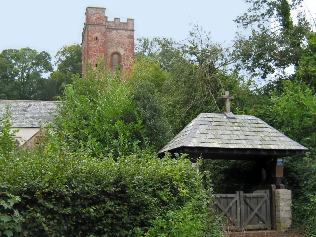
📷 5Historic churches · South West England
Dobwalls
Dobwalls (Cornish: Fos an Mogh) is a village and civil parish in south-east Cornwall, England, United Kingdom. It is situated 3 mi (5 km) west of Liskeard. The name is spelt Dubwalls on Bartholomew's
 📷 5
📷 5Museums · South West England
Dobwalls Adventure Park
Dobwalls Adventure Park was a family-run visitor attraction in the village of Dobwalls, near Liskeard, Cornwall. Founded in 1970 by John Southern, the park was one of Cornwall's top visitor attraction
 📷 3
📷 3Historic houses · South West England
Bosent Cross
Bosent Cross — a Grade II*-listed historic house in england-south-west, United Kingdom.
 📷 5
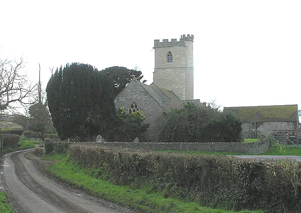
📷 5Historic churches · South West England
Trevelmond
Trevelmond — a church in england-south-west, United Kingdom.
Caravan parks · South West England
Pine Green Caravan & Camping Park
Pine Green Caravan & Camping Park — a caravan park in england south west.
More places in this region
 📷 5
📷 5Historic churches · South West England
Abbey Church of St Mary and St Petroc
Abbey Church of St Mary and St Petroc — church in Bodmin, Cornwall, England, UK; former monastic church.
 📷 5
📷 5Historic churches · South West England
All Saints Church
All Saints Church — church in Dodington, West Somerset, England, UK.
 📷 5
📷 5Historic churches · South West England
All Saints Church, Otterhampton
All Saints Church, Otterhampton — church in Otterhampton, Somerset, England, UK.
 📷 5
📷 5Historic churches · South West England
All Saints Church, South Milton
All Saints Church, South Milton — church in South Milton, Devon, England, UK.
Frequently asked questions
- Where is Dobwalls and Trewidland?
- Dobwalls and Trewidland is in South-West England, United Kingdom (postcode PL14 6JE), in the parish of Dobwalls.
- Is Dobwalls and Trewidland free to visit?
- Yes, Dobwalls and Trewidland is free to enter.
- How do I get to Dobwalls and Trewidland?
- Drivers can navigate to postcode PL14 6JE. It sits within the South East Cornwall parliamentary constituency.