Museums · South East England
Dinton, Wiltshire
Dinton is a village, civil parish and former manor in Wiltshire, England, in the Nadder valley on the B3089 road about 8 miles (13 km) west of Salisbury. The parish population was 696 at the 2011 cens

Michael Dibb — CC BY-SA 2.0 via Wikimedia Commons licence
_-_geograph.org.uk_-_7346711.jpg)
Plan your visit
- Typical visit
- 1.5 h–3 h
- Best time of year
- Year-round
- Family-friendly
- Limited wheelchair access
About
Dinton is a village, civil parish and former manor in Wiltshire, England, in the Nadder valley on the B3089 road about 8 miles (13 km) west of Salisbury. The parish population was 696 at the 2011 census, estimated at 733 in 2019. The civil parish includes the village of Baverstock, about 1 mile (1.6 km) east of Dinton village.
Photo gallery
From the Wikipedia article
Dinton is a village, civil parish and former manor in Wiltshire, England, in the Nadder valley on the B3089 road about 8 miles (13 km) west of Salisbury. The parish population was 696 at the 2011 census, estimated at 733 in 2019. The civil parish includes the village of Baverstock, about 1 mile (1.6 km) east of Dinton village.
Excerpt from Wikipedia under CC BY-SA 4.0. See the source article linked in Sources below.
Background
History
The northern bounds of the parish follow a prehistoric line known as Grim's Ditch, through downland overlooking the Wylye valley further north. Hanging Langford Camp, an Iron Age settlement, is just beyond the parish boundary. The hillfort known as Wick Ball Camp lies near the western boundary of the parish, partly within Dinton Park. A Roman road from the Mendip lead mines to Old Sarum passed east–west, just south of the ditch. After the Dissolution in 1540, much of Dinton's land was acquired by the Earls of Pembroke. Later other land was purchased by the Wyndham family, which created Dinton Park. All Pembroke and Wyndham land was sold in the 20th century. Dinton had a school from an early…
Visiting
The parish has local services, including two public houses and a village hall. The railway remains open as part of the London Waterloo to Exeter line; the nearest station is . The village school continues on the same site as Dinton C of E Primary School. The Monarch's Way long-distance footpath crosses the parish north of Dinton, leaving via Grovely Wood.
Sourced from Wikipedia under CC BY-SA 4.0.
- Coordinates
- 51.0830, -1.9810
- District
- Wiltshire
- Parish
- Dinton
- Postcode
- SP3 5EA
- Parliamentary constituency
- Salisbury
- Official site
- www.dintonparishcouncil.org
Sources
- wikipedia: Dinton, Wiltshire (CC BY-SA 4.0)
Other places nearby
Loading nearby places…
Nearby
 📷 5
📷 5Historic houses · South East England
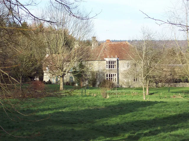
Hydes House
Hydes House — Grade I listed building in Dinton, Wiltshire, England, UK.
 📷 5
📷 5Historic houses · South East England
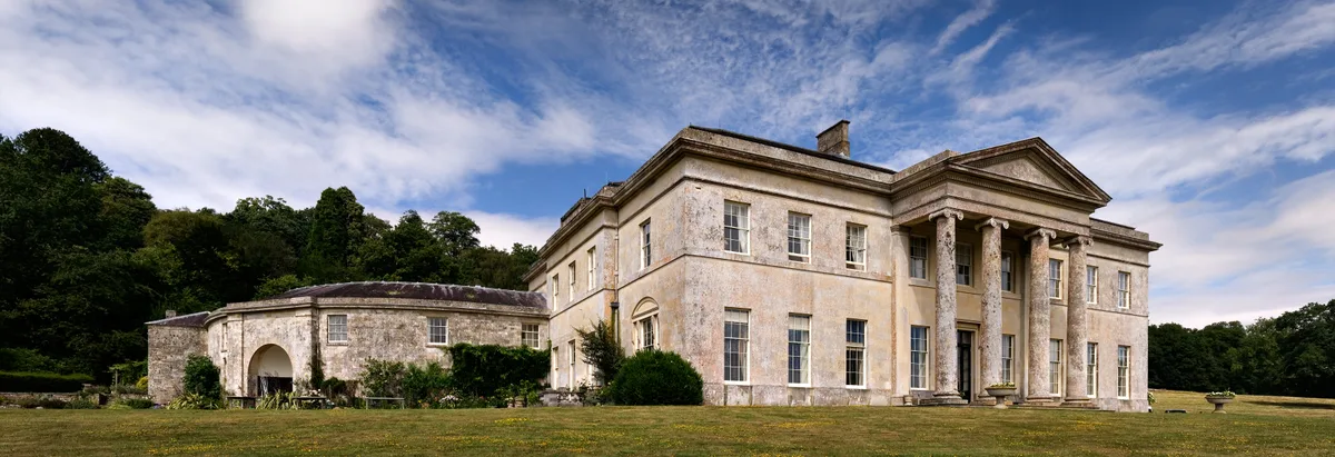
Philipps House
Philipps House — Country house in Dinton, Wiltshire, England, UK.
 📷 5
📷 5Towns & cities · South East England
Baverstock
Baverstock — village in Wiltshire, England, UK.
Campsites · South East England
Marshwood Farm Camping
Marshwood Farm Camping — a campsite in england south east.
Vineyards · South East England
Wick Ball camp, the Common
Wick Ball camp, the Common — a UK vineyard in england south east, producing English or Welsh wine from cool-climate grape varieties.
 Flagship📷 5
Stately homes · South East England
Baverstock Manor
Baverstock Manor — manor house in Baverstock, Dinton, Wiltshire, England, UK.
More museums in this region
 📷 5
📷 5Museums · South East England
Adjutant General's Corps Museum
Adjutant General's Corps Museum — military museum in Winchester, Hampshire, England, United Kingdom.
 📷 5
📷 5Museums · South East England
Alexander Keiller Museum
Alexander Keiller Museum — museum in South West England, United Kingdom.
 📷 5
📷 5Museums · South East England
Amberley Museum
Amberley Museum — open-air industrial museum in West Sussex, United Kingdom.
 📷 5
📷 5Museums · South East England
American Museum and Gardens
American Museum and Gardens — culture and arts museum near Bath, England, United Kingdom.
Frequently asked questions
- Where is Dinton, Wiltshire?
- Dinton, Wiltshire is in South East England, in the United Kingdom — coordinates 51.0830°, -1.9810°.
- Is Dinton, Wiltshire wheelchair accessible?
- Partially — OpenStreetMap notes limited wheelchair access at Dinton, Wiltshire. Check ahead for specific facilities.