Harbours & ports · Scottish Highlands
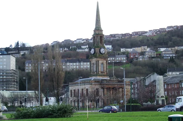
Dingwall
Also known as: Inbhir Pheofharain
Dingwall in Scotland Islands, United Kingdom.

Dave Thompson — CC BY-SA 2.0 via Wikimedia Commons licence
Plan your visit
- Typical visit
- 45 min–1.5 h
- Family-friendly
- Dog-friendly
About
Dingwall is a place of interest in Scotland Islands, United Kingdom — drawn from open-data sources for visitor reference. See the linked Wikipedia article for the full description.
Photo gallery
From the Wikipedia article
Dingwall (Scots: Dingwal, Scottish Gaelic: Inbhir Pheofharain [ˈiɲɪɾʲ ˈfjɔhəɾɛɲ]) is a town on the Cromarty Firth in Easter Ross in the Highlands of Scotland. It has enjoyed the status of royal burgh since the 13th century, and its local government is the Highland Council. The town has a population of 5,491, and though today it lies inland, its topography used to be that of an east-coast harbour. At one time, it was a significant medieval port, a hub of foreign trading and customs collection. Dingwall’s medieval history affirms its status as an important country town and administrative centre, an extension perhaps of its history as a Viking settlement as evidenced by the Norse origin (Þingvöllr) of its name. The royal burgh is also the site of historic castles and clan skirmishes. Dingwall Castle was once the biggest castle north of Stirling. On the town's present-day outskirts lies Tulloch Castle, parts of which may date back to the 12th century. In 1411 the Battle of Dingwall is said to have taken place between the Clan Mackay and the Clan Donald.
Excerpt from Wikipedia under CC BY-SA 4.0. See the source article linked in Sources below.
Background
History
Its name, derived from the Scandinavian (field or meeting-place of the thing, or local assembly; compare Tynwald, Tingwall, Thingwall in the British Isles alone, plus many others across northern Europe), preserves the Viking connections of the town; Gaels call it (), meaning "the mouth of the Peffery" or meaning "cabbage town". The site of the , and of the medieval Moothill, thought to have been established by the Vikings after they invaded in the 8th century, lies beneath the Cromartie memorial.
Sourced from Wikipedia under CC BY-SA 4.0.
- Coordinates
- 57.5972, -4.4278
- District
- Highland
- Postcode
- IV15 9RY
- Parliamentary constituency
- Caithness, Sutherland and Easter Ross
- Official site
- www.dingwallcc.com
Sources
Other places nearby
Loading nearby places…
Nearby
 📷 5
📷 5Forts · Scottish Highlands
Obelisk to Earl of Cromarty, Tulloch Street, Dingwall
Obelisk to Earl of Cromarty, Tulloch Street, Dingwall — a martello broad in scotland-highlands, United Kingdom.
📷 3Memorials & monuments · Scottish Highlands
Cromartie Memorial
Cromartie Memorial — a memorial in scotland-highlands, United Kingdom.
📷 3Archaeological sites · Scottish Highlands
Dingwall Thing Site
Dingwall Thing Site — a archaeological in scotland-highlands, United Kingdom.
 📷 5
📷 5Historic churches · Scottish Highlands
St Clement's Church of Scotland Parish Church, Church Street, Dingwall
St Clement's Church of Scotland Parish Church, Church Street, Dingwall — category A listed building-listed church in scotland-highlands, United Kingdom.
📷 3Archaeological sites · Scottish Highlands
Dingwall Stone
Dingwall Stone in Scotland Islands, United Kingdom.
📷 3Public art & sculpture · Scottish Highlands
Golden Bull
Golden Bull — a public art in scotland-highlands, United Kingdom.
More places in this region
 Flagship📷 4
Harbours & ports · Scottish Highlands
Port Glasgow
Port Glasgow — town in the Inverclyde council area of Scotland, UK.
 📷 3
📷 3Harbours & ports · Scottish Highlands
Aberdeen Harbour
Aberdeen Harbour — maritime port in Aberdeen, Scotland, UK.
 📷 3
📷 3Harbours & ports · Scottish Highlands
Banff Harbour
Banff Harbour — harbor in Banff, Aberdeenshire, Scotland, UK.
 📷 3
📷 3Harbours & ports · Scottish Highlands
Banff Harbour
Banff Harbour — harbour at Banff, Aberdeenshire, Scotland, UK.
Frequently asked questions
- Where is Dingwall?
- Dingwall is in Scottish Highlands, in the United Kingdom — coordinates 57.5972°, -4.4278°.