Beaches · South West England
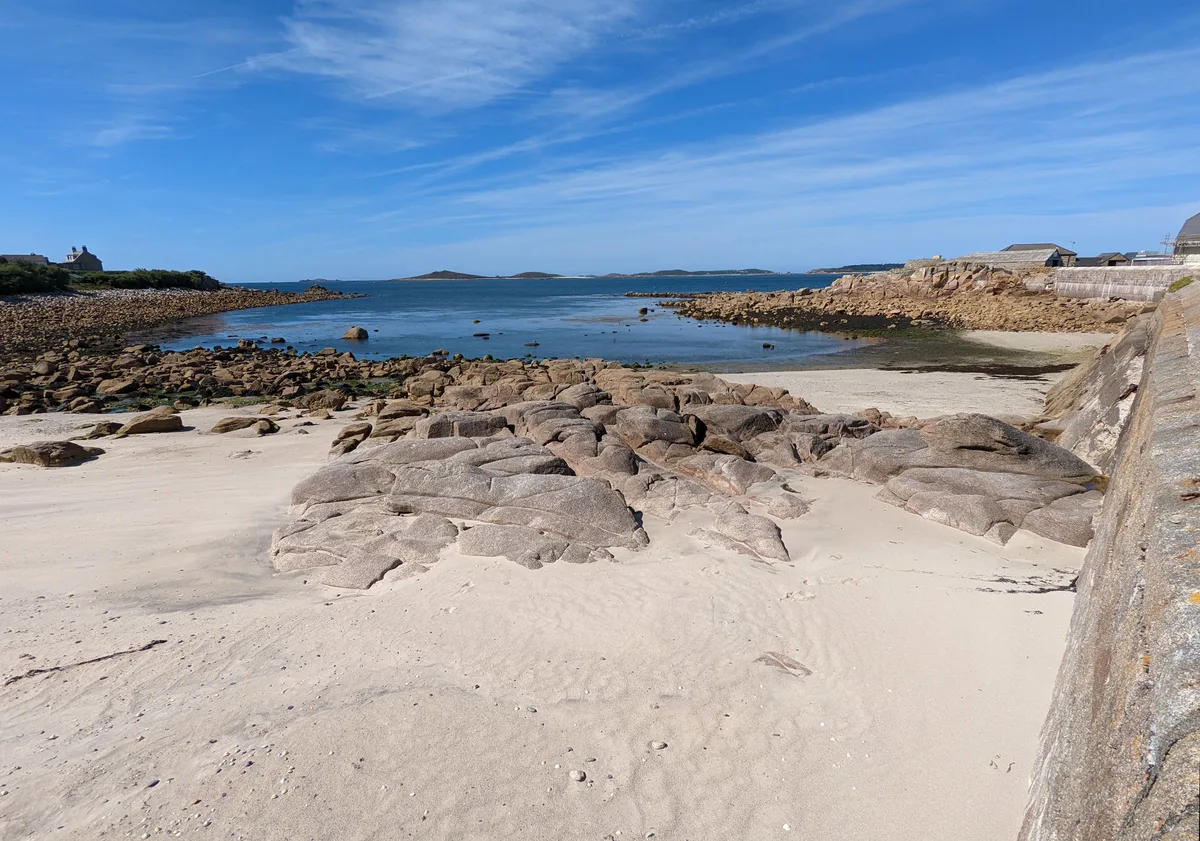
Crooklets Beach
Crooklets Beach is a beach in the United Kingdom.

Julian P Guffogg — CC BY-SA 2.0 via Wikimedia Commons licence
Plan your visit
- Typical visit
- 1 h–3 h
- Best time of year
- Summer (Jun–Aug)
- Free entry
- Family-friendly
- Dog-friendly
About
Crooklets Beach is a beach on the coast of South-West England. The site is within the Cornwall National Landscape (AONB), and is a designated Site of Special Scientific Interest. It sits within the North Cornwall parliamentary constituency. Postcode area EX23.
Photo gallery
Protected designations
- Site of Special Scientific Interest: Bude Coast SSSI
- Area of Outstanding Natural Beauty: Cornwall
Designations sourced from Natural England open data under OGL v3.
From the Wikipedia article
Bude (, locally /buːd/ or /bɛwd/; Cornish Standard Written Form: Porthbud) is a seaside town in north Cornwall, England, in the civil parish of Bude-Stratton and at the mouth of the River Neet (also known locally as the River Strat). It was sometimes formerly known as Bude Haven. It lies southwest of Stratton, south of Flexbury and Poughill, and north of Widemouth Bay, located along the A3073 road off the A39. Bude is twinned with Ergué-Gabéric in Brittany, France. Bude's coast faces Bude Bay in the Celtic Sea, part of the Atlantic Ocean. At the 2021 census, the built-up area as defined by the Office of National Statistics had a population of 7,350. Its earlier importance was as a harbour, and then a source of sea sand useful for improving the inland soil. This was transported on the Bude Canal. The Victorians favoured it as a seaside resort. With new rail links, it became a popular seaside destination in the 20th century. Bradshaw's Guide of 1866, Section 2, described Bude as "a small port and picturesque village in the north-eastern extremity of Cornwall". It described the town as having the dignity of a fashionable marine resort with excellent facilities for bathers. The harbour bed consists of fine bright yellow sand consisting of small shells. "The sea view is of a striking, bold and sublime description – the rocks rising on every side to lofty broken elevations." It also describes Bude as a romantic retreat.
Excerpt from Wikipedia under CC BY-SA 4.0. See the source article linked in Sources below.
- Coordinates
- 50.8358, -4.5549
- District
- Cornwall
- Parish
- Bude-Stratton
- Postcode
- EX23 8NE
- Parliamentary constituency
- North Cornwall
Sources
- osm: w619399211 (ODbL)
- wikipedia: Crooklets Beach (CC BY-SA 4.0)
Other places nearby
Loading nearby places…
Nearby
 📷 3
📷 3Viewpoints · South West England
Wrangle Point
Wrangle Point is a viewpoint in the United Kingdom.
 📷 5
📷 5Beaches · South West England
First Cove
First Cove — Beach (pebblestone).
 📷 5
📷 5Beaches · South West England
Middle Beach
Middle Beach is a beach in the United Kingdom.
 📷 5
📷 5Beaches · South West England
Maer Low Cliff beach
Maer Low Cliff beach — Beach (pebblestone).
.jpg?width=1200) 📷 5
📷 5Beaches · South West England
Bude Sea Pool
Bude Sea Pool — Outdoor swimming pool / lido.
 📷 5
📷 5Towns & cities · South West England
Maer
Maer — village in Cornwall, United Kingdom.
More beaches in this region
 📷 5
📷 5Beaches · South West England
Amy's Cove
Amy's Cove is a beach in the United Kingdom.
 📷 5
📷 5Beaches · South West England
Arlo Porth
Arlo Porth is a beach in the United Kingdom.
 📷 5
📷 5Beaches · South West England
Arthur's Beach (Sunny Cove)
Arthur's Beach (Sunny Cove) is a beach in the United Kingdom.
 📷 5
📷 5Beaches · South West England
Ayrmer Cove
Ayrmer Cove is a beach in the United Kingdom.
Frequently asked questions
- Where is Crooklets Beach?
- Crooklets Beach is in South-West England, United Kingdom (postcode EX23 8NE), in the parish of Bude-Stratton.
- Is Crooklets Beach a protected site?
- Yes — Crooklets Beach is part of the Bude Coast SSSI Site of Special Scientific Interest and the Cornwall National Landscape (AONB).
- Is Crooklets Beach free to visit?
- Yes, Crooklets Beach is free to enter.
- How do I get to Crooklets Beach?
- Drivers can navigate to postcode EX23 8NE. It sits within the North Cornwall parliamentary constituency.