Natural landmarks · North West England
Crompton Moor
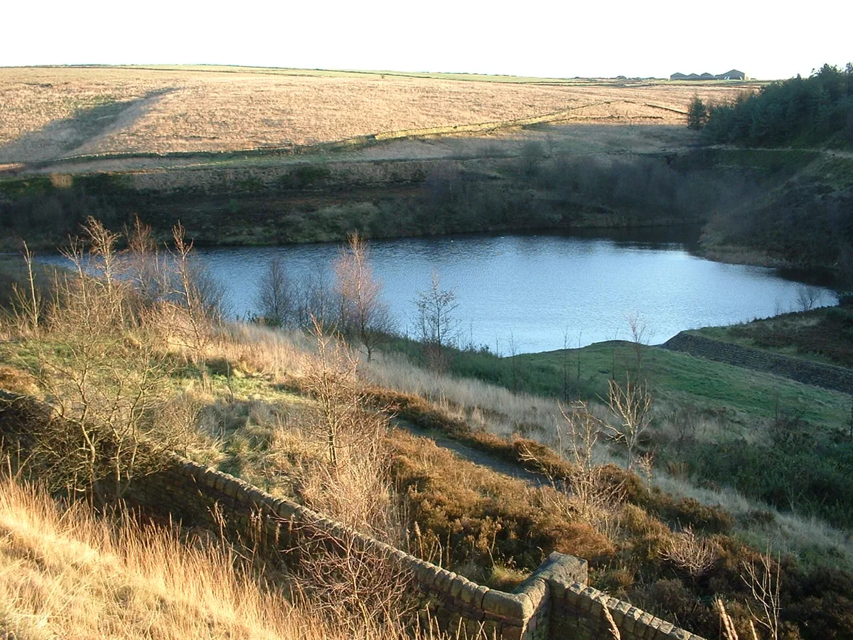
Crompton Moor — mountain in the United Kingdom.

Wikimedia Commons contributors — see linked file page for photographer and licence licence
Plan your visit
- Typical visit
- 1 h–2 h
- Nearest railway station
- Smithy Bridge · 5.8 km
- Free entry
- Dog-friendly
About
Crompton Moor is a named natural landmark in the United Kingdom. Part of South Pennines. Wikidata describes it as: "mountain in the United Kingdom". Coordinates: 53.5911°, -2.0619°.
Photo gallery
Protected designations
- Site of Special Scientific Interest: South Pennine Moors SSSI
Designations sourced from Natural England open data under OGL v3.
From the Wikipedia article
Crompton Moor (archaically known as High Moor) is an area of moorland in the South Pennines, in North West England. It lies along the northeastern outskirts of Shaw and Crompton, in the Metropolitan Borough of Oldham, Greater Manchester. Spanning approximately 160 acres (65 ha), and reaching an elevation of 1,282 feet (391 m) at Crow Knowl, Crompton Moor is one of the largest open spaces run by Oldham Countryside Service. It is a registered common of Greater Manchester, and a Site of Biological Importance since 2003. The Friends of Crompton Moor are an active conservation group, who work in partnership with Oldham Countryside Service to maintain and protect this locally unique environment. Most of Crompton Moor is covered in purple moor grass and heather, but there is also a significant amount of pine forest. Wildlife on the moors includes red grouse, golden plover, and the meadow pipit. An early type of axe known as a palstave has been discovered on Crompton Moor, providing evidence of Bronze Age human activity. During the 18th century Crompton Moor had several farms; dry stone walls still exist from these times as evidence of field division for pasture. Crow Knowl, at the summit of Crompton Moor, features a transmitter station, Crow Knowl Telecommunications mast, and an Ordnance Survey triangulation station (at grid reference SD960105). Crow Knowl overlooks Rochdale to the northwest, Manchester to the southwest and Denshaw to the east, amongst other parts of Greater Manchester. Crompton Moor has been the site of several wildfires. A significant fire occurred in 1995, raging for over two weeks and burning a large proportion of the surface vegetation as well as the subsurface peat. Another took place in March 2007. Brushes Clough and Pingot are former coal and sandstone quarries on Crompton Moor. During the 1970s, quarrying was halted, the land was reclaimed, and thousands of pine trees were planted. The area has since been used for recreation, including hiking,…
Excerpt from Wikipedia under CC BY-SA 4.0. See the source article linked in Sources below.
- Coordinates
- 53.5911, -2.0619
- District
- Oldham
- Parish
- Saddleworth
- Postcode
- OL3 5UE
- Parliamentary constituency
- Oldham East and Saddleworth
- Nearest railway station
- Smithy Bridge — 5.8 km
Sources
- wikidata: Q278498 (CC0)
- wikipedia: Crompton Moor (CC BY-SA 4.0)
- commons: Crompton Moor.jpg (CC BY-SA 4.0)
Other places nearby
Loading nearby places…
Nearby
 📷 3
📷 3Reservoirs & lochs · North West England
Brushes Clough Reservoir
Brushes Clough Reservoir — reservoir in Greater Manchester, England, UK.
 📷 3
📷 3Natural landmarks · North West England
Crompton Waterfall
Crompton Waterfall — a other in england-north-west, United Kingdom.
Campsites · North West England
Dog Hill Scout Campsite
Dog Hill Scout Campsite — a campsite in england north west.
 📷 3
📷 3Historic houses · North West England
Crompton Hall
Crompton Hall — historic house in Crompton, Lancashire, England.
 📷 3
📷 3Reservoirs & lochs · North West England
Rooden Reservoir
Rooden Reservoir — reservoir in Greater Manchester, England, UK.
 📷 3
📷 3Historic houses · North West England
37, Huddersfield Road
37, Huddersfield Road — house in Saddleworth, Oldham, Greater Manchester, England, UK.
More natural landmarks in this region
 ★ Iconic📷 4
Natural landmarks · North West England
Coniston Water
Lake District lake — Swallows and Amazons setting and Donald Campbell water-speed history.
 📷 3
📷 3Natural landmarks · North West England
Elter Water
Elter Water — lake in the United Kingdom.
 📷 3
📷 3Natural landmarks · North West England
Esthwaite Water
Esthwaite Water — lake in the United Kingdom.
 Flagship📷 5
Natural landmarks · North West England
Semerwater
Semerwater — lake in North Yorkshire, England, UK.
Frequently asked questions
- Where is Crompton Moor?
- Crompton Moor is in North-West England, United Kingdom (postcode OL3 5UE), in the parish of Saddleworth.
- Is Crompton Moor a protected site?
- Yes — Crompton Moor is part of the South Pennine Moors SSSI Site of Special Scientific Interest.
- Is Crompton Moor free to visit?
- Yes, Crompton Moor is free to enter.
- How do I get to Crompton Moor?
- The nearest railway station is Smithy Bridge, about 5.8 km away. Drivers can navigate to postcode OL3 5UE.