Castles · South West England
Cranmore Castle
Cranmore Castle is an Iron Age earthwork situated on a hillside above the Devon town of Tiverton in south-west England. Its National Grid reference is SS958118. It is an English Heritage scheduled mon

Lewis Clarke — CC BY-SA 2.0 via Wikimedia Commons licence
Plan your visit
- Typical visit
- 1.5 h–3 h
- Family-friendly
- Limited wheelchair access
About
Cranmore Castle is an Iron Age earthwork situated on a hillside above the Devon town of Tiverton in south-west England. Its National Grid reference is SS958118. It is an English Heritage scheduled monument, and has been given a National Monument number of 34256. The earthwork is widely described in guidebooks and histories as an Iron Age hill fort though more recent archaeological evaluations and histories, such as Mike Sampson's recently published work, point out that it seems inefficient as a fortification, since it is overlooked from the south by the higher slope of Exeter Hill/Newtes Hill. The earthwork is also unusual in that the area it encloses slopes from 120 metres (390 ft) to 170 metres (560 ft) above sea level. This arrangement does however offer clear lines of sight to Cadbury Castle, Castle Close below Stoodleigh up the Exe Valley, Huntsham Castle, Hembury fort and other significant hills and earthworks, suggesting that all were contemporary. It also manages to overlook the confluence of the rivers Lowman and Exe and the forded crossings on those rivers, which a higher position would not allow. The hillside that Cranmore Castle stands above is called Skrink Hills or Shrink Hills in various early histories of the area. and it is from there that Thomas Fairfax's artillery laid siege to Tiverton Castle. The promontory of land that links Cranmore to the edge of Newtes Hill is traversed by the old Exeter Road, which travels past the earthwork on its way from Tiverton…
Photo gallery
From the Wikipedia article
Cranmore Castle is an Iron Age earthwork situated on a hillside above the Devon town of Tiverton in south-west England. Its National Grid reference is SS958118. It is an English Heritage scheduled monument, and has been given a National Monument number of 34256. The earthwork is widely described in guidebooks and histories as an Iron Age hill fort though more recent archaeological evaluations and histories, such as Mike Sampson's recently published work, point out that it seems inefficient as a fortification, since it is overlooked from the south by the higher slope of Exeter Hill/Newtes Hill. The earthwork is also unusual in that the area it encloses slopes from 120 metres (390 ft) to 170 metres (560 ft) above sea level. This arrangement does however offer clear lines of sight to Cadbury Castle, Castle Close below Stoodleigh up the Exe Valley, Huntsham Castle, Hembury fort and other significant hills and earthworks, suggesting that all were contemporary. It also manages to overlook the confluence of the rivers Lowman and Exe and the forded crossings on those rivers, which a higher position would not allow. The hillside that Cranmore Castle stands above is called Skrink Hills or Shrink Hills in various early histories of the area. and it is from there that Thomas Fairfax's artillery laid siege to Tiverton Castle. The promontory of land that links Cranmore to the edge of Newtes Hill is traversed by the old Exeter Road, which travels past the earthwork on its way from Tiverton to Exeter. The hill and road have latterly been known as Exeter Hill, and this road almost certainly follows the path of a prehistoric trackway. Current theories about the nature of the earthwork suggest that it might have been a winter enclosure for livestock or a market site, though the earthworks are very substantial for such applications and could even point to a tribal oppidum. Certainly the area would be large enough. The Ordnance Survey Map of Southern Britain in the Iron Age shows…
Excerpt from Wikipedia under CC BY-SA 4.0. See the source article linked in Sources below.
- Coordinates
- 50.8960, -3.4820
- County
- Devon
- District
- Mid Devon
- Parish
- Tiverton
- Postcode
- EX16 4LW
- Parliamentary constituency
- Tiverton and Minehead
Sources
- wikipedia: Cranmore Castle (CC BY-SA 4.0)
Other places nearby
Loading nearby places…
Nearby
Vineyards · South West England
Cranmore Castle
Cranmore Castle — a UK vineyard in england south west, producing English or Welsh wine from cool-climate grape varieties.
 📷 5
📷 5Museums · South West England
Mid Devon
Mid Devon — a museum in england-south-west, United Kingdom.
 📷 5
📷 5Parks · South West England
Grand Western Canal County Park
Grand Western Canal County Park — park in the United Kingdom.
 📷 3
📷 3Museums · South West England
Tiverton Museum of Mid Devon Life
Tiverton Museum of Mid Devon Life — a museum in england-south-west, United Kingdom.
Cinemas · South West England
The Tivoli
The Tivoli — a cinema in england south west.
 📷 5
📷 5Historic houses · South West England
Gotham House
Gotham House — house in Tiverton, Mid Devon, England, UK.
More castles in this region
 📷 5
📷 5Castles · South West England
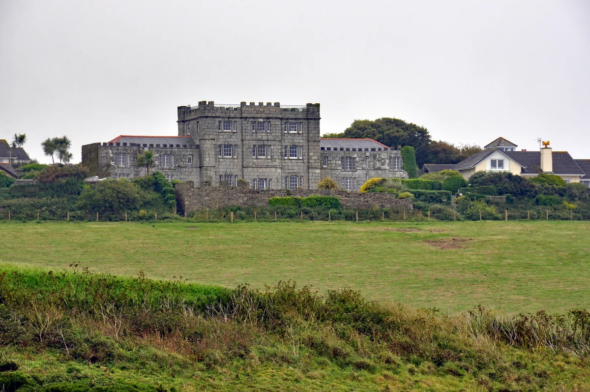
Acton Castle
Acton Castle — Cornish historic building.
 📷 5
📷 5Castles · South West England
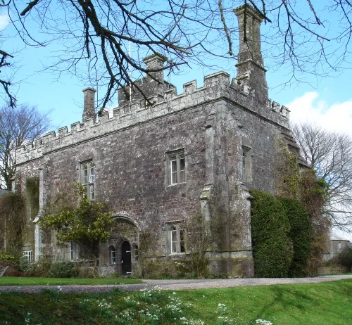
Affeton Castle
Affeton Castle — castle in East Worlington, Devon, England, UK.
 📷 5
📷 5Castles · South West England
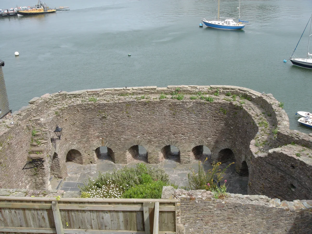
Bayard's Cove Fort
Bayard's Cove Fort — castle in Devon, England, UK.
 📷 5
📷 5Castles · South West England
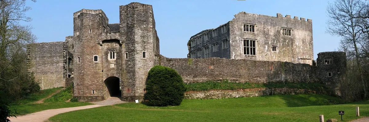
Berry Pomeroy Castle
Berry Pomeroy Castle — Grade I listed English country house in South Hams, United Kingdom.
Frequently asked questions
- Where is Cranmore Castle?
- Cranmore Castle is in Devon, South-West England, United Kingdom (postcode EX16 4LW), in the parish of Tiverton.
- Does Cranmore Castle charge admission?
- Cranmore Castle typically charges admission. Check the official site for current ticket prices and opening hours.
- How do I get to Cranmore Castle?
- Drivers can navigate to postcode EX16 4LW. It sits within the Tiverton and Minehead parliamentary constituency.