Mountains & hills · Scottish Lowlands
Craignaw
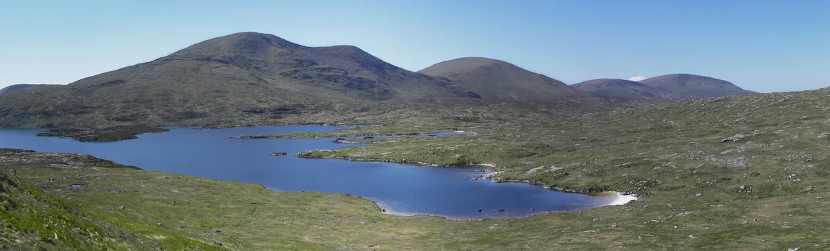
Craignaw — Named summit at 645 m.

Wikimedia Commons contributors — see linked file page for photographer and licence licence
Plan your visit
- Typical visit
- 3 h–8 h
- Best time of year
- Late spring – early autumn (May–Oct)
- Free entry
- Dog-friendly
About
Craignaw is a named summit in the United Kingdom. Wikidata describes it as: "Named summit at 645 m.". Coordinates: 55.1205°, -4.4182°.
Photo gallery
From the Wikipedia article
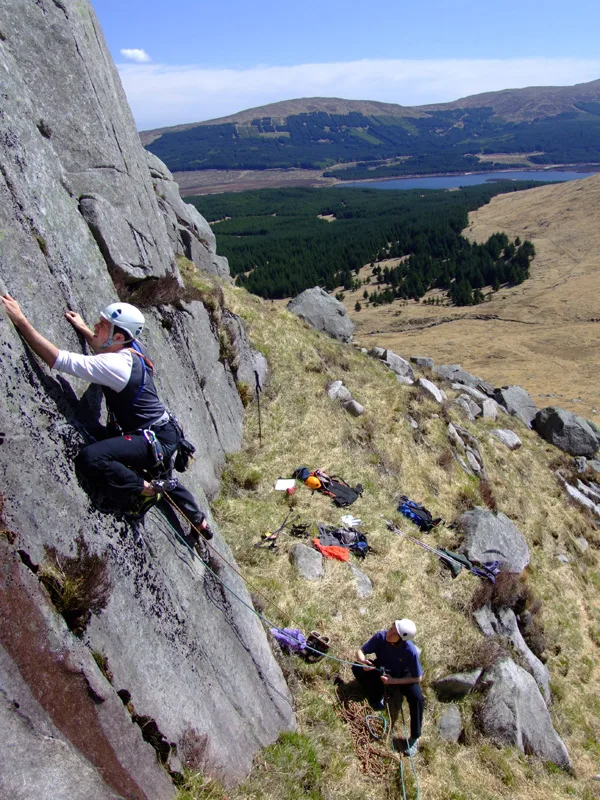
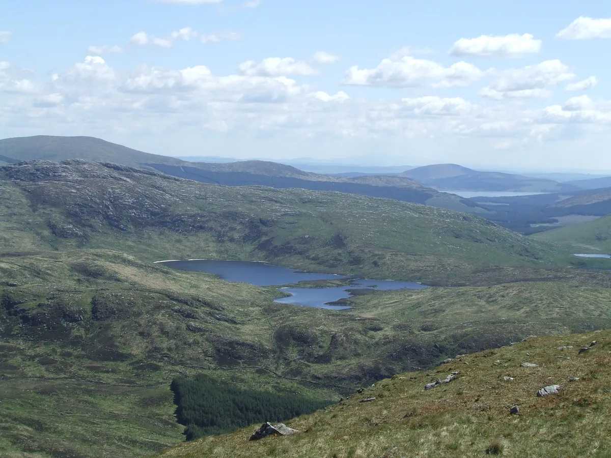
Craignaw is a hill in the Dungeon Hills, a sub-range of the Galloway Hills range, part of the Southern Uplands of Scotland. Unlike many hills in the Southern Uplands, Craignaw has a complex and rocky summit area, with a long line of crags and rough ground on the east side. The hill is largely composed of granite. Near the north end of the hill is an interesting area of terrain known as the "Deil's Bowlin' Green" where various rounded granite boulders are scatterd at random over an area of nearly horizontal granite slabs. These are believed to be glacial erratics or result from a similar glacier process. On the west side of the hill, near grid reference NX458831, a few hundred meters from the summit is an F-111E Aardvark crash site. The site is marked by a small memorial to the two U.S. Air Force pilots who were killed in the accident (Captains Spaulding and Hetzner). Although the crash happened on 19 December 1979 there are still small amounts of aircraft debris in the area.
Excerpt from Wikipedia under CC BY-SA 4.0. See the source article linked in Sources below.
- Coordinates
- 55.1205, -4.4182
- Address
- Dumfries and Galloway, Scotland
Sources
- osm: n526169711 (ODbL)
- wikipedia: Craignaw (CC BY-SA 4.0)
- commons: Craignaw-snibe-hill.jpg (CC BY-SA 4.0)
Other places nearby
Loading nearby places…
Nearby
 📷 3
📷 3Natural landmarks · Scottish Lowlands
Craignaw
Craignaw — mountain in Dumfries and Galloway, Scotland, UK.
 📷 3
📷 3Natural landmarks · Scottish Lowlands
Loch Neldricken
Loch Neldricken — lake in Dumfries and Galloway, Scotland, UK, outflows south via Mid Burn to Loch Valley.
 Flagship📷 3
Natural landmarks · Scottish Lowlands
Loch Enoch
Loch Enoch — lake in Dumfries and Galloway, Scotland, UK.
 📷 3
📷 3Natural landmarks · Scottish Lowlands
Loch Valley
Loch Valley — lake in Dumfries and Galloway, Scotland, UK, outflows via Gairland and Glenhead Burns to Loch Trool.
 📷 3
📷 3Mountains & hills · Scottish Lowlands
Mullwharchar
Mullwharchar — Named summit at 691.9 m.
 📷 5
📷 5Natural landmarks · Scottish Lowlands
Merrick
Merrick — 843m high mountain in Dumfries and Galloway, Scotland, UK.
More mountains in this region
 📷 3
📷 3Mountains & hills · Scottish Lowlands
Andrewhinney Hill
Andrewhinney Hill — Named summit at 677 m.
 📷 3
📷 3Mountains & hills · Scottish Lowlands
Arbory Hill
Arbory Hill — Named summit at 429 m.
 📷 3
📷 3Mountains & hills · Scottish Lowlands
Auchenton Hill ( East Mount Lowther)
Auchenton Hill ( East Mount Lowther) — Named summit at 631 m.
 📷 3
📷 3Mountains & hills · Scottish Lowlands
Bakestall
Bakestall — Named summit at 673.5 m.
Frequently asked questions
- Where is Craignaw?
- Craignaw is in Scottish Lowlands, in the United Kingdom — coordinates 55.1205°, -4.4182°.
- Is Craignaw free to visit?
- Yes — admission to Craignaw is free.