Mountains & hills · South Wales
Craig Y Llyn
Also known as: Rhigos Mountain
Craig Y Llyn — Named summit at 600 m.

Wikimedia Commons contributors — see linked file page for photographer and licence licence
Plan your visit
- Typical visit
- 3 h–8 h
- Best time of year
- Late spring – early autumn (May–Oct)
- Nearest railway station
- Treherbert · 6.0 km
- Free entry
- Dog-friendly
About
Craig Y Llyn is a named summit in the United Kingdom. Also known as: Rhigos Mountain. Wikidata describes it as: "Named summit at 600 m.". Coordinates: 51.7164°, -3.5840°.
Photo gallery
From the Wikipedia article
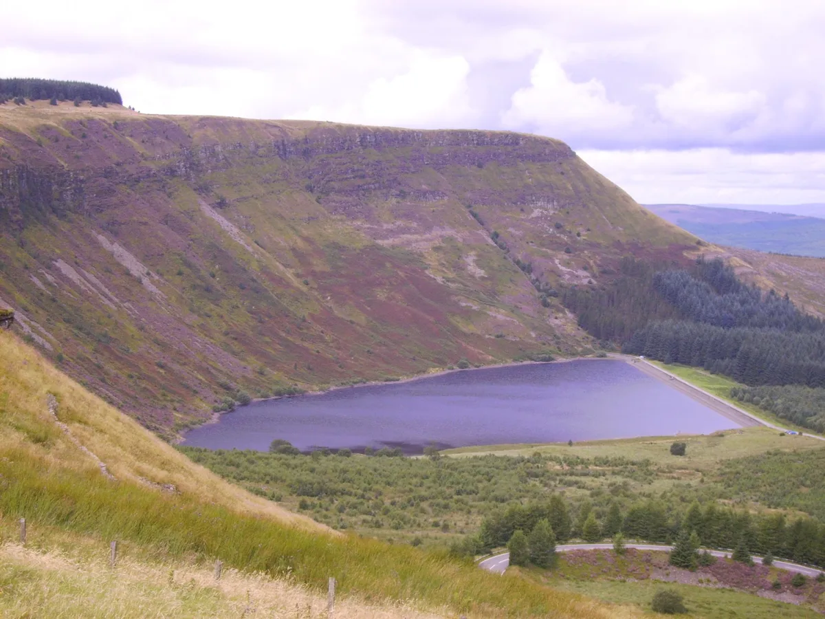
Craig y Llyn (Welsh for 'rock/cliff of the lake') is a mountain situated to the south of the village of Rhigos in the Cynon Valley on the south side of the upper Vale of Neath and north of the Rhondda Valleys in South Wales; it is the highest point in the ancient kingdom and, later, county of Glamorgan (Morgannwg), and the southern Welsh coalfield plateau.
Excerpt from Wikipedia under CC BY-SA 4.0. See the source article linked in Sources below.
Background
Description
The summit of Craig y Llyn lies within the borough of Neath Port Talbot whilst its eastern slopes are within Rhondda Cynon Taf, the boundary running in a north - south direction 200 m to the east of the summit. The name derives from the sandstone cliffs which drop steeply down to the lake on its northern side. The hill is covered by forestry, except for the steep north and northeast faces, and is crowned with a trig point. Several footpaths cross near the summit of the hill, including the Coed Morgannwg Way. The highest point in Neath Port Talbot, Craig y Llyn, is commonly known as the Rhigos Mountain after the village of Rhigos located on the northern side of the mountain in the Cynon…
Sourced from Wikipedia under CC BY-SA 4.0.
- Coordinates
- 51.7164, -3.5840
- Address
- Neath Port Talbot & Rhigos, Rhondda Cynon Taf, Wales
- Nearest railway station
- Treherbert — 6 km
Sources
- osm: n3428629785 (ODbL)
- wikipedia: Craig y Llyn (CC BY-SA 4.0)
- commons: Craig-y-Llyn.JPG (CC BY-SA 4.0)
Other places nearby
Loading nearby places…
Nearby
 📷 3
📷 3Reservoirs & lochs · South Wales
Llyn Fawr
Llyn Fawr — reservoir in Rhondda Cynon Taf, Wales, UK.
 📷 3
📷 3Mountains & hills · South Wales
Mynydd Pen-y-cae
Mynydd Pen-y-cae — a mountain in wales-south, United Kingdom, 573 m.
 📷 4
📷 4Viewpoints · South Wales
Craig y Llyn
Craig y Llyn — Named viewpoint at 490 m elevation.
 📷 3
📷 3Towns & cities · South Wales
Rhigos
Rhigos — village and community in Rhondda Cynon Taf, Wales, UK.
 📷 3
📷 3Natural landmarks · South Wales
Zipworld Tower
Zipworld Tower — a other in wales-south, United Kingdom.
Mountain bike trails · South Wales
Skyline
Skyline — a mtb trail in wales south.
More mountains in this region
 Flagship📷 3
Mountains & hills · South Wales
Milford Haven Waterway
Milford Haven Waterway — ria, or flooded valley, in Pembrokeshire, south-west Wales, UK.
 📷 5
📷 5Mountains & hills · South Wales
Ogof Ffynnon Ddu
Ogof Ffynnon Ddu — cave in the Upper Swansea Valley in South Wales.
 📷 3
📷 3Mountains & hills · South Wales
Abereiddi Bay
Abereiddi Bay — bay in the United Kingdom.
 📷 3
📷 3Mountains & hills · South Wales
Allt Lwyd
Allt Lwyd — Named summit at 653 m.
Frequently asked questions
- Where is Craig Y Llyn?
- Craig Y Llyn is in South Wales, United Kingdom.
- Is Craig Y Llyn free to visit?
- Yes, Craig Y Llyn is free to enter.
- How do I get to Craig Y Llyn?
- The nearest railway station is Treherbert, about 6.0 km away.