Hill forts · Scottish Highlands
Craig Phadrig
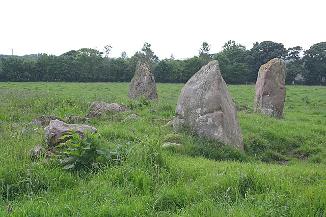
Craig Phadrig — archaeological site in Highland, Scotland, UK.

Wikimedia Commons contributors — see linked file page for photographer and licence licence
Plan your visit
- Typical visit
- 1 h–2 h
- Nearest railway station
- Inverness · 2.8 km
- Free entry
- Dog-friendly
About
Craig Phadrig is a hill fort in the United Kingdom. Heritage designation: scheduled monument. Wikidata describes it as: "archaeological site in Highland, Scotland, UK". Coordinates: 57.4772°, -4.2697°.
Photo gallery
From the Wikipedia article
Craig Phadrig (Scottish Gaelic: Creag Phàdraig, meaning Rock of Patrick) is a forested hill on the western edge of Inverness, Scotland. A hill fort on the summit is generally supposed to have been the base of the Pictish king Bridei mac Maelchon (ruled circa 554–584). The hill rises to 172 metres (564 ft) above sea level and overlooks the Beauly Firth to the north and the mouth of the River Ness to the north-east. The hill is currently owned and managed by Forestry and Land Scotland.
Excerpt from Wikipedia under CC BY-SA 4.0. See the source article linked in Sources below.
- Coordinates
- 57.4772, -4.2697
- District
- Highland
- Postcode
- IV3 8RX
- Parliamentary constituency
- Inverness, Skye and West Ross-shire
- Nearest railway station
- Inverness — 2.8 km
Sources
- wikidata: Q5181319 (CC0)
- wikipedia: Craig Phadrig (CC BY-SA 4.0)
- commons: The old fort in Craig Phadrig Woods - geograph.org.uk - 389967.jpg (CC BY-SA 4.0)
Other places nearby
Loading nearby places…
Nearby
 📷 3
📷 3Hill forts · Scottish Highlands
Craig Phadrig Hillfort
Craig Phadrig Hillfort — a hill fort in scotland-highlands, United Kingdom.
 📷 3
📷 3Memorials & monuments · Scottish Highlands
Battle of Clachnaharry Memorial
Battle of Clachnaharry Memorial — a memorial in scotland-highlands, United Kingdom.
 📷 3
📷 3Stadiums · Scottish Highlands
Telford Street Park
Telford Street Park — stadium in Highland, Scotland, UK.
 📷 3
📷 3Memorials & monuments · Scottish Highlands
Thomas Telford Memorial
Thomas Telford Memorial — a memorial in scotland-highlands, United Kingdom.
 📷 4
📷 4Cemeteries · Scottish Highlands
Tomnahurich Cemetery
Tomnahurich Cemetery is a cemetery in the United Kingdom.
Caravan parks · Scottish Highlands
Torvean Caravan Park
Torvean Caravan Park — a caravan park in scotland highlands.
More places in this region
 📷 3
📷 3Hill forts · Scottish Highlands
Aquhorthies stone circle
Aquhorthies stone circle — architectural structure in Aberdeenshire, Scotland, UK.
 📷 3
📷 3Hill forts · Scottish Highlands
Auchagallon Stone Circle
Auchagallon Stone Circle — archaeological site in North Ayrshire, Scotland, UK.
 📷 3
📷 3Hill forts · Scottish Highlands
Auchinhove
Auchinhove — archaeological site in Moray, Scotland, UK.
 📷 3
📷 3Hill forts · Scottish Highlands
Balbridie
Balbridie — Neolithic timber hall remains in Aberdeenshire, Scotland, UK.
Frequently asked questions
- Where is Craig Phadrig?
- Craig Phadrig is in the Scottish Highlands, United Kingdom (postcode IV3 8RX).
- Is Craig Phadrig a listed building?
- Craig Phadrig is officially recognised as scheduled monument listed.
- Is Craig Phadrig free to visit?
- Yes, Craig Phadrig is free to enter.
- How do I get to Craig Phadrig?
- The nearest railway station is Inverness, about 2.8 km away. Drivers can navigate to postcode IV3 8RX.