Archaeological sites · Mid Wales
Craig Gwrtheyrn
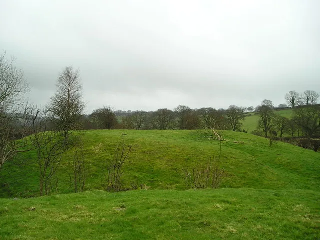
Craig Gwrtheyrn in Wales Mid, United Kingdom.

Marion Phillips — CC BY-SA 2.0 via Wikimedia Commons licence
Plan your visit
- Typical visit
- 45 min–1.5 h
- Free entry
- Dog-friendly
About
Craig Gwrtheyrn is a place of interest in Wales Mid, United Kingdom — drawn from open-data sources for visitor reference. See the linked Wikipedia article for the full description.
Photo gallery
From the Wikipedia article
Craig Gwrtheyrn, or Caer Gwrtheyrn, is an Iron Age hillfort on the south side of the River Teifi, about 1.2 miles (1.9 km) west of the village of Llanfihangel-ar-Arth, in Carmarthenshire, Wales.
Excerpt from Wikipedia under CC BY-SA 4.0. See the source article linked in Sources below.
Background
History
Craig Gwrtheyrn (Vortigern's Rock), or Caer Gwrtheyrn (Vortigern's Castle), is associated with the 5th-century British warlord Vortigern. He may be mythical; there are various historical accounts written in subsequent centuries in which he seems to be described. According to one story (in Historia Brittonum, compiled in the 9th century) Vortigern, fleeing from St Germanus, built a castle on the River Teifi. A fire, brought from heaven by the prayers of St Germanus, who had followed him there, set the castle alight; Vortigern, his family and other inhabitants of the castle perished. There are other versions of Vortigern's death, and other places where it is claimed he was buried. It is not…
Description
The fort is on an imposing hill overlooking the River Teifi. The defences measure about 160 m north to south, and 125 m east to west, following the contours of the hill, enclosing an area of about 1.5 ha. The drystone rampart, of which traces remain, was originally 2 – thick. There is a ditch around the rampart (except on the very steep north-east side); stones from the rampart have fallen into this. There is an entrance on the south-west, where two further banks create a barbican and where there is also a small area of chevaux de frise: sharp stones set on end, of which about 30 remain.
Sourced from Wikipedia under CC BY-SA 4.0.
- Coordinates
- 52.0386, -4.2858
- District
- Ceredigion
- Parish
- Llandysul
- Postcode
- SA44 4PD
- Parliamentary constituency
- Ceredigion Preseli
Sources
- wikidata: Q13126339 (CC0)
- wikipedia: Craig Gwrtheyrn (CC BY-SA 4.0)
Other places nearby
Loading nearby places…
Nearby
Vineyards · Mid Wales
Caer Gwrtheyrn
Caer Gwrtheyrn — a UK vineyard in wales mid, producing English or Welsh wine from cool-climate grape varieties.
 📷 3
📷 3Castles · Mid Wales
Castell Llwyn Bedw
Castell Llwyn Bedw — scheduled monument in Wales.
 📷 5
📷 5Historic bridges · Mid Wales
Pont Dolfor
Pont Dolfor — Grade II listed building-listed bridge in wales-mid, United Kingdom.
 📷 5
📷 5Historic churches · Mid Wales
St Tysul's Church
St Tysul's Church — Grade II* listed building-listed church in wales-mid, United Kingdom.
Hotels · Mid Wales
The Porth Hotel
The Porth Hotel — a hotel in wales mid.
 📷 4
📷 4Other places · Mid Wales
Llandysul
Llandysul in Wales Mid, United Kingdom.
More archaeological sites in this region
 📷 3
📷 3Archaeological sites · Mid Wales
Castle Pulverbatch
Castle Pulverbatch — medieval castle in Shropshire, England, UK.
 📷 5
📷 5Archaeological sites · Mid Wales
Clun Forest
Clun Forest — forest on the border of Shropshire, England and Powys, Wales, UK.
 📷 3
📷 3Archaeological sites · Mid Wales
Hafren Forest
Hafren Forest is a archaeological site in the United Kingdom.
 📷 3
📷 3Archaeological sites · Mid Wales
Mitchell's Fold stone circle, standing stone and cairn 280m south west of Mitchell's Fold
Mitchell's Fold stone circle, standing stone and cairn 280m south west of Mitchell's Fold — archaeological site in Chirbury with Brompton, Shropshire, England, UK.
Frequently asked questions
- Where is Craig Gwrtheyrn?
- Craig Gwrtheyrn is in Mid Wales, in the United Kingdom — coordinates 52.0386°, -4.2858°.
- Is Craig Gwrtheyrn free to visit?
- Yes — admission to Craig Gwrtheyrn is free.