Historic bridges · Scottish Lowlands
Corby Bridge
Also known as: Wetheral Viaduct
Corby Bridge is a historic bridge in the United Kingdom.

Wikimedia Commons contributors — see linked file page for photographer and licence licence
Plan your visit
- Typical visit
- 15 min–30 min
- Nearest railway station
- Wetheral · 0.1 km
- Free entry
- Dog-friendly
About
Corby Bridge is a named historic bridge in the United Kingdom. OpenStreetMap heritage rating: 2/5. Also known as: Wetheral Viaduct. Coordinates: 54.8839°, -2.8297°.
Photo gallery
Protected designations
- Site of Special Scientific Interest: River Eden and Tributaries SSSI
Designations sourced from Natural England open data under OGL v3.
From the Wikipedia article
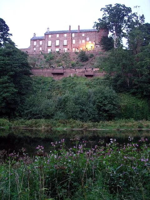
Corby Bridge (also known as Wetheral Viaduct to distinguish it from the nearby Corby Viaduct) is a railway viaduct adjacent to and immediately east of Wetheral railway station at Wetheral, near Carlisle, in north-western England, begun in 1830 and completed in 1834. It is 920 feet (280 m) long and 100 feet (30 m) high, and has been a Grade I listed building since 1 April 1957.
Excerpt from Wikipedia under CC BY-SA 4.0. See the source article linked in Sources below.
Background
History
Construction of the viaduct began in 1830 and took four years to complete; it opened on 12 August 1834. The works were carried out by the contractor, William S. Denton. The footbridge was added to the north face in 1851 Gordon Biddle, a railway historian, described the viaduct as "much larger and more imposing" than other structures on the route. It is a grade I listed building.
Description
The bridge consists of five semi-circular arches, supported by six piers—two in the river bed and two on each bank. Each arch has a span of 89 ft, built from large blocks of stone with decorative channelling to the joints and voussoirs. A parapet extends 1.5 m above the bridge deck, below which is a deep square cornice. The structure, including the parapet, is 33 m above the summer height of the River Eden, wide enough to carry two tracks, and has a total length of 280 m The bridge is faced with red sandstone from Newbiggin Quarry near Carlisle and filled with sandstone rubble from Wetheral and Corby Beck Quarries. At the western end of the parapets is a plaque on each side, one in English…
Sourced from Wikipedia under CC BY-SA 4.0.
- Coordinates
- 54.8839, -2.8297
- District
- Cumberland
- Parish
- Wetheral
- Postcode
- CA4 8HB
- Parliamentary constituency
- Carlisle
- Nearest railway station
- Wetheral — 0.1 km
- Opening
- | inaugurated =
Sources
- osm: w512639499 (ODbL)
- wikipedia: Corby Bridge (CC BY-SA 4.0)
- commons: Railway bridge at Wetheral taken from the banks of the river - geograph.org.uk - 286754.jpg (CC BY-SA 4.0)
Other places nearby
Loading nearby places…
Nearby
Hotels · Scottish Lowlands
Crown Hotel
Crown Hotel — a hotel in scotland lowlands.
 📷 3
📷 3Memorials & monuments · Scottish Lowlands
Wetheral Cross
Wetheral Cross — a memorial in scotland-lowlands, United Kingdom.
 📷 3
📷 3Historic bridges · Scottish Lowlands
Corby Viaduct
Corby Viaduct is a historic bridge in the United Kingdom.
 📷 5
📷 5Abbeys & priories · Scottish Lowlands
Wetheral Priory Gatehouse
Wetheral Priory Gatehouse — a Grade I-listed abbey in scotland-lowlands, United Kingdom.
 📷 5
📷 5Castles · Scottish Lowlands
Corby Castle
Corby Castle — tower house in Cumbria, England, UK.
 📷 3
📷 3Holy wells · Scottish Lowlands
Wall And Gate Piers To East Of Corby Castle
Wall And Gate Piers To East Of Corby Castle — Grade I listed wall in Wetheral, Cumberland, Cumbria , England, UK.
More bridges in this region
 📷 3
📷 3Historic bridges · Scottish Lowlands
Alston Arches Viaduct
Alston Arches Viaduct is a historic bridge in the United Kingdom.
 📷 3
📷 3Historic bridges · Scottish Lowlands
Armstrong Bridge
Armstrong Bridge is a historic bridge in the United Kingdom.
 📷 3
📷 3Historic bridges · Scottish Lowlands
Ballochmyle Viaduct
Ballochmyle Viaduct is a historic bridge in the United Kingdom.
 📷 3
📷 3Historic bridges · Scottish Lowlands
Bellasis Bridge
Bellasis Bridge is a historic bridge in the United Kingdom.
Frequently asked questions
- Where is Corby Bridge?
- Corby Bridge is in the Scottish Lowlands, United Kingdom (postcode CA4 8HB), in the parish of Wetheral.
- Who owns Corby Bridge?
- Corby Bridge is owned by | maint = Network Rail.
- Is Corby Bridge a protected site?
- Yes — Corby Bridge is part of the River Eden and Tributaries SSSI Site of Special Scientific Interest.
- Is Corby Bridge free to visit?
- Yes, Corby Bridge is free to enter.
- How do I get to Corby Bridge?
- The nearest railway station is Wetheral, about 0.1 km away. Drivers can navigate to postcode CA4 8HB.