Towns & cities · West Midlands
Colwall
Colwall — village in Herefordshire, England, UK.

Wikimedia Commons contributors — see linked file page for photographer and licence licence
Plan your visit
- Typical visit
- 3 h–6 h
- Nearest railway station
- Colwall · 0.1 km
- Free entry
- Family-friendly
- Dog-friendly
About
Colwall is a town, city, village or settlement in the United Kingdom. Recent population estimates put it at around 2,373 people. Wikidata describes it as: "village in Herefordshire, England, UK". Coordinates: 52.0803°, -2.3575°.
Photo gallery
Protected designations
- Site of Special Scientific Interest: The Malvern Hills SSSI
- Area of Outstanding Natural Beauty: Cotswolds
- Area of Outstanding Natural Beauty: Malvern Hills
Designations sourced from Natural England open data under OGL v3.
From the Wikipedia article
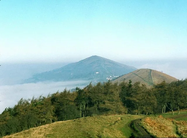
Colwall is a civil parish in Herefordshire, England, on the border with Worcestershire, on the western side of the Malvern Hills, and within the AONB. Areas of the village are known as Colwall Stone, Upper Colwall which shares a common border at the Wyche Cutting with the Malvern suburb of Malvern Wells, and Colwall Green, spread along 2 miles (3.2 km) of the B4218 road, with the historic village core (at the parish church) being 1 mile (1.6 km) to the west of Colwall Stone. A feature of Colwall is the view of the Iron Age British Camp (Herefordshire Beacon), which largely falls within the southeast corner of the parish. The towns of Ledbury and Malvern are 5 miles (8.0 km) southwest and 3 miles (4.8 km) northeast respectively from Colwall Stone, via the B4218. Colwall is often included in the informal region referred to as "The Malverns", which refers to the Malvern Hills and the surrounding settlements.
Excerpt from Wikipedia under CC BY-SA 4.0. See the source article linked in Sources below.
- Coordinates
- 52.0803, -2.3575
- District
- Herefordshire, County of
- Parish
- Colwall
- Postcode
- WR13 6QH
- Parliamentary constituency
- North Herefordshire
- Population
- 2,373
- Nearest railway station
- Colwall — 0.1 km
- Official site
- www.neighbourhood.statistics.gov.uk
Sources
- wikidata: Q944953 (CC0)
- wikipedia: Colwall (CC BY-SA 4.0)
- commons: Colwall Green - geograph.org.uk - 907228.jpg (CC BY-SA 4.0)
Other places nearby
Loading nearby places…
Nearby
 📷 3
📷 3Memorials & monuments · West Midlands
The Stone
The Stone — a memorial in england-west-midlands, United Kingdom.
 📷 5
📷 5Natural landmarks · West Midlands
The Downs, Malvern College Prep School
The Downs, Malvern College Prep School — a school heritage in england-west-midlands, United Kingdom.
 📷 3
📷 3Miniature railways · West Midlands
Downs Light Railway
Downs Light Railway — a miniature railway in england-west-midlands, United Kingdom.
 📷 5
📷 5Natural landmarks · West Midlands
The Elms School
The Elms School — a school heritage in england-west-midlands, United Kingdom.
 📷 4
📷 4Gardens · West Midlands
Perrycroft
Perrycroft — a garden in england-west-midlands, United Kingdom.
 📷 3
📷 3Mountains & hills · West Midlands
Pinnacle Hill
Pinnacle Hill — Named summit at 358 m.
More towns in this region
 Flagship📷 3
Towns & cities · West Midlands
Adderbury
Adderbury — village and civil parish in Cherwell district, Oxfordshire, England.
 Flagship📷 3
Towns & cities · West Midlands
Admington
Admington — village in Warwickshire, England, UK.
 Flagship📷 3
Towns & cities · West Midlands
Aldington
Aldington — village in Worcestershire, United Kingdom.
 Flagship📷 5
Towns & cities · West Midlands
Anstey
Anstey — large village in Leicestershire, England.
Frequently asked questions
- Where is Colwall?
- Colwall is in the West Midlands, United Kingdom (postcode WR13 6QH), in the parish of Colwall.
- Is Colwall a protected site?
- Yes — Colwall is part of the The Malvern Hills SSSI Site of Special Scientific Interest and the Cotswolds National Landscape (AONB).
- Is Colwall free to visit?
- Yes, Colwall is free to enter.
- How do I get to Colwall?
- The nearest railway station is Colwall, about 0.1 km away. Drivers can navigate to postcode WR13 6QH.