Forests & woodlands · London
Coldfall Wood
Coldfall Wood is a forest or woodland in the United Kingdom.

Wikimedia Commons contributors — see linked file page for photographer and licence licence
Plan your visit
- Typical visit
- 1 h–3 h
- Nearest railway station
- East Finchley · 1.2 km
- Free entry
- Family-friendly
- Dog-friendly
About
Coldfall Wood is a named forest, woodland or nature reserve in the United Kingdom. Coordinates: 51.5971°, -0.1580°. This entry is part of The Great Britain Guide, a free, ad-free, open-data tourist directory.
Photo gallery
From the Wikipedia article
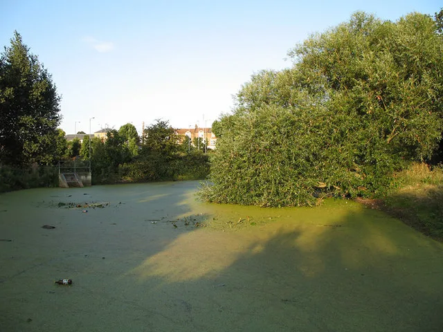
Coldfall Wood is an ancient woodland in Muswell Hill, North London. It covers an area of approximately 14 hectares (35 acres) and is surrounded by St Pancras and Islington Cemetery, the East Finchley public allotments, and the residential streets Creighton Avenue and Barrenger Road. It is the site of the discoveries which first led to the recognition that glaciation had once reached southern England. It was declared a local nature reserve in 2013, and is also a Site of Borough Importance for Nature Conservation, Grade 1.
Excerpt from Wikipedia under CC BY-SA 4.0. See the source article linked in Sources below.
Background
History
The London Borough of Haringey contains four ancient woods: Highgate Wood, Queen's Wood, Coldfall Wood, and Bluebell Wood. All are shown on John Rocque's 1754 Map of Middlesex. Until the early 20th century Coldfall Wood was more than twice its current size, reaching south to the properties bordering Fortis Green. The southern section was felled and partially excavated for gravel, before being used for residential development and the sites of Tollington and William Grimshaw schools (later Fortismere School). Tollington first rented and felled part of the wood for a sports field in the 1920s and subsequently moved to a new building on the site. William Grimshaw was built later to the north.…
Sourced from Wikipedia under CC BY-SA 4.0.
- Coordinates
- 51.5971, -0.1580
- District
- Haringey
- Parish
- Haringey, unparished area
- Postcode
- N10 1HU
- Parliamentary constituency
- Hornsey and Friern Barnet
- Nearest railway station
- East Finchley — 1.2 km
- Official site
- www.coldfallwoods.co.uk
Sources
- osm: w4001294 (ODbL)
- wikipedia: Coldfall Wood (CC BY-SA 4.0)
- commons: Shadows in Coldfall wood.jpg (CC BY-SA 4.0)
Other places nearby
Loading nearby places…
Nearby
 📷 5
📷 5Cemeteries · London
St Pancras and Islington Cemetery
St Pancras and Islington Cemetery is a cemetery in the United Kingdom.
 📷 5
📷 5Historic churches · London
Muswell Hill District Synagogue
Muswell Hill District Synagogue — a church in england-london, United Kingdom.
📷 5Natural landmarks · London
Tollington School
Tollington School — a school heritage in england-london, United Kingdom.
 📷 5
📷 5Chapels · London
Fortis Green
Fortis Green — a methodist chapel in england-london, United Kingdom.
 📷 5
📷 5Theatres · London
Phoenix Cinema
Phoenix Cinema in England London, United Kingdom.
 📷 5
📷 5Wildlife reserves · London
Glebelands Local Nature Reserve
Glebelands Local Nature Reserve — nature reserve in the London Borough of Barnet.
More forests in this region
 📷 5
📷 5Forests & woodlands · London
Ackroyd Drive Green Link
Ackroyd Drive Green Link is a forest or woodland in the United Kingdom.
 📷 5
📷 5Forests & woodlands · London
Adams Road Bird Sanctuary
Adams Road Bird Sanctuary is a forest or woodland in the United Kingdom.
 📷 5
📷 5Forests & woodlands · London
Adelaide Nature Reserve
Adelaide Nature Reserve is a forest or woodland in the United Kingdom.
 📷 5
📷 5Forests & woodlands · London
Angel's Wings
Angel's Wings — Public artwork by Thomas Heatherwick.
Frequently asked questions
- Where is Coldfall Wood?
- Coldfall Wood is in London, United Kingdom (postcode N10 1HU), in the parish of Haringey, unparished area.
- Is Coldfall Wood free to visit?
- Yes, Coldfall Wood is free to enter.
- How do I get to Coldfall Wood?
- The nearest railway station is East Finchley, about 1.2 km away. Drivers can navigate to postcode N10 1HU.