Natural landmarks · North West England
Cold Fell
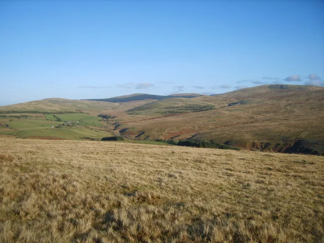
Cold Fell — mountain in United Kingdom.

Wikimedia Commons contributors — see linked file page for photographer and licence licence
Plan your visit
- Typical visit
- 1 h–2 h
- Nearest railway station
- Braystones · 6.7 km
- Free entry
- Dog-friendly
About
Cold Fell is a named natural landmark in the United Kingdom. Wikidata describes it as: "mountain in United Kingdom". Coordinates: 54.4667°, -3.4500°.
Photo gallery
From the Wikipedia article
Cold Fell is a hill in the west of the English Lake District. It is easily climbed from the road between Ennerdale Bridge and Calder Bridge. This road is in fact known as Cold Fell Road and is used by many Sellafield employees living in Cockermouth. The fell is grassy and nowhere steep. The summit is very flat but offers a view of the west Cumbrian coastline and Sellafield. Cold Fell is home to a group of horses which roam freely about a number of fells in the area. Cold Fell is the subject of a chapter of Wainwright's book The Outlying Fells of Lakeland. Unusually he does not specify a route of ascent, saying: "If, with the aid of the map only, you cannot find the top of Cold Fell, then take some good advice, old man, and pack it in." He lists the height as 955 feet (291 m).
Excerpt from Wikipedia under CC BY-SA 4.0. See the source article linked in Sources below.
- Coordinates
- 54.4667, -3.4500
- District
- Cumberland
- Parish
- Ponsonby
- Postcode
- CA20 1DY
- Parliamentary constituency
- Whitehaven and Workington
- Nearest railway station
- Braystones — 6.7 km
Sources
- wikidata: Q5142252 (CC0)
- wikipedia: Cold Fell (Calder Bridge) (CC BY-SA 4.0)
- commons: On Cold Fell - geograph.org.uk - 1621368.jpg (CC BY-SA 4.0)
Other places nearby
Loading nearby places…
Nearby
 📷 3
📷 3Mountains & hills · North West England
Cold Fell
Cold Fell — Named summit at 293 m.
Campsites · North West England
Strudda Bank Farm Glamping Pods
Strudda Bank Farm Glamping Pods — a campsite in england north west.
 📷 3
📷 3Burial mounds & barrows · North West England
Tongue How Cairn Ring
Tongue How Cairn Ring — a burial mound in england-north-west, United Kingdom.
 📷 3
📷 3Archaeological sites · North West England
Birrel Sike settlement
Birrel Sike settlement — a archaeological in england-north-west, United Kingdom.
 📷 3
📷 3Mountains & hills · North West England
Stone Pike
Stone Pike — a mountain in england-north-west, United Kingdom.
 📷 2
📷 2Historic houses · North West England
Haile Hall
Haile Hall — house in Haile, Copeland, England, UK.
More natural landmarks in this region
 ★ Iconic📷 4
Natural landmarks · North West England
Coniston Water
Lake District lake — Swallows and Amazons setting and Donald Campbell water-speed history.
 📷 3
📷 3Natural landmarks · North West England
Elter Water
Elter Water — lake in the United Kingdom.
 📷 3
📷 3Natural landmarks · North West England
Esthwaite Water
Esthwaite Water — lake in the United Kingdom.
 Flagship📷 5
Natural landmarks · North West England
Semerwater
Semerwater — lake in North Yorkshire, England, UK.
Frequently asked questions
- Where is Cold Fell?
- Cold Fell is in North-West England, United Kingdom (postcode CA20 1DY), in the parish of Ponsonby.
- Is Cold Fell free to visit?
- Yes, Cold Fell is free to enter.
- How do I get to Cold Fell?
- The nearest railway station is Braystones, about 6.7 km away. Drivers can navigate to postcode CA20 1DY.