Towns & cities · London
Cobham
Cobham — village in the Borough of Elmbridge in Surrey, England.

Wikimedia Commons contributors — see linked file page for photographer and licence licence
Plan your visit
- Typical visit
- 3 h–6 h
- Nearest railway station
- Cobham & Stoke d'Abernon · 1.8 km
- Free entry
- Family-friendly
- Dog-friendly
About
Cobham is a town, city, village or settlement in the United Kingdom. It covers approximately 8 km². Recent population estimates put it at around 9,739 people. Address: KT11. Wikidata describes it as: "village in the Borough of Elmbridge in Surrey, England". Coordinates: 51.3289°, -0.4094°.
Photo gallery
From the Wikipedia article
Cobham () is a large village in the Borough of Elmbridge in Surrey, England, centred 17 miles (27 km) south-west of London and 10 miles (16 km) northeast of Guildford on the River Mole. It has a commercial/services High Street, a significant number of primary and private schools and the Painshill landscape park.
Excerpt from Wikipedia under CC BY-SA 4.0. See the source article linked in Sources below.
Background
History
Cobham is an ancient settlement whose origins can be traced back on the ground through Roman times to the Iron Age. It lay within the Elmbridge hundred. Cobham appears in Domesday Book as Covenham and was held by Chertsey Abbey. Its Domesday assets were: 12½ hides; 3 mills worth 13s 4d, 10 ploughs, 1 alike unit of meadow, woodland worth 40 hogs. It rendered altogether £14 per year to its feudal system overlords. Historically, Cobham other than outlying farms comprised two developed areas, Street Cobham and Church Cobham. The former lay on the Portsmouth-London Road, and the building now known as the Cobham Exchange was once a coaching inn. The latter grew up around St Andrew's Church, which…
Sourced from Wikipedia under CC BY-SA 4.0.
- Coordinates
- 51.3289, -0.4094
- County
- Surrey
- District
- Elmbridge
- Parish
- Elmbridge, unparished area
- Postcode
- KT11
- Parliamentary constituency
- Runnymede and Weybridge
- Population
- 9,739
- Nearest railway station
- Cobham & Stoke d'Abernon — 1.8 km
- Official site
- web.archive.org
Sources
- wikidata: Q1006990 (CC0)
- wikipedia: Cobham, Surrey (CC BY-SA 4.0)
- commons: High Street, Cobham - geograph.org.uk - 791039.jpg (CC BY-SA 4.0)
Other places nearby
Loading nearby places…
Nearby
 📷 5
📷 5Manor houses · London
Ham Manor
Ham Manor — Grade II* listed building-listed manor in england-london, United Kingdom.
 📷 5
📷 5Watermills · London
Cobham Mill
Cobham Mill is a watermill in the United Kingdom.
 📷 5
📷 5Historic houses · London
Church Stile House
Church Stile House — house in Elmbridge, Surrey, England, UK.
 📷 5
📷 5Theatres · London
Village Hall Cinema
Village Hall Cinema in England London, United Kingdom.
 📷 5
📷 5Historic churches · London
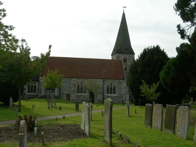
Church of St Andrew, Cobham
Church of St Andrew, Cobham — church in Cobham, Surrey, England, UK.
 📷 5
📷 5Natural landmarks · London
Cobham Free School
Cobham Free School — a school heritage in england-london, United Kingdom.
More towns in this region
 Flagship📷 10
Towns & cities · London
Aldenham
Aldenham — village and civil parish in Hertfordshire, England.
 Flagship📷 10
Towns & cities · London
Ashdon
Ashdon — village and civil parish in Essex, UK.
 Flagship📷 10
Towns & cities · London
Betchworth
Betchworth — village and civil parish in the Mole Valley district of Surrey, England.
 Flagship📷 10
Towns & cities · London
Boxley
Boxley — village and civil parish in Maidstone District, Kent, England, UK.
Frequently asked questions
- Where is Cobham?
- Cobham is in Surrey, London, United Kingdom (postcode KT11), in the parish of Elmbridge, unparished area.
- Is Cobham free to visit?
- Yes, Cobham is free to enter.
- How do I get to Cobham?
- The nearest railway station is Cobham & Stoke d'Abernon, about 1.8 km away. Drivers can navigate to postcode KT11.