Archaeological sites · Scottish Highlands
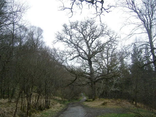
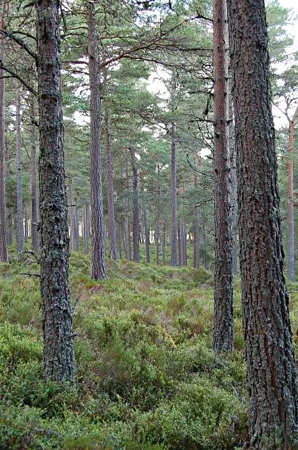
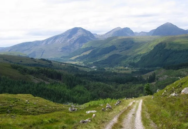
Clashindarroch Forest
Clashindarroch Forest — forest in Aberdeenshire, Scotland, UK.

Wikimedia Commons contributors — see linked file page for photographer and licence licence
Plan your visit
- Typical visit
- 45 min–1.5 h
- Free entry
- Dog-friendly
About
Clashindarroch Forest is an archaeological site in the United Kingdom. Wikidata describes it as: "forest in Aberdeenshire, Scotland, UK". Coordinates: 57.3236°, -2.9565°.
Photo gallery
From the Wikipedia article
Clashindarroch Forest is possibly the largest forest in Aberdeenshire, situated to the south-west of the market town of Huntly. Managed by Forestry and Land Scotland. It is the location of a series of Nordic Skiing trails managed by the Nordic Ski Centre. The forest is home to a small Scottish wildcat population, a species considered to be at the verge of extinction. In 2006, a proposal was made to construct a 47 turbine windfarm in the forest which was the subject of a public inquiry in May 2006. Construction of the 18 Senvion MM82 turbine 36.9MW Clashindarroch Wind Farm phase 1 project was completed in 2015. In 2020 Vattenfall sought planning permission for a 77MW phase 2 development of 14 turbines.
Excerpt from Wikipedia under CC BY-SA 4.0. See the source article linked in Sources below.
- Coordinates
- 57.3236, -2.9565
- District
- Moray
- Postcode
- AB54 4HP
- Parliamentary constituency
- Moray West, Nairn and Strathspey
- Official site
- scotland.forestry.gov.uk
Sources
- wikidata: Q5127828 (CC0)
- wikipedia: Clashindarroch Forest (CC BY-SA 4.0)
- commons: Clashindarroch Forest - geograph.org.uk - 458178.jpg (CC BY-SA 4.0)
Other places nearby
Loading nearby places…
Nearby
 📷 3
📷 3Archaeological sites · Scottish Highlands
Hall of Tolophin
Hall of Tolophin — a archaeological in scotland-highlands, United Kingdom.
 📷 5
📷 5Historic churches · Scottish Highlands
Cabrach Parish Church
Cabrach Parish Church — category B listed building-listed church in scotland-highlands, United Kingdom.
 📷 5
📷 5Historic bridges · Scottish Highlands
Bridge, Cabrach
Bridge, Cabrach — category C listed building-listed bridge in scotland-highlands, United Kingdom.
 📷 5
📷 5Historic bridges · Scottish Highlands
Bridge, Milltown Burn, Milltown
Bridge, Milltown Burn, Milltown — category C listed building-listed bridge in scotland-highlands, United Kingdom.
Vineyards · Scottish Highlands
Wheedlemont
Wheedlemont — a UK vineyard in scotland highlands, producing English or Welsh wine from cool-climate grape varieties.
 📷 3
📷 3Hill forts · Scottish Highlands
Wheedlemont Hillfort
Wheedlemont Hillfort — a hill fort in scotland-highlands, United Kingdom.
More archaeological sites in this region
 📷 5
📷 5Archaeological sites · Scottish Highlands
Ariundle Oakwood National Nature Reserve
Ariundle Oakwood National Nature Reserve — forested nature reserve in Highland, Scotland, UK.
 📷 3
📷 3Archaeological sites · Scottish Highlands
Abernethy Forest
Abernethy Forest — forest in Highland, Scotland, UK.
 📷 3
📷 3Archaeological sites · Scottish Highlands
Abriachan Forest
Abriachan Forest — Forest near Abriachan village in Scotland.
 📷 3
📷 3Archaeological sites · Scottish Highlands
Achnashellach Forest
Achnashellach Forest is a archaeological site in the United Kingdom.
Frequently asked questions
- Where is Clashindarroch Forest?
- Clashindarroch Forest is in Scottish Highlands, in the United Kingdom — coordinates 57.3236°, -2.9565°.
- Is Clashindarroch Forest free to visit?
- Yes — admission to Clashindarroch Forest is free.