National landscapes (AONB) · Mid Wales
Church Stretton
Church Stretton is a market town and civil parish in south Shropshire, England, 13 miles (21 km) south of Shrewsbury and 15 miles (24 km) north of Ludlow. The population of the parish as a whole in 20

Anthony Parkes — CC BY-SA 2.0 via Wikimedia Commons licence
Plan your visit
- Typical visit
- 3 h–6 h
- Free entry
- Dog-friendly
About
Church Stretton is a market town and civil parish in south Shropshire, England, 13 miles (21 km) south of Shrewsbury and 15 miles (24 km) north of Ludlow. The population of the parish as a whole in 2024 was given by ONS as 4469. The town was nicknamed Little Switzerland in the late Victorian and Edwardian period for its landscape, and became a health resort. The local geology includes some of the oldest rocks in England and a notable fault is named after the town. Church Stretton is in the Shropshire Hills Area of Outstanding Natural Beauty.
Photo gallery
From the Wikipedia article
Church Stretton is a market town and civil parish in south Shropshire, England, 13 miles (21 km) south of Shrewsbury and 15 miles (24 km) north of Ludlow. The population of the parish as a whole in 2024 was given by ONS as 4469. The town was nicknamed Little Switzerland in the late Victorian and Edwardian period for its landscape, and became a health resort. The local geology includes some of the oldest rocks in England and a notable fault is named after the town. Church Stretton is in the Shropshire Hills Area of Outstanding Natural Beauty.
Excerpt from Wikipedia under CC BY-SA 4.0. See the source article linked in Sources below.
Background
History
People have lived in the Stretton Gap (or Dale) for thousands of years; an Iron Age hillfort on Caer Caradoc overlooks the town. The name "Stretton" is derived from the Old English words stræt meaning "Roman road" and tun meaning "settlement"; a Roman road, Watling Street runs through the Stretton Gap, though the town (and adjacent settlements) were not historically located on this road – during the "Dark Ages" the settlements grew a short distance away from the old thoroughfare, for defensive purposes. Today the modern A49 road, which was constructed on its current alignment through the Stretton Gap in the late 1930s, runs along a similar course to the Roman Road. The Roman road was…
Description
The Burway is an ancient route which leads up from the town to the plateau on the Long Mynd. It is Shropshire's highest public road, reaching 492 m above sea level and passing close to the highest point of the Long Mynd, called Pole Bank (516 m). The gliding club at the southern end of the Long Mynd can be accessed via the Burway from either Asterton or Church Stretton. The part of the road within the town is called Burway Road and begins at the crossroads in the town centre, where the B5477 and B4371 meet.
Sourced from Wikipedia under CC BY-SA 4.0.
- Coordinates
- 52.5390, -2.8080
- District
- Shropshire
- Parish
- Church Stretton
- Postcode
- SY6 6DL
- Parliamentary constituency
- South Shropshire
- Official site
- www.churchstretton.co.uk
Sources
- wikipedia: Church Stretton (CC BY-SA 4.0)
Other places nearby
Loading nearby places…
Nearby
Cafés · Mid Wales
Berry's
Berry's — a café in wales mid.
 📷 5
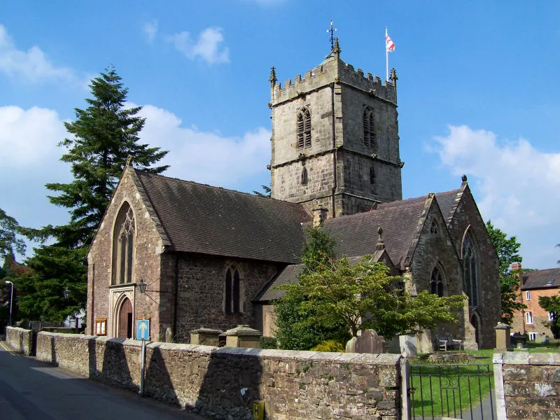
📷 5Historic churches · Mid Wales
St Laurence's Church, Church Stretton
St Laurence's Church, Church Stretton — church in Church Stretton, Shropshire, England, UK.
B&Bs · Mid Wales
Victoria House
Victoria House — a bed-and-breakfast in wales mid.
 📷 3
📷 3Memorials & monuments · Mid Wales
Church Stretton War Memorial
Church Stretton War Memorial — Grade II listed building-listed memorial in wales-mid, United Kingdom.
 📷 3
📷 3Cemeteries · Mid Wales
Cunnery Road Cemetery
Cunnery Road Cemetery is a cemetery in the United Kingdom.
 📷 4
📷 4Forests & woodlands · Mid Wales
Rectory Wood
Rectory Wood in Wales Mid, United Kingdom.
More national landscapes in this region
 📷 4
📷 4National landscapes (AONB) · Mid Wales
Long Mynd
The Long Mynd is a heath and moorland plateau that forms part of the Shropshire Hills in Shropshire, England. The high ground, which is common land and designated as a National Landscape, lies between
 📷 4
📷 4National landscapes (AONB) · Mid Wales
Shropshire Hills National Landscape
The Shropshire Hills National Landscape is a designated National Landscape in Shropshire, England. It is located in the south of the county, extending to its border with Wales. Designated in 1958, the
 📷 5
📷 5National landscapes (AONB) · Mid Wales
River Wye
River Wye in Wales Mid, United Kingdom.
 📷 4
📷 4National landscapes (AONB) · Mid Wales
Chapel Lawn
Chapel Lawn in Wales Mid, United Kingdom.
Frequently asked questions
- Where is Church Stretton?
- Church Stretton is in Mid Wales, United Kingdom (postcode SY6 6DL), in the parish of Church Stretton.
- Is Church Stretton free to visit?
- Yes, Church Stretton is free to enter.
- How do I get to Church Stretton?
- Drivers can navigate to postcode SY6 6DL. It sits within the South Shropshire parliamentary constituency.