Historic churches · East Midlands
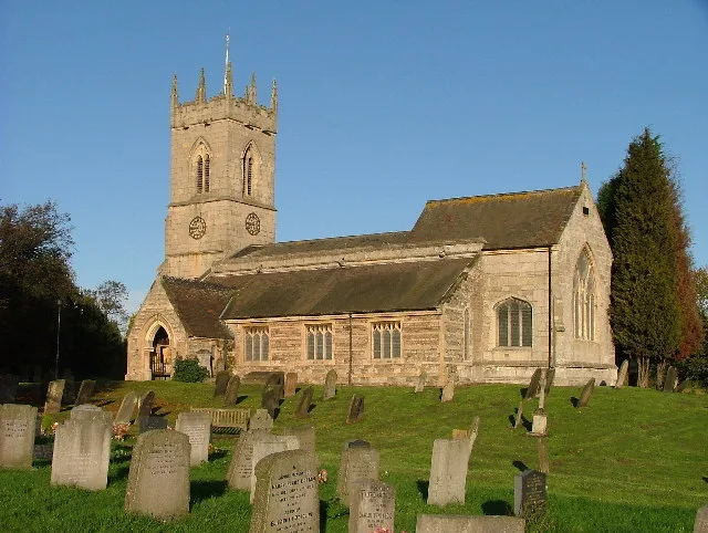
Church of St Mary and All Saints, Chesterfield
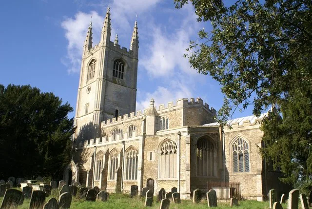
Church of St Mary and All Saints, Chesterfield — church with crooked spire in Chesterfield.

Wikimedia Commons contributors — see linked file page for photographer and licence licence
Plan your visit
- Typical visit
- 30 min–1 h
- Nearest railway station
- Chesterfield · 0.4 km
- Free entry
- Family-friendly
About
Church of St Mary and All Saints, Chesterfield is a historic church in the United Kingdom. Records date its origin to 1500. Heritage designation: Grade I listed building. Affiliated with Anglicanism. Wikidata describes it as: "church with crooked spire in Chesterfield". Coordinates: 53.2361°, -1.4242°.
Photo gallery
Heritage listing
Chesterfield Parish Church is an Anglican church dedicated to Saint Mary and All Saints, in Chesterfield, Derbyshire, England. Building of the church began in 1234 AD, though the present church dates predominantly from the 14th century. Designated a Grade I listed building in 1971, St Mary's is best known for its twisted and leaning spire (known as the Crooked Spire). It is the largest parish church in the Diocese of Derby and forms part of the Archdeaconry of Chesterfield.
From the Historic England List Entry under OGL v3.
From the Wikipedia article
Chesterfield Parish Church is an Anglican church dedicated to Saint Mary and All Saints, in Chesterfield, Derbyshire, England. Building of the church began in 1234 AD, though the present church dates predominantly from the 14th century. Designated a Grade I listed building in 1971, St Mary's is best known for its twisted and leaning spire (known as the Crooked Spire). It is the largest parish church in the Diocese of Derby and forms part of the Archdeaconry of Chesterfield. In 1994, it also became the UK's only representative in the Association of the Twisted Spires of Europe; of the 72 member churches, it is deemed to have the greatest lean and twist.
Excerpt from Wikipedia under CC BY-SA 4.0. See the source article linked in Sources below.
Background
History
Evidence of a Christian church on the site dates to the Anglo-Saxon era; a font thought to date from 890 to 1050 AD can be seen in the south transept of the current church. There is mention of the 'Church in Chesterfield' during the 11th-century reign of Edward the Confessor, and historians believe there was also a Norman church. Construction on the present church started in 1234 AD. It was continued and expanded throughout the medieval period, particularly in the 14th century. It is laid out in a classic cruciform and comprises a nave, aisles, north and south transepts and the chancel which is surrounded by four guild chapels. During the Reformation in the 1500s, the church lost much of…
Sourced from Wikipedia under CC BY-SA 4.0.
- Coordinates
- 53.2361, -1.4242
- County
- Derbyshire
- District
- Chesterfield
- Parish
- Chesterfield, unparished area
- Postcode
- S41 7TD
- Parliamentary constituency
- Chesterfield
- Established
- 1500
- Nearest railway station
- Chesterfield — 0.4 km
- Opening
- "closed"
- Official site
- www.chesterfieldparishchurch.org.uk
Sources
- wikidata: Q5117560 (CC0)
- wikipedia: Church of St Mary and All Saints, Chesterfield (CC BY-SA 4.0)
- commons: Crooked spire of Chesterfield Parish Church - geograph.org.uk - 341995.jpg (CC BY-SA 4.0)
Other places nearby
Loading nearby places…
Nearby
 📷 3
📷 3Memorials & monuments · East Midlands
War Memorial in Churchyard to North East of St Mary's Church
War Memorial in Churchyard to North East of St Mary's Church — Grade II listed building-listed memorial in england-east-midlands, United Kingdom.
 📷 5
📷 5Museums · East Midlands
Chesterfield Museum and Art Gallery
Chesterfield Museum and Art Gallery — a museum in england-east-midlands, United Kingdom.
📷 3Museums · East Midlands
Chesterfield Museum
Chesterfield Museum — a museum in england-east-midlands, United Kingdom.
 📷 3
📷 3Distilleries · East Midlands
Ginnners
Ginnners — Whisky/spirit distillery.
 📷 3
📷 3Theatres · East Midlands
Pomegranate Theatre
Pomegranate Theatre is a theatre in the United Kingdom.
📷 3Theatres · East Midlands
Winding Wheel
Winding Wheel is a theatre in the United Kingdom.
Other places from this era
 📷 5
📷 5Historic churches · London
All Saints Church, Conington
All Saints Church, Conington — church in Conington, Huntingdonshire, Cambridgeshire, England, UK.
 📷 5
📷 5Historic churches · London
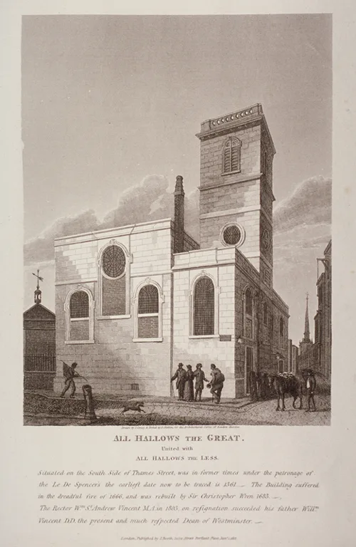
All-Hallows-the-Great
All-Hallows-the-Great — church in City of London, UK.
 📷 5
📷 5Historic churches · London
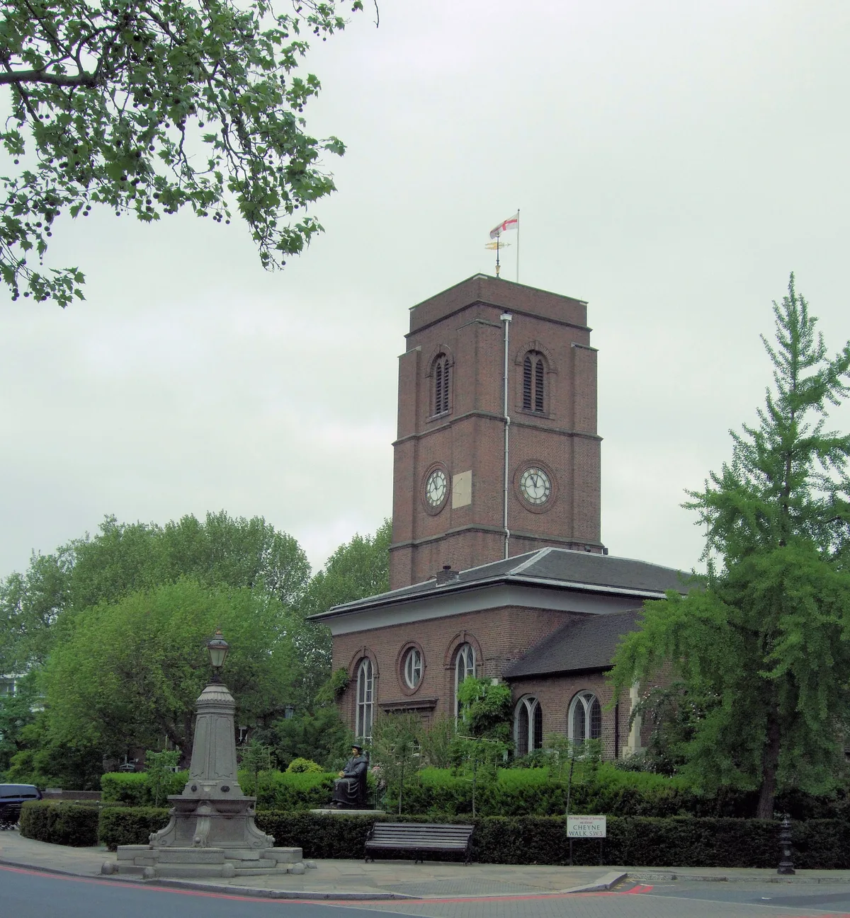
Chelsea Old Church
Chelsea Old Church — church in Royal Borough of Kensington and Chelsea, UK.
 📷 5
📷 5Historic churches · London
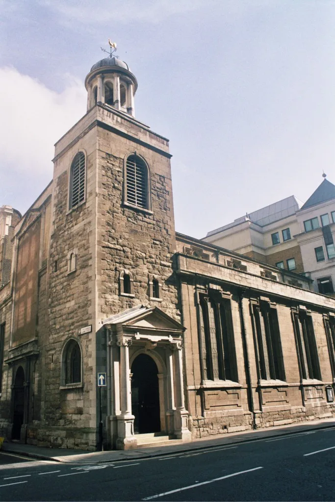
Church of St Katharine Cree, London
Church of St Katharine Cree, London — church in City of London, UK.
More places in this region
 📷 3
📷 3Historic churches · East Midlands
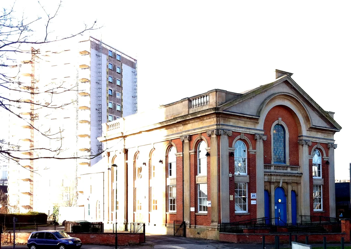
Addison Street Congregational Church
Addison Street Congregational Church — church in United Kingdom.
 📷 3
📷 3Historic churches · East Midlands
Albion Congregational Church
Albion Congregational Church — church building in Nottingham, Nottinghamshire, England, UK.
 📷 3
📷 3Historic churches · East Midlands
All Hallows' Church, Ordsall
All Hallows' Church, Ordsall — Grade I listed church in Bassetlaw, Nottinghamshire, England, UK.
 📷 3
📷 3Historic churches · East Midlands
All Saints Church
All Saints Church — church in Barrowby, Lincolnshire, England, UK.
Frequently asked questions
- Where is Church of St Mary and All Saints, Chesterfield?
- Church of St Mary and All Saints, Chesterfield is in Derbyshire, the East Midlands, United Kingdom (postcode S41 7TD), in the parish of Chesterfield, unparished area.
- When was Church of St Mary and All Saints, Chesterfield built?
- Built or established in 1500.
- Is Church of St Mary and All Saints, Chesterfield a listed building?
- Church of St Mary and All Saints, Chesterfield is officially recognised as Grade I listed building listed.
- Is Church of St Mary and All Saints, Chesterfield free to visit?
- Yes, Church of St Mary and All Saints, Chesterfield is free to enter.
- How do I get to Church of St Mary and All Saints, Chesterfield?
- The nearest railway station is Chesterfield, about 0.4 km away. Drivers can navigate to postcode S41 7TD.