Historic churches · Central Scotland
church and burial ground 150m SE of Cranshaws House
church and burial ground 150m SE of Cranshaws House — scheduled monument-listed church in scotland-central, United Kingdom.

M J Richardson — CC BY-SA 2.0 via Wikimedia Commons licence
Plan your visit
- Typical visit
- 30 min–1 h
- Free entry
About
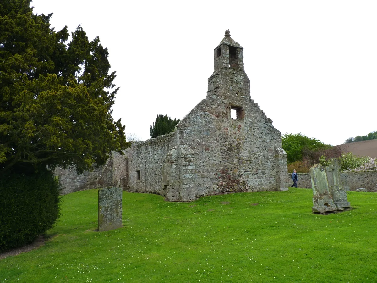
church and burial ground 150m SE of Cranshaws House is a scheduled monument-listed church in scotland-central, United Kingdom, registered on the Historic Environment Scotland register (entry SM12422). Listed status protects buildings and structures of special architectural or historic interest. See the linked Wikipedia article for further details.
Photo gallery
Heritage listing
Date Added 20/02/2009 Type Ecclesiastical: burial ground, cemetery, graveyard; church Local Authority Scottish Borders Parish Cranshaws NGR NT 68371 61670 Coordinates 368371, 661670 — The monument comprises the remains of a later medieval church located to the north-west of an associated burial ground, now disused. The monument lies on a SE-facing slope of Cranshaws Hill, at around 230m above sea level. The first known mention of the church, probably dedicated to St Ninian, dates to 1275, but excavated evidence suggests it may be an earlier foundation. Described as ruinous in 1660, the new parish church 850m to the east replaced it in 1739. The church survives as a single-cell rectangular structure that measures 19.5m east-west by 5m transversely. A 3m length of the E gable, of partially reconstructed rubble masonry, stands to a height in excess of 3m and 1m wide. Elsewhere piles of loose rubble about 1m in width and standing to a height of 0.5m mark the foundations. The foundations are less well preserved and discontinuous in the north and west of the structure. The two entrances in the southern side, identified by excavation in the 19th century, are visible as two breaks in the southern wall at its western end. A wall dividing the W end, also identified through excavation, is not now visible. The burial ground is sub-rectangular in plan and defined by a later stone plantation boundary dyke. On its southern side this cuts into the raised area of the burial ground and in the NW corner it crosses a corner of the church foundations. A number of burials, some marked by upstanding gravestones, survive within the burial ground. Twelve sculptured stones were noted in 1925, including a figure in Jacobean dress. A portion of greywacke basin, previously noted within the boundary
From Historic Environment Scotland under OGL v3.
Place summary
The church and burial ground 150m SE of Cranshaws House is located in central Scotland. It is designated as a scheduled monument, highlighting its historical significance.
AI-generated from the structured facts on this page (operator, designation, listing, era). Not a substitute for visiting.
- Coordinates
- 55.8472, -2.5067
- District
- Scottish Borders
- Postcode
- TD11 3SJ
- Parliamentary constituency
- Berwickshire, Roxburgh and Selkirk
Sources
- wikidata: Q56662824 (CC0)
Other places nearby
Loading nearby places…
Nearby
📷 4Castles · North East England
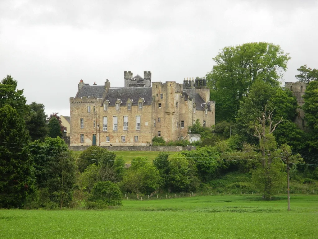
Cranshaws Castle
Cranshaws Castle in England North East, United Kingdom.
 📷 4
📷 4Abbeys & priories · North East England
Cranshaws
Cranshaws in England North East, United Kingdom.
 📷 5
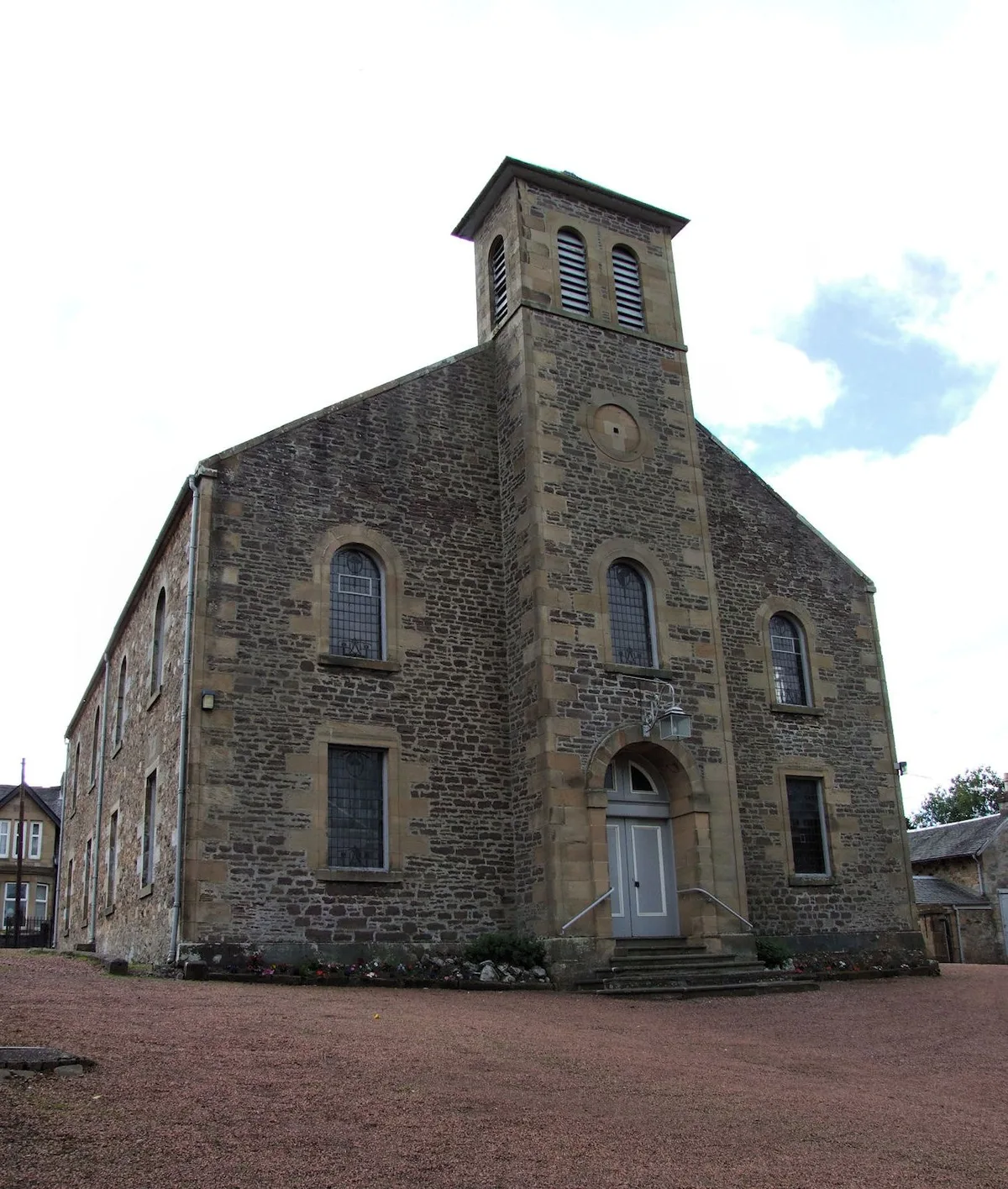
📷 5Historic churches · Central Scotland
Cranshaws Parish Church
Cranshaws Parish Church — category A listed building-listed church in scotland-central, United Kingdom.
 📷 5
📷 5Historic bridges · Central Scotland
Smiddyhill Bridge
Smiddyhill Bridge — category B listed building-listed bridge in scotland-central, United Kingdom.
Vineyards · Central Scotland
St Agnes
St Agnes — a UK vineyard in scotland central, producing English or Welsh wine from cool-climate grape varieties.
 📷 3
📷 3Natural landmarks · Central Scotland
Whiteadder
Whiteadder — a other in scotland-central, United Kingdom.
More places in this region
 📷 3
📷 3Historic churches · Central Scotland
Abbeygreen Church
Abbeygreen Church — church building in Lesmahagow, South Lanarkshire, Scotland, UK.
 📷 3
📷 3Historic churches · Central Scotland
Abdie Church
Abdie Church — church in Fife, Scotland, UK.
 📷 3
📷 3Historic churches · Central Scotland
Abercorn Church
Abercorn Church — church in West Lothian, Scotland, UK.
 📷 3
📷 3Historic churches · Central Scotland
Airth Old Parish Church
Airth Old Parish Church — church in Falkirk, Scotland, UK.
Frequently asked questions
- Where is church and burial ground 150m SE of Cranshaws House?
- church and burial ground 150m SE of Cranshaws House is in central Scotland, United Kingdom (postcode TD11 3SJ).
- Is church and burial ground 150m SE of Cranshaws House a listed building?
- church and burial ground 150m SE of Cranshaws House is officially recognised as scheduled monument listed.
- Is church and burial ground 150m SE of Cranshaws House free to visit?
- Yes, church and burial ground 150m SE of Cranshaws House is free to enter.
- How do I get to church and burial ground 150m SE of Cranshaws House?
- Drivers can navigate to postcode TD11 3SJ. It sits within the Berwickshire, Roxburgh and Selkirk parliamentary constituency.