Towns & cities · South East England
Chiseldon
Chiseldon — village and civil parish in Wiltshire, England, UK.

Wikimedia Commons contributors — see linked file page for photographer and licence licence
Plan your visit
- Typical visit
- 3 h–6 h
- Nearest railway station
- Lakeside · 3.2 km
- Free entry
- Family-friendly
- Dog-friendly
About
Chiseldon is a town, city, village or settlement in the United Kingdom. Recent population estimates put it at around 2,492 people. Address: SN4. Wikidata describes it as: "village and civil parish in Wiltshire, England, UK". Coordinates: 51.5141°, -1.7348°.
Photo gallery
Protected designations
- Area of Outstanding Natural Beauty: Cotswolds
- Area of Outstanding Natural Beauty: North Wessex Downs
Designations sourced from Natural England open data under OGL v3.
From the Wikipedia article
Chiseldon is a village and civil parish in the Borough of Swindon, Wiltshire, England. The village lies on the edge of the Marlborough Downs, a mile south of junction 15 of the M4 motorway, on the A346 between Swindon and Marlborough. The large village of Wroughton is 2.5 miles (4 km) to the west. The parish includes the hamlets of Badbury, Badbury Wick, Draycot Foliat, Hodson, and Ridgeway View; the ancient manor of Burderop is also within the parish.
Excerpt from Wikipedia under CC BY-SA 4.0. See the source article linked in Sources below.
Background
History
Settlements in the area date back to prehistoric and Roman times, but Chiseldon itself was started by the Saxons. The Domesday Book of 1086 recorded a large settlement of 70 households at Chiseldene. It takes its name from the Old English cisel dene, or gravel valley. At one point the nearby hamlet of Draycot Foliat was larger than Chiseldon. Chiseldon lies on one of the country's oldest highways, the Icknield Way, although this section of the road is more commonly known as The Ridgeway. The spelling "Chisledon" has also been used, and continues in the name of the ecclesiastical parish. In 2004, a group of Iron Age cauldrons were discovered at a site close to the centre of the village. This…
Description
]] The Parish of Chiseldon encompasses not only the village but also the neighbouring hamlets of Draycot Foliat and Hodson. Draycot Foliat had its own church and parish in the medieval period, but in 1571 the Bishop of Salisbury ordered the church in Draycot to be demolished, as neither parish could sustain their own rectors any longer. As Chiseldon was the larger, Draycot was incorporated into that parish, and the materials from the church in Draycot were used to repair the church in Chiseldon. In 2017 a community governance review redrew the northern boundary of the parish to follow the M4, transferring the area to the north to the newly created Central Swindon South parish. This area…
Sourced from Wikipedia under CC BY-SA 4.0.
- Coordinates
- 51.5141, -1.7348
- District
- Swindon
- Parish
- Chiseldon
- Postcode
- SN4
- Parliamentary constituency
- East Wiltshire
- Population
- 2,492
- Nearest railway station
- Lakeside — 3.2 km
- Official site
- chiseldonparishcouncil.com
Sources
- wikidata: Q1922836 (CC0)
- wikipedia: Chiseldon (CC BY-SA 4.0)
- commons: ChiseldonGreen.jpg (CC BY-SA 4.0)
Other places nearby
Loading nearby places…
Nearby
 📷 5
📷 5Historic houses · South East England
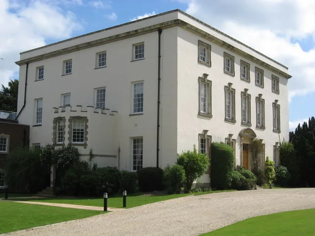
Chiseldon House Hotel
Chiseldon House Hotel — a Grade II*-listed historic house in england-south-east, United Kingdom.
 📷 5
📷 5Historic churches · South East England
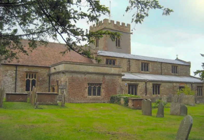
Church of the Holy Cross
Church of the Holy Cross — church in Chiseldon, UK.
 📷 5
📷 5Museums · South East England
Chiseldon Museum
Chiseldon Museum — a museum in england-south-east, United Kingdom.
 📷 5
📷 5Stately homes · South East England
Burderop Park
Burderop Park — building in Wiltshire, England, UK.
 📷 5
📷 5Public art & sculpture · South East England
Cipher Wave
Cipher Wave — a public art in england-south-east, United Kingdom.
📷 5Memorials & monuments · South East England
RAF Princess Alexandra Hospital
RAF Princess Alexandra Hospital — a memorial in england-south-east, United Kingdom.
More towns in this region
 Flagship📷 10
Towns & cities · South East England
Aldermaston
Aldermaston — village and civil parish in West Berkshire in England, UK.
 Flagship📷 10
Towns & cities · South East England
Aldingbourne
Aldingbourne — village and civil parish in Arun, West Sussex, UK.
 Flagship📷 10
Towns & cities · South East England
Aldington
Aldington — village and civil parish in the Ashford District of Kent, England.
 Flagship📷 10
Towns & cities · South East England
Aldworth
Aldworth — village and civil parish in the English county of Berkshire.
Frequently asked questions
- Where is Chiseldon?
- Chiseldon is in South-East England, United Kingdom (postcode SN4), in the parish of Chiseldon.
- Is Chiseldon a protected site?
- Yes — Chiseldon is part of the Cotswolds National Landscape (AONB) and the North Wessex Downs National Landscape (AONB).
- Is Chiseldon free to visit?
- Yes, Chiseldon is free to enter.
- How do I get to Chiseldon?
- The nearest railway station is Lakeside, about 3.2 km away. Drivers can navigate to postcode SN4.