Towns & cities · South East England
Chisbury
Chisbury — village in Wiltshire, England, UK.

Wikimedia Commons contributors — see linked file page for photographer and licence licence
Plan your visit
- Typical visit
- 3 h–6 h
- Nearest railway station
- Bedwyn · 1.6 km
- Free entry
- Family-friendly
- Dog-friendly
About
Chisbury is a town, city, village or settlement in the United Kingdom. Address: SN8. Wikidata describes it as: "village in Wiltshire, England, UK". Coordinates: 51.3940°, -1.6020°.
Photo gallery
Protected designations
- Site of Special Scientific Interest: River Kennet SSSI
- Area of Outstanding Natural Beauty: Cotswolds
- Area of Outstanding Natural Beauty: North Wessex Downs
Designations sourced from Natural England open data under OGL v3.
From the Wikipedia article
Chisbury is a hamlet and prehistoric hill fort in the civil parish of Little Bedwyn in Wiltshire, England. Chisbury is about 4 miles (6 km) west of Hungerford and about 6 miles (10 km) south-east of Marlborough.
Excerpt from Wikipedia under CC BY-SA 4.0. See the source article linked in Sources below.
Background
History
At 176 m above sea level, Chisbury hillfort is the highest point in Little Bedwyn parish and encloses an area of about 14 acre. Palaeolithic, Neolithic and Bronze Age artefacts have been found in the area, but the hillfort was most probably built in the late Iron Age in the 1st century AD. The hillfort was re-used in the Anglo-Saxon times as a burh, cited as Cyssanbyrig in the Burghal Hidage document which lists the fortifications of Wessex in the later part of the 9th century, although Julian Orbach cautions that this may be a misreading for Tisbury. St. Martin's chapel, on the eastern edge of the hillfort, seems to have been built in the early part of the 13th century. Chisbury Manor…
Sourced from Wikipedia under CC BY-SA 4.0.
- Coordinates
- 51.3940, -1.6020
- District
- Wiltshire
- Parish
- Little Bedwyn
- Postcode
- SN8
- Parliamentary constituency
- East Wiltshire
- Nearest railway station
- Bedwyn — 1.6 km
Sources
- wikidata: Q1241079 (CC0)
- wikipedia: Chisbury (CC BY-SA 4.0)
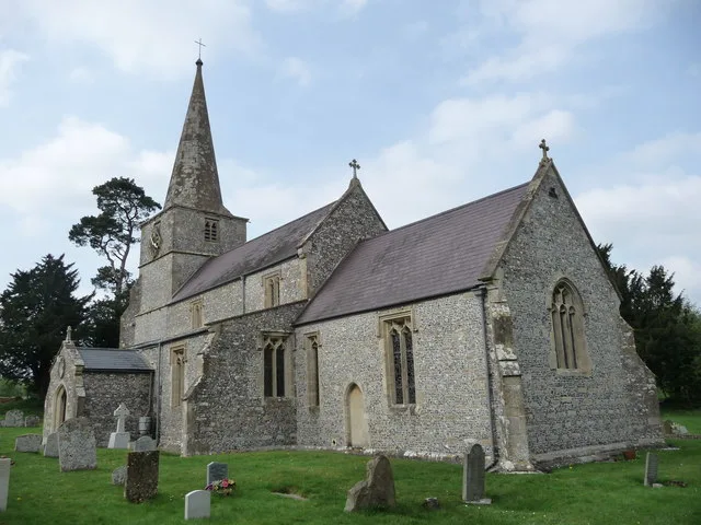
- commons: St. Martin's Chapel, Chisbury Manor Farm - geograph.org.uk - 99682.jpg (CC BY-SA 4.0)
Other places nearby
Loading nearby places…
Nearby
📷 5Chapels · South East England
St Martin's Chapel, Chisbury
St Martin's Chapel, Chisbury — chapel in Chisbury, England.
 📷 5
📷 5Canal locks · South East England
Little Bedwyn Lock
Little Bedwyn Lock — lock in Wiltshire, England.
 📷 5
📷 5Canal locks · South East England
Potter's Lock
Potter's Lock is a canal lock in the United Kingdom.
 📷 5
📷 5Abbeys & priories · South East England
Church of St Michael
Church of St Michael — Grade I listed church in Little Bedwyn, Wiltshire, England, UK.
 📷 5
📷 5Cathedrals · South East England
Church of St Michael
Church of St Michael is a cathedral in the United Kingdom.
 📷 5
📷 5Canal locks · South East England
Burnt Mill Lock
Burnt Mill Lock — canal lock in Wiltshire, England.
More towns in this region
 Flagship📷 10
Towns & cities · South East England
Aldermaston
Aldermaston — village and civil parish in West Berkshire in England, UK.
 Flagship📷 10
Towns & cities · South East England
Aldingbourne
Aldingbourne — village and civil parish in Arun, West Sussex, UK.
 Flagship📷 10
Towns & cities · South East England
Aldington
Aldington — village and civil parish in the Ashford District of Kent, England.
 Flagship📷 10
Towns & cities · South East England
Aldworth
Aldworth — village and civil parish in the English county of Berkshire.
Frequently asked questions
- Where is Chisbury?
- Chisbury is in South-East England, United Kingdom (postcode SN8), in the parish of Little Bedwyn.
- Is Chisbury a protected site?
- Yes — Chisbury is part of the River Kennet SSSI Site of Special Scientific Interest and the Cotswolds National Landscape (AONB).
- Is Chisbury free to visit?
- Yes, Chisbury is free to enter.
- How do I get to Chisbury?
- The nearest railway station is Bedwyn, about 1.6 km away. Drivers can navigate to postcode SN8.