Historic churches · North West England
Cheetham, Manchester
Cheetham is an inner-city area and electoral ward of Manchester, England, which in 2011 had a population of 22,562. It lies on the west bank of the River Irk, 1.4 miles (2.3 km) north of Manchester ci

Whatlep — CC BY-SA 2.0 via Wikimedia Commons licence
Plan your visit
- Typical visit
- 30 min–1 h
- Free entry
About
Cheetham is an inner-city area and electoral ward of Manchester, England, which in 2011 had a population of 22,562. It lies on the west bank of the River Irk, 1.4 miles (2.3 km) north of Manchester city centre, close to the boundary with Salford, bounded by Crumpsall to the north, Broughton to the west, Harpurhey to the east, and Piccadilly and Deansgate to the south. Historically part of Lancashire, Cheetham was a township in the parish of Manchester and hundred of Salford. It was amalgamated into the Borough of Manchester in 1838, and in 1896 became part of the North Manchester. Cheetham is home to a multi-ethnic community, a result of several waves of immigration to Britain. In the mid-19th century, it attracted Irish people fleeing the Great Famine. It is now home to the Irish World Heritage Centre. Jews settled in the late-19th and early-20th centuries, fleeing persecution in continental Europe. Migrants from Pakistan and the Caribbean settled in the 1950s and 1960s, and more recently people from Africa, Eastern Europe and the Far East. Heavily urbanised following the Industrial Revolution, Cheetham is bisected by Cheetham Hill Road, which is lined with churches, mosques, synagogues and temples, as well as terraced houses dating from its history as a textile processing district. Markets along the road trade in wares and foodstuffs from all over the world. The Museum of Transport in Manchester in Boyle Street, Cheetham, is part of Queen's Road bus depot.
Photo gallery
From the Wikipedia article
Cheetham is an inner-city area and electoral ward of Manchester, England, which in 2011 had a population of 22,562. It lies on the west bank of the River Irk, 1.4 miles (2.3 km) north of Manchester city centre, close to the boundary with Salford, bounded by Crumpsall to the north, Broughton to the west, Harpurhey to the east, and Piccadilly and Deansgate to the south. Historically part of Lancashire, Cheetham was a township in the parish of Manchester and hundred of Salford. It was amalgamated into the Borough of Manchester in 1838, and in 1896 became part of the North Manchester. Cheetham is home to a multi-ethnic community, a result of several waves of immigration to Britain. In the mid-19th century, it attracted Irish people fleeing the Great Famine. It is now home to the Irish World Heritage Centre. Jews settled in the late-19th and early-20th centuries, fleeing persecution in continental Europe. Migrants from Pakistan and the Caribbean settled in the 1950s and 1960s, and more recently people from Africa, Eastern Europe and the Far East. Heavily urbanised following the Industrial Revolution, Cheetham is bisected by Cheetham Hill Road, which is lined with churches, mosques, synagogues and temples, as well as terraced houses dating from its history as a textile processing district. Markets along the road trade in wares and foodstuffs from all over the world. The Museum of Transport in Manchester in Boyle Street, Cheetham, is part of Queen's Road bus depot.
Excerpt from Wikipedia under CC BY-SA 4.0. See the source article linked in Sources below.
Background
History
(now used as a restaurant)]] (RC)]] Neolithic implements have been discovered at Cheetham Hill, implying human habitation 7 10,000 years ago. Cheetham is not mentioned in the Domesday Book of 1086 and does not appear in records until 1212, when it was documented to have been a thegnage estate comprising "a plough-land", with an annual rate of 1 mark payable by the tenant, Roger de Middleton, to King John of England. The Anglican churches as of 1955 were St Mark's (1794), St Luke's (1839), St John Evangelist's (Paley & Austin, 1871), St Alban's (J. S. Crowther); at that time there was also a Presbyterian chapel and nine synagogues. St Mark's Church was built in 1794; in 1855 the chancel was…
Sourced from Wikipedia under CC BY-SA 4.0.
- Coordinates
- 53.5040, -2.2310
- District
- Manchester
- Parish
- Manchester, unparished area
- Postcode
- M8 8UW
- Parliamentary constituency
- Manchester Central
- Official site
- motgm.uk
Sources
- wikipedia: Cheetham, Manchester (CC BY-SA 4.0)
Other places nearby
Loading nearby places…
Nearby
 📷 3
📷 3Museums · North West England
Museum of Transport Greater Manchester
Museum of Transport Greater Manchester — a museum in england-north-west, United Kingdom.
 📷 5
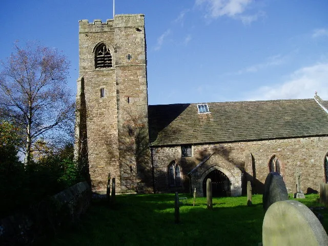
📷 5Historic churches · North West England
St Luke's Church, Cheetham
St Luke's Church, Cheetham — a church in england-north-west, United Kingdom.
 📷 5
📷 5Historic churches · North West England
Khizra mosque
Khizra mosque — a church in england-north-west, United Kingdom.
 📷 5
📷 5Theatres · North West England
Odeon Cheetham Hill
Odeon Cheetham Hill — a cinema heritage in england-north-west, United Kingdom.
 📷 5
📷 5Theatres · North West England
ABC Cheetham Hill
ABC Cheetham Hill — a cinema heritage in england-north-west, United Kingdom.
📷 5Theatres · North West England
Temple Cinema
Temple Cinema — a cinema heritage in england-north-west, United Kingdom.
More places in this region
 📷 3
📷 3Historic churches · North West England
All Hallows Church, Great Mitton
All Hallows Church, Great Mitton — church in the village of Great Mitton, Lancashire, England, UK.
 📷 3
📷 3Historic churches · North West England
All Saints Church, Barnacre
All Saints Church, Barnacre — grade II listed church in Barnacre-with-Bonds, Wyre, Lancashire, England, UK.
 📷 3
📷 3Historic churches · North West England
All Saints Church, Becconsall
All Saints Church, Becconsall — church in United Kingdom.
 📷 3
📷 3Historic churches · North West England
All Saints Church, Burton in Lonsdale
All Saints Church, Burton in Lonsdale — church in Burton in Lonsdale, North Yorkshire, England, UK.
Frequently asked questions
- Where is Cheetham, Manchester?
- Cheetham, Manchester is in North-West England, United Kingdom (postcode M8 8UW), in the parish of Manchester, unparished area.
- Is Cheetham, Manchester free to visit?
- Yes, Cheetham, Manchester is free to enter.
- How do I get to Cheetham, Manchester?
- Drivers can navigate to postcode M8 8UW. It sits within the Manchester Central parliamentary constituency.