Towns & cities · West Midlands
Charwelton
Charwelton — village and civil parish in Northamptonshire, England.

Wikimedia Commons contributors — see linked file page for photographer and licence licence
Plan your visit
- Typical visit
- 3 h–6 h
- Free entry
- Family-friendly
- Dog-friendly
About
Charwelton is a town, city, village or settlement in the United Kingdom. It covers approximately 1,717 km². Recent population estimates put it at around 212 people. Address: NN11. Wikidata describes it as: "village and civil parish in Northamptonshire, England". Coordinates: 52.1950°, -1.2190°.
Photo gallery
From the Wikipedia article
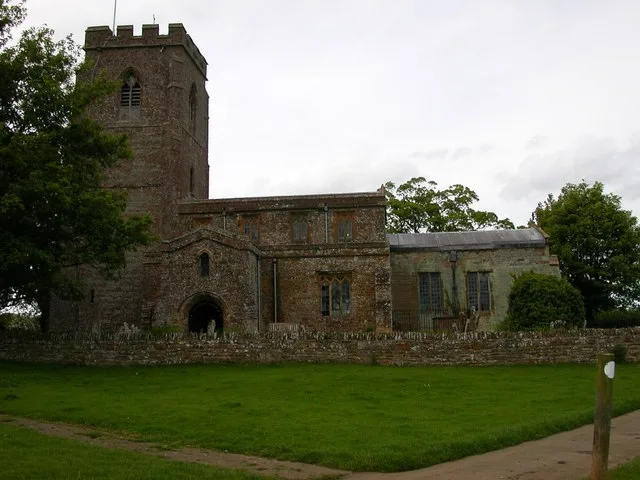
Charwelton is a village and civil parish about 5 miles (8 km) south of Daventry in Northamptonshire, England. The 2011 Census recorded the parish's population (including Fawsley) as 220. The villages name means 'River Cherwell farm/settlement'. The present village, formerly called Upper or Over Charwelton, is where the main road between Daventry and Banbury, now the A361 road, crosses the river. The parish church is almost 1 mile (2 km) southeast at Church Charwelton, which is a hamlet and deserted medieval village. The Jurassic Way long distance footpath between Banbury and Stamford passes through both Church Charwelton and Upper Charwelton.
Excerpt from Wikipedia under CC BY-SA 4.0. See the source article linked in Sources below.
- Coordinates
- 52.1950, -1.2190
- District
- West Northamptonshire
- Parish
- Charwelton
- Postcode
- NN11
- Parliamentary constituency
- Daventry
- Population
- 212
- Official site
- www.charwelton.org.uk
Sources
- wikidata: Q1772233 (CC0)
- wikipedia: Charwelton (CC BY-SA 4.0)
- commons: Church Charwelton.jpg (CC BY-SA 4.0)
Other places nearby
Loading nearby places…
Nearby
 📷 3
📷 3Memorials & monuments · West Midlands
Charwelton and Fawsley War Memorial
Charwelton and Fawsley War Memorial — Grade II listed building-listed memorial in england-west-midlands, United Kingdom.
 📷 3
📷 3Historic churches · West Midlands
Church of Holy Trinity
Church of Holy Trinity — church in Charwelton, Northamptonshire, England, UK.
.jpg?width=1200) 📷 3
📷 3Historic houses · West Midlands
Manor House
Manor House — historic building in Byfield, Daventry, Northamptonshire, England, United Kingdom.
 📷 3
📷 3Historic houses · West Midlands
Byfield market cross
Byfield market cross — a Grade II*-listed historic house in england-west-midlands, United Kingdom.
📷 3Memorials & monuments · West Midlands
Byfield Memorial Cross
Byfield Memorial Cross — a memorial in england-west-midlands, United Kingdom.
Hotels · West Midlands
Fawsley Hall Hotel & Spa
Fawsley Hall Hotel & Spa — a hotel in england west midlands. 4-star. Brand: Handpicked Hotels.
More towns in this region
 Flagship📷 3
Towns & cities · West Midlands
Adderbury
Adderbury — village and civil parish in Cherwell district, Oxfordshire, England.
 Flagship📷 3
Towns & cities · West Midlands
Admington
Admington — village in Warwickshire, England, UK.
 Flagship📷 3
Towns & cities · West Midlands
Aldington
Aldington — village in Worcestershire, United Kingdom.
 Flagship📷 5
Towns & cities · West Midlands
Anstey
Anstey — large village in Leicestershire, England.
Frequently asked questions
- Where is Charwelton?
- Charwelton is in the West Midlands, United Kingdom (postcode NN11), in the parish of Charwelton.
- Is Charwelton free to visit?
- Yes, Charwelton is free to enter.
- How do I get to Charwelton?
- Drivers can navigate to postcode NN11. It sits within the Daventry parliamentary constituency.