Harbours & ports · East Midlands
Centre Port
Centre Port — Proposed development in Eastern England.

Wikimedia Commons licence
Plan your visit
- Typical visit
- 45 min–1.5 h
- Family-friendly
- Dog-friendly
About
Centre Port is a harbour in the United Kingdom. Wikidata describes it as: "Proposed development in Eastern England". Coordinates: 53.0130°, 0.3970°.
Protected designations
- Site of Special Scientific Interest: The Wash SSSI
- Ramsar wetland: The Wash
Designations sourced from Natural England open data under OGL v3.
From the Wikipedia article
Centre Port is a proposed development across The Wash in Eastern England, which would link Norfolk and Lincolnshire by road. The plan is to link Hunstanton in Norfolk, with Gibraltar Point in Lincolnshire, creating an 11-mile (18 km) road, with a port and a railway at the midway point. Additionally the development would be a tidal barrage to prevent sea flooding, and would use tidal power to create enough electricity to power 600,000 homes. Whilst no formal plans have yet been submitted, the scheme has come under widespread criticism from those living in the area and from wildlife groups.
Excerpt from Wikipedia under CC BY-SA 4.0. See the source article linked in Sources below.
Background
History
The Wash is a large tidal area between the counties of Lincolnshire and Norfolk on the eastern coast of England. The Wash is fed by several major watercourses, the main ones are: (anticlockwise from the north) the Steeping River, River Witham, River Welland, River Nene and the River Great Ouse, and covers an area of 615 km2. The Nene, Ouse, Walland and Witham, collectively discharge an average flow of 30.6 m3/s (2,643,840 m3 per day.) fresh water into The Wash. The sea area of The Wash is significantly smaller than it was in the 16th century, as much of the land has been reclaimed - places such as Wisbech, now far inland, were subjected to flooding such as in 1236 when hundreds died in a…
Description
Developer Port Evo announced plans in November 2022 to develop a tidal barrage across The Wash. This would include a causeway with an 11 mi road along the entire length of the barrage, and also include: The port would provide a deep-water trans-shipment point for container traffic by rail. This would feed into the line between and , providing a quicker route into the Midlands and Northern England than the current route from the East Anglian ports. The project has an initial estimate of 2028 for completion.
Sourced from Wikipedia under CC BY-SA 4.0.
- Coordinates
- 53.0130, 0.3970
- Address
- The Wash, England
Sources
- wikidata: Q120291582 (CC0)
- wikipedia: Centre Port (CC BY-SA 4.0)
Other places nearby
Loading nearby places…
Nearby
 📷 5
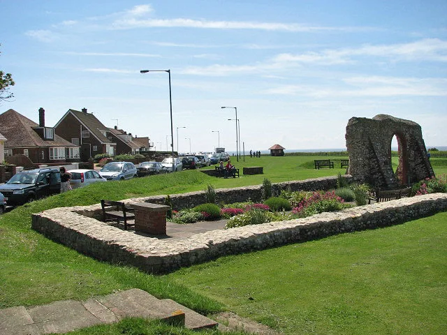
📷 5Memorials & monuments · East Midlands
Coastguard Lookout
Coastguard Lookout — a memorial in england-east-midlands, United Kingdom.
 📷 5
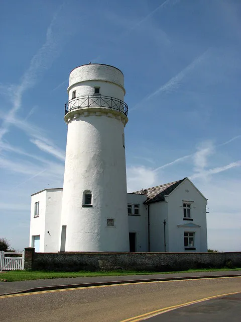
📷 5Lighthouses · East Midlands
Old Hunstanton Lighthouse
Old Hunstanton Lighthouse — lighthouse in Hunstanton, King's Lynn and West Norfolk, Norfolk, England, UK.
 📷 4
📷 4Public art & sculpture · East Midlands
Wuffing
Wuffing — a public art in england-east-midlands, United Kingdom.
📷 3Historic houses · East Midlands
Chapel of Saint Edmund
Chapel of Saint Edmund — a historic house in england-east-midlands, United Kingdom.
 📷 3
📷 3Lighthouses · East Midlands
Light on Chapel of St Edmund
Light on Chapel of St Edmund is a lighthouse in the United Kingdom.
Hotels · East Midlands
Le Strange Arms hotel
Le Strange Arms hotel — a hotel in england east midlands.
More places in this region
 📷 3
📷 3Harbours & ports · East Midlands
Blakeney Harbour
Blakeney Harbour — harbour at Blakeney, Norfolk, England, UK.
 📷 3
📷 3Harbours & ports · East Midlands
King's Lynn Docks
King's Lynn Docks is a harbour in the United Kingdom.
 📷 3
📷 3Harbours & ports · East Midlands
Wells Harbour
Wells Harbour — harbour in Wells next the Sea, Norfolk, England.
Frequently asked questions
- Where is Centre Port?
- Centre Port is in East Midlands, in the United Kingdom — coordinates 53.0130°, 0.3970°.