Hill forts · North West England
Castleshaw Roman fort
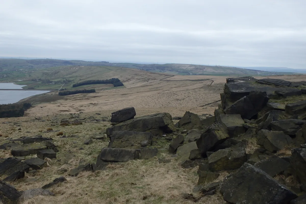
Castleshaw Roman fort — Roman fort in Saddleworth, Greater Manchester, England, UK.

Wikimedia Commons contributors — see linked file page for photographer and licence licence
Plan your visit
- Typical visit
- 1 h–2 h
- Nearest railway station
- Greenfield · 5.0 km
- Free entry
- Dog-friendly
About
Castleshaw Roman fort is a hill fort in the United Kingdom. Heritage designation: part of a Scheduled Monument. Part of Castleshaw Roman forts, 250m west of Castle Shaw Farm. Wikidata describes it as: "Roman fort in Saddleworth, Greater Manchester, England, UK". Coordinates: 53.5830°, -2.0030°.
Photo gallery
Protected designations
- Site of Special Scientific Interest: South Pennine Moors SSSI
Designations sourced from Natural England open data under OGL v3.
From the Wikipedia article
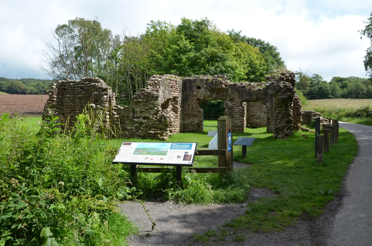
Castleshaw Roman fort was a castellum in the Roman province of Britannia. Although there is no evidence to substantiate the claim, it has been suggested that Castleshaw Roman fort is the site of Rigodunum, a Brigantian settlement. The remains of the fort are located on Castle Hill on the eastern side of Castleshaw Valley at the foot of Standedge but overlooking the valley. The hill is on the edge of Castleshaw in Greater Manchester. The fort was constructed in c. AD 79, but fell out of use at some time during the 90s. It was replaced by a smaller fortlet, built in c. 105, around which a civilian settlement grew. It may have served as a logistical and administrative centre, although it was abandoned in the 120s. The site has been the subject of antiquarian and archaeological investigation since the 18th century, but the civilian settlement lay undiscovered until the 1990s. The fort, fortlet, and civilian settlement are all protected as a scheduled monument, recognising its importance as a "nationally important" archaeological site or historic building, and protecting it against unauthorised change.
Excerpt from Wikipedia under CC BY-SA 4.0. See the source article linked in Sources below.
Background
Architecture
The fort was rectangular in shape and had sides of 115 m and 100 m, covering an area of approximately 1.2 ha. The fortlet was rectangular, with sides of 50 m by 40 m, and covered 1950 m2. The inner ditch was 3.9 m wide and 1.3 m deep while the outer ditch was 2.5 m wide and 0.9 m deep. A Punic ditch is a defensive v-shaped ditch with one side much steeper than the other; the ditches surrounding the fortlet had an outer face at 27 degrees and the inner face at 69 degrees. Whether corner towers were a feature of the fortlet is unknown, no evidence remains aside from a single posthole, although only the north and east corners survive in good condition. There were two gateways, one to the north…
Sourced from Wikipedia under CC BY-SA 4.0.
- Coordinates
- 53.5830, -2.0030
- District
- Oldham
- Parish
- Saddleworth
- Postcode
- OL3 5HS
- Parliamentary constituency
- Oldham East and Saddleworth
- Nearest railway station
- Greenfield — 5 km
Sources
- wikidata: Q5050612 (CC0)
- wikipedia: Castleshaw Roman Fort (CC BY-SA 4.0)
- commons: Ditch of Castleshaw Roman fort.jpg (CC BY-SA 4.0)
Other places nearby
Loading nearby places…
Nearby
 📷 3
📷 3Archaeological sites · North West England
Rigodunum Roman Fort
Rigodunum Roman Fort — a archaeological in england-north-west, United Kingdom.
 📷 3
📷 3Mountains & hills · Yorkshire & the Humber
Standedge
Standedge — Named summit at 457 m.
 📷 3
📷 3Historic churches · North West England
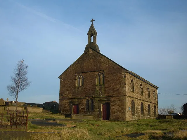
St Thomas' Church, Friarmere
St Thomas' Church, Friarmere — church in Delph, Oldham, Greater Manchester, England, UK.
 📷 3
📷 3Historic bridges · Yorkshire & the Humber
Huddersfield Narrow Canal No. 66 Bridge
Huddersfield Narrow Canal No. 66 Bridge — Grade II listed building-listed bridge in england-yorkshire, United Kingdom.
.JPG?width=1200) 📷 3
📷 3Mills · North West England
Shore Mill
Shore Mill — mill in Saddleworth, Oldham, England, UK.
 📷 3
📷 3Historic houses · North West England
9 and 11, High Street
9 and 11, High Street — Grade II listed building in Delph, Saddleworth, Oldham, Greater Manchester, OL3.
More places in this region
 📷 5
📷 5Hill forts · North West England
Buckton Castle
Buckton Castle — 12th-century castle in Mossley, Greater Manchester, England, UK.
 📷 3
📷 3Hill forts · North West England
Glannoventa
Glannoventa — Roman fort and settlement.
 📷 5
📷 5Hill forts · North West England
Hoghton Tower
Hoghton Tower — Grade I listed house in Hoghton, Lancashire, England, United Kingdom.
 📷 5
📷 5Hill forts · North West England
Ravenglass Roman Bath House
Ravenglass Roman Bath House — archaeological site at Ravenglass, United Kingdom.
Frequently asked questions
- Where is Castleshaw Roman fort?
- Castleshaw Roman fort is in North-West England, United Kingdom (postcode OL3 5HS), in the parish of Saddleworth.
- Is Castleshaw Roman fort a listed building?
- Castleshaw Roman fort is officially recognised as part of a Scheduled Monument listed.
- Is Castleshaw Roman fort a protected site?
- Yes — Castleshaw Roman fort is part of the South Pennine Moors SSSI Site of Special Scientific Interest.
- Is Castleshaw Roman fort free to visit?
- Yes, Castleshaw Roman fort is free to enter.
- How do I get to Castleshaw Roman fort?
- The nearest railway station is Greenfield, about 5.0 km away. Drivers can navigate to postcode OL3 5HS.