Parks · South West England
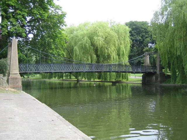
Castle Park, Bristol
Castle Park, Bristol — park in City of Bristol, United Kingdom.

Wikimedia Commons contributors — see linked file page for photographer and licence licence
Plan your visit
- Typical visit
- 1 h–2 h
- Nearest railway station
- Bristol Temple Meads · 0.9 km
- Free entry
- Family-friendly
- Dog-friendly
About
Castle Park, Bristol is a public park in the United Kingdom. Records date its origin to 1977. Wikidata describes it as: "park in City of Bristol, United Kingdom". Coordinates: 51.4558°, -2.5881°.
Photo gallery
Protected designations
- Site of Special Scientific Interest: Severn Estuary SSSI
Designations sourced from Natural England open data under OGL v3.
From the Wikipedia article
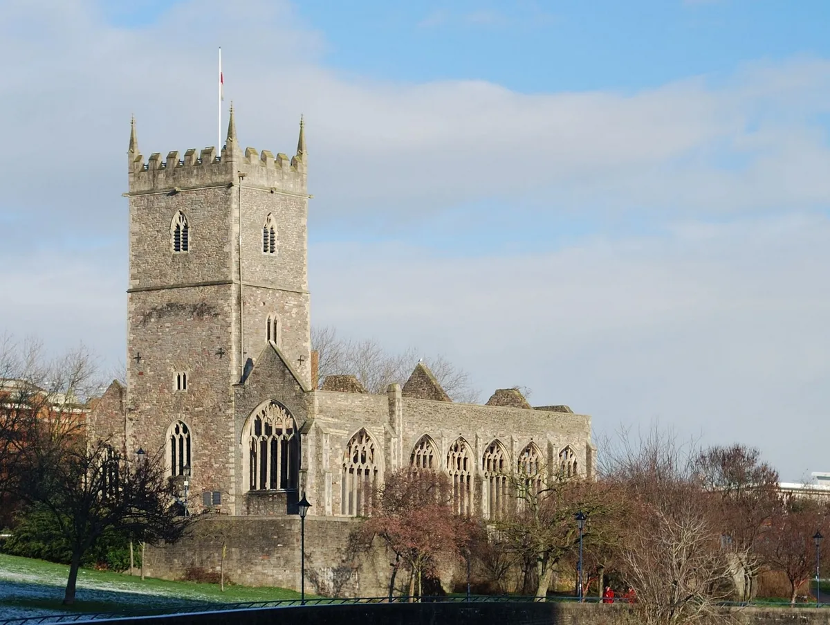
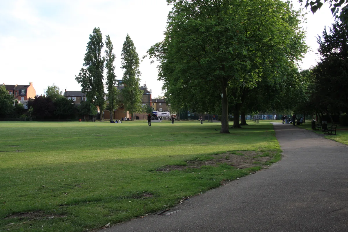
Castle Park (sometimes referred to as Castle Green) is a public open space in Bristol, England, managed by Bristol City Council. It is bounded by the Floating Harbour and Castle Street to the south, Lower Castle Street to the east, and Broad Weir, Newgate and Wine Street to the north. Its western boundary is less obviously defined and has been the subject of controversy, perhaps because the area around High Street and St Mary le Port Church, though not part of the park and always intended for development, is often considered at the same time as the park. Opened on 30 September 1978, the park occupies the site of what was once Bristol's main shopping district. The area was largely destroyed by the Luftwaffe during the Blitz, and that which remained was subsequently demolished by 1969, the last demolitions being the Bear & Ragged Staff and the Cat and Wheel pubs in Little Peter Street. In the years since the end of the Second World War, Castle Park has become home to a number of anti-fascist memorials. The ruined 14th-century tower of St Mary-le-Port Church stands to the west of the park, surrounded by derelict financial office buildings. Adjoining the ruins of St Peter's Church in the middle of the park is a sensory herb garden on the site of the former St Peters Churchyard cleared 1965, and five silver birch trees as a memorial to the beaches of the D-Day landings. To the east is a grassy arena covering Castle Green and the west half of Castle Street, and the partially excavated remains of the great stone keep Bristol Castle with 2 preserved vaulted chambers formerly in Castle Green (Tower Street) farther east. There is also a bandstand. Tree-lined St Peter's Square, to the north of St Peter's Church, (formerly Dolphin Street, Peter Street and Church or Chequer Lane) has been home to various events including German Christmas markets. In recent summers a tethered balloon was placed near the bandstand, offering ascents to sightseers. Recent attempts to develop the…
Excerpt from Wikipedia under CC BY-SA 4.0. See the source article linked in Sources below.
Background
History
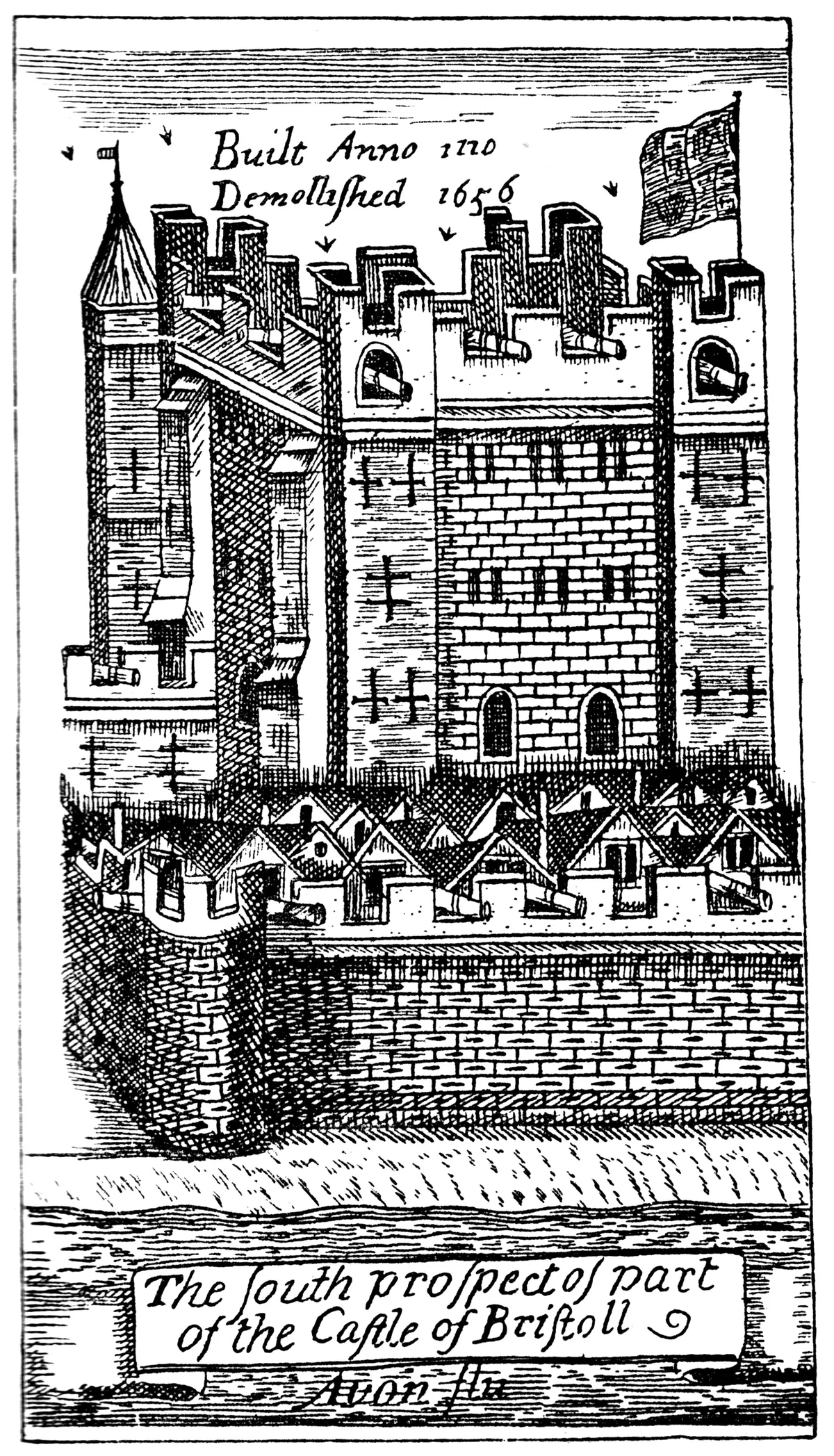
The town of Bristol was settled at some time in the Anglo-Saxon period on the northern or Mercian side of a crossing point of the River Avon, at or near to the present Bristol Bridge. The town lay entirely between the Avon and the Frome, which at that time emerged into the Avon just downstream of Bristol Bridge. Archaeological excavations of the area in 1962-1963 suggest that the original settlement was centred to the east of St Peter's Church, with Mary-le-Port on its western limit. The building of Bristol Castle in the latter part of the 11th century resulted in the focus of the settlement being moved to the west, where it developed into a symmetrical plan centred on the crossroads of…
Architecture
Very little of Bristol Castle remains above ground. The most tangible survival is a vaulted chamber of the King's Hall, formerly on Tower Street near the now-truncated Castle Street. Other than that, the excavated remains of the south wall can be seen near the landing stage, and near St Peter's Church the sally port and traces of the west wall are visible. The foundations of the keep are on show next to the public toilets on Newgate. The park contains a number of memorials. The ruins of St Peter's Church are a memorial to the civilians and auxiliary personnel killed in the aerial bombing of Bristol, and a plaque on its wall lists their names. Adjoining the church is a sensory herb garden…
Sourced from Wikipedia under CC BY-SA 4.0.
- Coordinates
- 51.4558, -2.5881
- District
- Bristol, City of
- Parish
- Bristol, City of, unparished area
- Postcode
- BS2 0HQ
- Parliamentary constituency
- Bristol Central
- Established
- 1977
- Nearest railway station
- Bristol Temple Meads — 0.9 km
- Opening
- | camp_sites =
- Official site
- roxyleisure.co.uk
Sources
- wikidata: Q5050210 (CC0)
- wikipedia: Castle Park, Bristol (CC BY-SA 4.0)
- commons: Castle.park.bristol.arp.jpg (CC BY-SA 4.0)
Other places nearby
Loading nearby places…
Nearby
 📷 5
📷 5Castles · South West England
Bristol Castle
Bristol Castle — Norman castle in Bristol.
 📷 3
📷 3Public art & sculpture · South West England
The Ark and Fish
The Ark and Fish — a public art in england-south-west, United Kingdom.
 📷 3
📷 3Memorials & monuments · South West England
Sikh War Memorial
Sikh War Memorial — a memorial in england-south-west, United Kingdom.
 📷 3
📷 3Theatres · South Wales
News Theatre
News Theatre in Wales South, United Kingdom.
 📷 5
📷 5Historic churches · South West England
St Peter's Church, Bristol
St Peter's Church, Bristol — church in Bristol, England, UK.
 📷 5
📷 5Museums · South West England
Broadmead
Broadmead is a street in Bristol city centre in England, which has given its name to the principal shopping district of the city. It is part of Bristol Shopping Quarter.
Other parks from this era
 Flagship📷 10
Parks · London
Addiscombe Railway Park
Addiscombe Railway Park — park in London Borough of Croydon, United Kingdom.
 Flagship📷 10
Parks · London
Kilburn Grange Park
Kilburn Grange Park — park in the United Kingdom.
 Flagship📷 10
Parks · London
Wardown Park
Wardown Park — large park with museum and river in Luton, Bedfordshire, England, UK.
 📷 5
📷 5Parks · London
Beckenham Place Park
Beckenham Place Park — park in London Borough of Lewisham, England, UK.
More parks in this region
 Flagship📷 10
Parks · South West England
Morrab Gardens
Morrab Gardens — park in Penzance, United Kingdom.
 Flagship📷 10
Parks · South West England
Plymouth Hoe
Plymouth Hoe — public space in Plymouth, Devon, England, UK.
 Flagship📷 10
Parks · South West England
Stoke Park
Stoke Park — park in Bristol/South Gloucestershire, England, UK.
Parks · South West England
Central Park, Plymouth
Central Park, Plymouth — park in the United Kingdom.
Frequently asked questions
- Where is Castle Park, Bristol?
- Castle Park, Bristol is in South-West England, United Kingdom (postcode BS2 0HQ), in the parish of Bristol, City of, unparished area.
- When was Castle Park, Bristol built?
- Built or established in 1977.
- Who owns Castle Park, Bristol?
- Castle Park, Bristol is owned by Bristol City Council.
- Is Castle Park, Bristol a protected site?
- Yes — Castle Park, Bristol is part of the Severn Estuary SSSI Site of Special Scientific Interest.
- Is Castle Park, Bristol free to visit?
- Yes, Castle Park, Bristol is free to enter.
- How do I get to Castle Park, Bristol?
- The nearest railway station is Bristol Temple Meads, about 0.9 km away. Drivers can navigate to postcode BS2 0HQ.