Mountains & hills · Scottish Highlands
Càrn an Fhidhleir
Also known as: Càrn Ealar
Càrn an Fhidhleir — Named summit at 994 m.

Wikimedia Commons contributors — see linked file page for photographer and licence licence
Plan your visit
- Typical visit
- 3 h–8 h
- Best time of year
- Late spring – early autumn (May–Oct)
- Free entry
- Dog-friendly
About
Càrn an Fhidhleir is a named summit in the United Kingdom. Also known as: Càrn Ealar. Wikidata describes it as: "Named summit at 994 m.". Coordinates: 56.9359°, -3.8017°.
Photo gallery
From the Wikipedia article
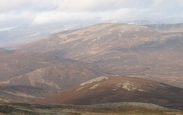
Carn an Fhidhleir (994 m) is a mountain in the Grampian Mountains of Scotland. It lies on the border of Inverness-shire, Perthshire and Aberdeenshire, in one of the most remote areas of Scotland between the Cairngorms and the Mounth. A domed mountain, it lies at the heart of a vast roadless area. It is possible to reach the peak from Glen Tilt or via the Linn of Dee by mountain bike. It is the triple point between the catchment area of three rivers: the River Dee, the River Spey and the River Tay.
Excerpt from Wikipedia under CC BY-SA 4.0. See the source article linked in Sources below.
- Coordinates
- 56.9359, -3.8017
- Address
- Highland / Perth and Kinross / Aberdeenshire, Scotland
- Official site
- www.hill-bagging.co.uk
Sources
- osm: n1158412531 (ODbL)
- wikipedia: Carn an Fhidhleir (CC BY-SA 4.0)
- commons: Carn an Fhidhleir - geograph.org.uk - 1054007.jpg (CC BY-SA 4.0)
Other places nearby
Loading nearby places…
Nearby
 📷 3
📷 3Mountains & hills · Scottish Highlands
Carn an Fhidhleir South Top
Carn an Fhidhleir South Top — a mountain in scotland-highlands, United Kingdom.
 📷 3
📷 3Mountains & hills · Scottish Highlands
Meall Tionail
Meall Tionail — a mountain in scotland-highlands, United Kingdom.
 📷 3
📷 3Mountains & hills · Scottish Highlands
An Sgarsoch
An Sgarsoch — Named summit at 1006 m.

Mountains & hills · Scottish Highlands
Scarsoch Bheag
Scarsoch Bheag — a mountain in scotland-highlands, United Kingdom.
 📷 2
📷 2Mountains & hills · Scottish Highlands
Meall Tionail na Beinne Brice
Meall Tionail na Beinne Brice — a mountain in scotland-highlands, United Kingdom.
 📷 3
📷 3Mountains & hills · Scottish Highlands
Tom Liath
Tom Liath — a mountain in scotland-highlands, United Kingdom.
More mountains in this region
 📷 3
📷 3Mountains & hills · Scottish Highlands
A' Bhuidheanach Bheag
A' Bhuidheanach Bheag — Named summit at 936 m.
 📷 3
📷 3Mountains & hills · Scottish Highlands
A' Chailleach
A' Chailleach — Named summit at 997 m.
 📷 3
📷 3Mountains & hills · Scottish Highlands
A' Chailleach
A' Chailleach — Named summit at 930 m.
 📷 3
📷 3Mountains & hills · Scottish Highlands
A' Chaoirnich
A' Chaoirnich — Named summit at 875 m.
Frequently asked questions
- Where is Càrn an Fhidhleir?
- Càrn an Fhidhleir is in Scottish Highlands, in the United Kingdom — coordinates 56.9359°, -3.8017°.
- Is Càrn an Fhidhleir free to visit?
- Yes — admission to Càrn an Fhidhleir is free.