Mountains & hills · Scottish Highlands
Càrn a' Mhàim
Càrn a' Mhàim — Named summit at 1037 m.

Wikimedia Commons contributors — see linked file page for photographer and licence licence
Plan your visit
- Typical visit
- 3 h–8 h
- Best time of year
- Late spring – early autumn (May–Oct)
- Nearest railway station
- Ptarmigan Station · 9.7 km
- Free entry
- Dog-friendly
About
Càrn a' Mhàim is a named summit in the United Kingdom. Wikidata describes it as: "Named summit at 1037 m.". Coordinates: 57.0369°, -3.6584°.
Photo gallery
From the Wikipedia article
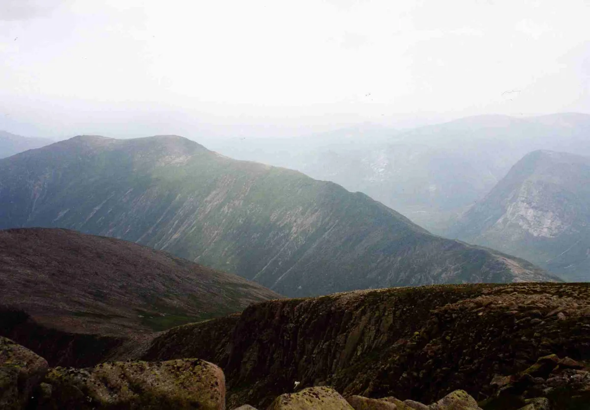
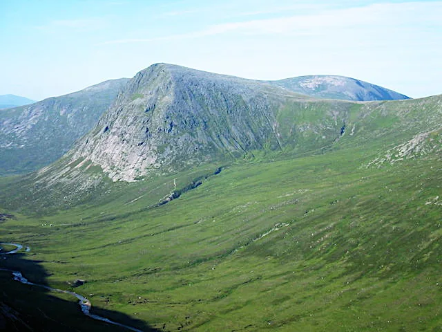
Càrn a' Mhàim is a Scottish mountain situated in the inner part of the Cairngorms range, some 15 kilometres west of Braemar in the county of Aberdeenshire.
Excerpt from Wikipedia under CC BY-SA 4.0. See the source article linked in Sources below.
Background
Description
The mountain is located on one of the two long ridges which radiate south from Ben Macdhui; it reaches a height of 1037 metres (3402 feet) and along with Macdhui and Derry Cairngorm forms the central body of the Cairngorms that lie between the two major passes of the Lairig Ghru and the Lairig an Laoigh. The mountain is notable in that it has the only ridge walk of any significance in the Cairngorms range. Its name translates from the Gaelic as "Cairn of the large rounded hill", when viewed from the south it does appear as rounded, although in reality the mountain is a north-south oriented ridge. Another possible meaning of the name is "Hill of the Pass" derived from mam or mhaim, meaning…
Sourced from Wikipedia under CC BY-SA 4.0.
- Coordinates
- 57.0369, -3.6584
- Address
- Cairngorms, Scotland
- Nearest railway station
- Ptarmigan Station — 9.7 km
- Official site
- www.walkhighlands.co.uk
Sources
- osm: n304585475 (ODbL)
- wikipedia: Càrn a' Mhàim (CC BY-SA 4.0)
- commons: Carn a' Mhaim from Ben Macdhui.jpg (CC BY-SA 4.0)
Other places nearby
Loading nearby places…
Nearby
 📷 3
📷 3Natural landmarks · Scottish Highlands
Càrn a' Mhàim
Càrn a' Mhàim — Scottish mountain situated in the inner part of the Cairngorms range.
 📷 3
📷 3Mountains & hills · Scottish Highlands
The Devil's Point
The Devil's Point — Named summit at 1004 m.
 📷 3
📷 3Natural landmarks · Scottish Highlands
The Devil's Point
The Devil's Point — 1004m high mountain in Aberdeenshire, Scotland, UK.
 📷 3
📷 3Mountains & hills · Scottish Highlands
Sron Riach
Sron Riach — a mountain in scotland-highlands, United Kingdom.
 📷 3
📷 3Mountains & hills · Scottish Highlands
Carn Crom
Carn Crom — a mountain in scotland-highlands, United Kingdom.
 📷 3
📷 3Mountains & hills · Scottish Highlands
Creagan nan Gabhar
Creagan nan Gabhar — a mountain in scotland-highlands, United Kingdom.
More mountains in this region
 📷 3
📷 3Mountains & hills · Scottish Highlands
A' Bhuidheanach Bheag
A' Bhuidheanach Bheag — Named summit at 936 m.
 📷 3
📷 3Mountains & hills · Scottish Highlands
A' Chailleach
A' Chailleach — Named summit at 997 m.
 📷 3
📷 3Mountains & hills · Scottish Highlands
A' Chailleach
A' Chailleach — Named summit at 930 m.
 📷 3
📷 3Mountains & hills · Scottish Highlands
A' Chaoirnich
A' Chaoirnich — Named summit at 875 m.
Frequently asked questions
- Where is Càrn a' Mhàim?
- Càrn a' Mhàim is in Scottish Highlands, in the United Kingdom — coordinates 57.0369°, -3.6584°. The nearest railway station is Ptarmigan Station, around 9.7 km away.
- Is Càrn a' Mhàim free to visit?
- Yes — admission to Càrn a' Mhàim is free.