Natural landmarks · Scottish Lowlands
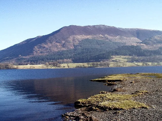
Carcluie Loch
Carcluie Loch — lake in South Ayrshire, Scotland, UK.

Wikimedia Commons licence
Plan your visit
- Typical visit
- 1 h–2 h
- Nearest railway station
- Ayr · 5.3 km
- Free entry
- Dog-friendly
About
Carcluie Loch is a named natural landmark in the United Kingdom. Wikidata describes it as: "lake in South Ayrshire, Scotland, UK". Coordinates: 55.4118°, -4.6094°.
Photo gallery
From the Wikipedia article
Carcluie Loch (NS 34894 16186) is a small freshwater loch in the South Ayrshire Council Area, lying in a glacial Kettle Hole, Parish of Dalrymple, Scotland.
Excerpt from Wikipedia under CC BY-SA 4.0. See the source article linked in Sources below.
Background
Description
Blaeu's map of circa 1654 taken from Timothy Pont's map of circa 1600 shows Loch Luy and nearby the dwelling of Kar Cluy. In 1821 the farm was recorded as Kirklewy, but no loch shown. In 1832 Thomson's map shows a small loch at Carcluie. In the 1870s, the OS map shows the loch as roughly oval in shape, covering an area of 0.709 hectares (1.752 acres). The loch is fed by the Carcluie Burn and another burn running down the hill from near the railway, with its outflow leading toward Broomberry.
Sourced from Wikipedia under CC BY-SA 4.0.
- Coordinates
- 55.4118, -4.6094
- District
- South Ayrshire
- Postcode
- KA6 6BS
- Parliamentary constituency
- Ayr, Carrick and Cumnock
- Nearest railway station
- Ayr — 5.3 km
Sources
- wikidata: Q5038174 (CC0)
- wikipedia: Carcluie Loch (CC BY-SA 4.0)
Other places nearby
Loading nearby places…
Nearby
 📷 3
📷 3Archaeological sites · Scottish Lowlands
Craigmuir Mote, dun site
Craigmuir Mote, dun site — a archaeological in scotland-lowlands, United Kingdom.
 📷 5
📷 5Historic bridges · Scottish Lowlands
Monkwood Bridge
Monkwood Bridge — category B listed building-listed bridge in scotland-lowlands, United Kingdom.
 📷 5
📷 5Historic churches · Scottish Lowlands
Parish Church and Churchyard, Church Street, Dalrymple
Parish Church and Churchyard, Church Street, Dalrymple — category B listed building-listed church in scotland-lowlands, United Kingdom.
 📷 5
📷 5Historic bridges · Scottish Lowlands
Dalrymple Bridge
Dalrymple Bridge — category B listed building-listed bridge in scotland-lowlands, United Kingdom.
 📷 3
📷 3Natural landmarks · Scottish Lowlands
Lindston Loch
Lindston Loch — lake in South Ayrshire, Scotland, UK.
 📷 4
📷 4Historic bridges · Scottish Lowlands
Brig o' Doon
Brig o' Doon is a historic bridge in the United Kingdom.
More natural landmarks in this region
 Flagship📷 3
Natural landmarks · Scottish Lowlands
Bassenthwaite Lake
Bassenthwaite Lake — lake in Cumbria, England, UK.
 Flagship📷 3
Natural landmarks · Scottish Lowlands
Loch Enoch
Loch Enoch — lake in Dumfries and Galloway, Scotland, UK.
 📷 5
📷 5Natural landmarks · Scottish Lowlands
Annandale Water
Annandale Water — lake in Dumfries and Galloway, Scotland, UK.
 📷 3
📷 3Natural landmarks · Scottish Lowlands
Bakestall
Bakestall — mountain in United Kingdom.
Frequently asked questions
- Where is Carcluie Loch?
- Carcluie Loch is in the Scottish Lowlands, United Kingdom (postcode KA6 6BS).
- Is Carcluie Loch free to visit?
- Yes, Carcluie Loch is free to enter.
- How do I get to Carcluie Loch?
- The nearest railway station is Ayr, about 5.3 km away. Drivers can navigate to postcode KA6 6BS.