Archaeological sites · London
Camlet Moat
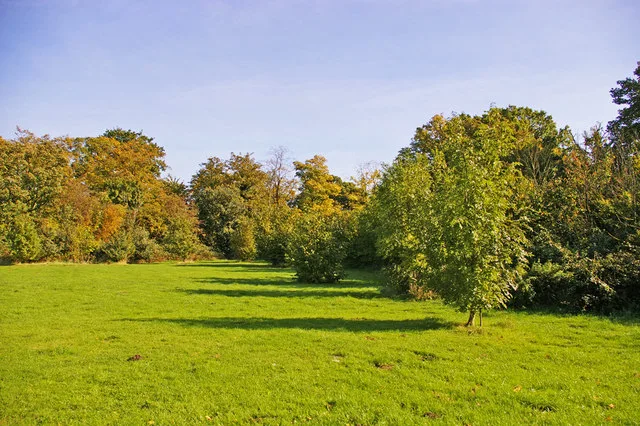
Camlet Moat — archaeological site in London Borough of Enfield, Greater London, England, UK.

Wikimedia Commons contributors — see linked file page for photographer and licence licence
Plan your visit
- Typical visit
- 45 min–1.5 h
- Nearest railway station
- Cockfosters · 1.9 km
- Free entry
- Dog-friendly
About
Camlet Moat is an archaeological site in the United Kingdom. Heritage designation: scheduled monument. Part of Trent Park. Wikidata describes it as: "archaeological site in London Borough of Enfield, Greater London, England, UK". Coordinates: 51.6676°, -0.1389°.
Photo gallery
Place summary
Camlet Moat is an archaeological site located in the London region, specifically within the unparished area of Enfield (postcode EN4). It is designated as a scheduled monument, highlighting its historical significance.
AI-generated from the structured facts on this page (operator, designation, listing, era). Not a substitute for visiting.
- Coordinates
- 51.6676, -0.1389
- District
- Enfield
- Parish
- Enfield, unparished area
- Postcode
- EN4 0QA
- Parliamentary constituency
- Enfield North
- Nearest railway station
- Cockfosters — 1.9 km
Sources
- wikidata: Q17642951 (CC0)
- commons: Camlet Moat, Trent Park, Enfield.jpg (CC BY-SA 4.0)
Other places nearby
Loading nearby places…
Nearby
 📷 5
📷 5Memorials & monuments · London
George Grey's Obelisk
George Grey's Obelisk is a memorial in the United Kingdom.
 📷 5
📷 5Forts · London
Obelisk on the west side of Moat Wood in Trent Park
Obelisk on the west side of Moat Wood in Trent Park — a martello broad in england-london, United Kingdom.
 📷 5
📷 5Public art & sculpture · London
Samson Slaying a Philistine
Samson Slaying a Philistine in England London, United Kingdom.
 📷 5
📷 5Public art & sculpture · London
Hercules and Antaeus
Hercules and Antaeus in England London, United Kingdom.
 Flagship📷 10
Parks · London
Trent Park
Trent Park — park in the London Borough of Enfield, UK.
Hotels · London
West Lodge Park
West Lodge Park — a hotel in england london.
More archaeological sites in this region
 Flagship📷 10
Archaeological sites · London
Epping Forest
Epping Forest — royal forest in England.
 Flagship📷 10
Archaeological sites · London
Grangewood Park
Grangewood Park — park in the United Kingdom.
 Flagship📷 10
Archaeological sites · London
Nunn Wood
Nunn Wood — woods in Essex, England, a Site of Special Scientific Interest.
 📷 5
📷 5Archaeological sites · London
A Bronze Age post alignment and timber platform at Flag Fen and associated Bronze Age and later field systems and settlement to
A Bronze Age post alignment and timber platform at Flag Fen and associated Bronze Age and later field systems and settlement to — archaeological site in Thorney, City of Peterborough, England, UK.
Frequently asked questions
- Where is Camlet Moat?
- Camlet Moat is in London, United Kingdom (postcode EN4 0QA), in the parish of Enfield, unparished area.
- Is Camlet Moat a listed building?
- Camlet Moat is officially recognised as scheduled monument listed.
- How do I get to Camlet Moat?
- The nearest railway station is Cockfosters, about 1.9 km away. Drivers can navigate to postcode EN4 0QA.