Historic churches · South West England
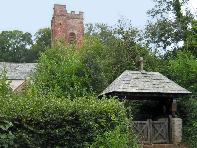
Camborne
Camborne (Cornish: Kammbronn, meaning "crooked hill") is a town and civil parish in Cornwall, England. At the 2021 census the population of the parish was 23,831 and the population of the built-up are

Mike Smith — CC BY-SA 2.0 via Wikimedia Commons licence
Plan your visit
- Typical visit
- 30 min–1 h
- Free entry
About
Camborne (Cornish: Kammbronn, meaning "crooked hill") is a town and civil parish in Cornwall, England. At the 2021 census the population of the parish was 23,831 and the population of the built-up area was 20,450. The town lies about 2 miles (3 km) inland, but the northern boundary of the parish is the coast, including Hell's Mouth and Deadman's Cove. The coast is followed by the South West Coast Path. As well as Camborne itself, the parish also includes a number of hamlets. Camborne was formerly one of the most significant tin-mining areas in the world.
Photo gallery
From the Wikipedia article
Camborne (Cornish: Kammbronn, meaning "crooked hill") is a town and civil parish in Cornwall, England. At the 2021 census the population of the parish was 23,831 and the population of the built-up area was 20,450. The town lies about 2 miles (3 km) inland, but the northern boundary of the parish is the coast, including Hell's Mouth and Deadman's Cove. The coast is followed by the South West Coast Path. As well as Camborne itself, the parish also includes a number of hamlets. Camborne was formerly one of the most significant tin-mining areas in the world.
Excerpt from Wikipedia under CC BY-SA 4.0. See the source article linked in Sources below.
Background
History
]] The first mention of the medieval Camborne churchtown is in 1181 although in 1931 the ruins of a probable Romano-British villa were found at Magor Farm, Illogan, near Camborne, and excavated that year under the guidance of the Royal Institution of Cornwall. There are also early Christian sites such as an inscribed altar stone, (now in the Church of St Martin and St Meriadoc), and dated to the 10th or 11th centuries, which attests to the existence of a settlement then. Langdon (1896) records seven stone crosses in the parish of which two are at Pendarves. By the late Middle Ages manorial holdings developed in the surrounding area, and church-paths linked the churchtown to the outlying…
Sourced from Wikipedia under CC BY-SA 4.0.
- Coordinates
- 50.2130, -5.3000
- District
- Cornwall
- Parish
- Camborne
- Postcode
- TR14 8HB
- Parliamentary constituency
- Camborne and Redruth
- Official site
- www.camborne-tc.gov.uk
Sources
- wikipedia: Camborne (CC BY-SA 4.0)
Other places nearby
Loading nearby places…
Nearby
📷 3Chapels · South West England
Cross in forecourt of Methodist Chapel, Chapel Street
Cross in forecourt of Methodist Chapel, Chapel Street — a Grade II*-listed chapel in england-south-west, United Kingdom.
 📷 4
📷 4Theatres · South West England
John Francis Basset
John Francis Basset in England South West, United Kingdom.
Hotels · South West England
Tyacks Hotel
Tyacks Hotel — a hotel in england south west.
 📷 4
📷 4Historic churches · South West England
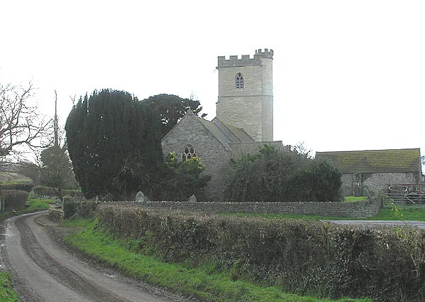
Church of St Martin and St Meriadocus
Church of St Martin and St Meriadocus — Grade I listed building-listed church in england-south-west, United Kingdom.
 📷 3
📷 3Historic churches · South West England
Wayside cross and cross-base in Camborne churchyard, 10m south west of the church
Wayside cross and cross-base in Camborne churchyard, 10m south west of the church — a Grade II*-listed church in england-south-west, United Kingdom.
 📷 3
📷 3Historic churches · South West England
Wayside cross in Camborne churchyard, 10m west of the church
Wayside cross in Camborne churchyard, 10m west of the church — a Grade II*-listed church in england-south-west, United Kingdom.
More places in this region
 📷 5
📷 5Historic churches · South West England
Abbey Church of St Mary and St Petroc
Abbey Church of St Mary and St Petroc — church in Bodmin, Cornwall, England, UK; former monastic church.
 📷 5
📷 5Historic churches · South West England
All Saints Church
All Saints Church — church in Dodington, West Somerset, England, UK.
 📷 5
📷 5Historic churches · South West England
All Saints Church, Otterhampton
All Saints Church, Otterhampton — church in Otterhampton, Somerset, England, UK.
 📷 5
📷 5Historic churches · South West England
All Saints Church, South Milton
All Saints Church, South Milton — church in South Milton, Devon, England, UK.
Frequently asked questions
- Where is Camborne?
- Camborne is in South-West England, United Kingdom (postcode TR14 8HB), in the parish of Camborne.
- Is Camborne free to visit?
- Yes, Camborne is free to enter.
- How do I get to Camborne?
- Drivers can navigate to postcode TR14 8HB. It sits within the Camborne and Redruth parliamentary constituency.