Natural landmarks · North West England
Calf Top
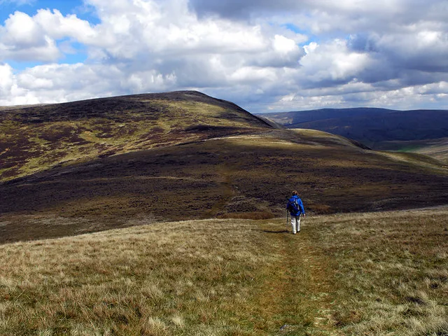
Calf Top — mountain in United Kingdom.

Wikimedia Commons contributors — see linked file page for photographer and licence licence
Plan your visit
- Typical visit
- 1 h–2 h
- Free entry
- Dog-friendly
About
Calf Top is a named natural landmark in the United Kingdom. Wikidata describes it as: "mountain in United Kingdom". Coordinates: 54.2649°, -2.5174°.
Photo gallery
From the Wikipedia article
Calf Top is a mountain in the western part of the Yorkshire Dales, England. It is located in the county of Cumbria, although Lancashire and North Yorkshire are not far away. Calf Top is a dominating profile in the view from many of the smaller hills to its west, such as Lambrigg Fell and Hutton Roof Crags. Calf Top is separated from its neighbours, Great Coum and Aye Gill Pike by the deep trench of Barbondale, meaning that although it is lower than most of the hills in its region, it has high relative height and is a Marilyn.
Excerpt from Wikipedia under CC BY-SA 4.0. See the source article linked in Sources below.
- Coordinates
- 54.2649, -2.5174
- Address
- Yorkshire Dales, England
- Official site
- web.archive.org
Sources
- wikidata: Q5019574 (CC0)
- wikipedia: Calf Top (CC BY-SA 4.0)
- commons: Calf Top, Middleton Fell, as seen from Castle Knott - geograph.org.uk - 1293008.jpg (CC BY-SA 4.0)
Other places nearby
Loading nearby places…
Nearby
 📷 3
📷 3Mountains & hills · North West England
Calf Top
Calf Top — Named summit at 609.606 m.
 📷 5
📷 5Caves · North West England
Short Gill Cave
Short Gill Cave — a cave broad in england-north-west, United Kingdom.
 📷 5
📷 5Caves · North West England
Barbon Pot
Barbon Pot — a cave broad in england-north-west, United Kingdom.
 📷 3
📷 3Historic bridges · North West England
Blindbeck Bridge
Blindbeck Bridge — Grade II listed building-listed bridge in england-north-west, United Kingdom.
 📷 4
📷 4Historic bridges · North West England
Oliver Bridge
Oliver Bridge — Grade II listed building-listed bridge in england-north-west, United Kingdom.
 📷 3
📷 3Public art & sculpture · North West England
Jack's Fold
Jack's Fold — a public art in england-north-west, United Kingdom.
More natural landmarks in this region
 ★ Iconic📷 4
Natural landmarks · North West England
Coniston Water
Lake District lake — Swallows and Amazons setting and Donald Campbell water-speed history.
 📷 3
📷 3Natural landmarks · North West England
Elter Water
Elter Water — lake in the United Kingdom.
 📷 3
📷 3Natural landmarks · North West England
Esthwaite Water
Esthwaite Water — lake in the United Kingdom.
 Flagship📷 5
Natural landmarks · North West England
Semerwater
Semerwater — lake in North Yorkshire, England, UK.
Frequently asked questions
- Where is Calf Top?
- Calf Top is in North West England, in the United Kingdom — coordinates 54.2649°, -2.5174°.
- Is Calf Top free to visit?
- Yes — admission to Calf Top is free.