Forts · North Wales
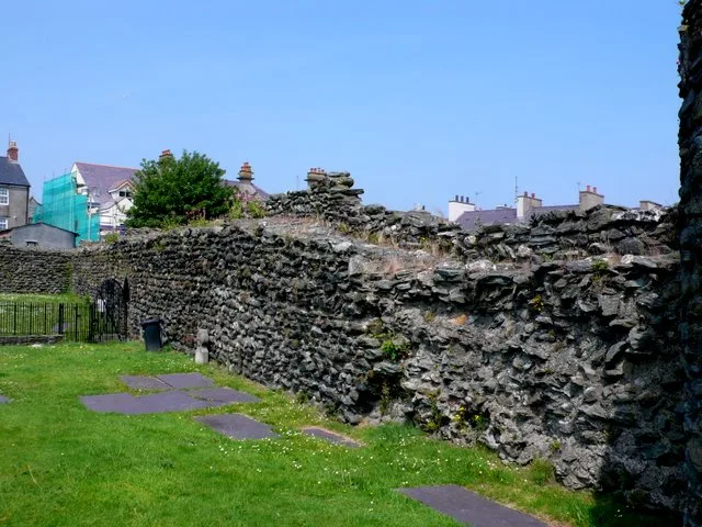
Caer Gybi Roman Fort
Also known as: Caer Rufeinig Caer Gybi
Caer Gybi Roman Fort is a fort in the United Kingdom.

Phil Williams — CC BY-SA 2.0 via Wikimedia Commons licence
Plan your visit
- Typical visit
- 45 min–1.5 h
- Nearest railway station
- Holyhead · 0.5 km
About
Caer Gybi Roman Fort is a historic fort or fortified site in the United Kingdom. Also known as: Caer Rufeinig Caer Gybi. Coordinates: 53.3115°, -4.6323°.
Photo gallery
From Cadw
Northern military outpost in a strategic coastal locationDating back to the 3rd century, Caer Gybi’s position on low cliffs overlooking the sea suggests it was part of a coastal network of defences, possibly linked to the late Roman watchtower at Caer y Twr on the summit of Holyhead Mountain.
Read more on the official property page.
Place summary
Caer Gybi Roman Fort is a historical site located in Holyhead, North Wales (postcode LL65). Also known as Caer Rufeinig Caer Gybi, this fort is a remnant of Roman military architecture, reflecting the strategic significance of the area during the Roman occupation.
AI-generated from the structured facts on this page (operator, designation, listing, era). Not a substitute for visiting.
- Coordinates
- 53.3115, -4.6323
- District
- Isle of Anglesey
- Parish
- Holyhead
- Postcode
- LL65 1UD
- Parliamentary constituency
- Ynys Môn
- Nearest railway station
- Holyhead — 0.5 km
Sources
- osm: w1327939234 (ODbL)
Other places nearby
Loading nearby places…
Nearby
 📷 5
📷 5Castles · North Wales
Caer Gybi
Caer Gybi — remains of a Roman fortlet in Holyhead, Anglesey, Wales, UK.
 📷 5
📷 5Historic churches · North Wales
Eglwys y Bedd
Eglwys y Bedd — Grade II listed building-listed church in wales-north, United Kingdom.
 📷 3
📷 3Theatres · North Wales
Cybi Cinema
Cybi Cinema in Wales North, United Kingdom.
.jpg?width=1200) 📷 3
📷 3Chapels · North Wales
Tabernacl Welsh Independent Chapel
Tabernacl Welsh Independent Chapel — Independent chapel in Holyhead.
 📷 5
📷 5Historic churches · North Wales
Holyhead
Holyhead — a church in wales-north, United Kingdom.
.jpg?width=1200) 📷 3
📷 3Chapels · North Wales
Hyfrydle Chapel
Hyfrydle Chapel — Calvinistic Methodist chapel in Holyhead.
More forts in this region
 📷 3
📷 3Forts · North Wales
Battle of Coleshill
Battle of Coleshill is a fort in the United Kingdom.
 📷 3
📷 3Forts · North Wales
Battle of Shrewsbury
Battle of Shrewsbury is a fort in the United Kingdom.
 📷 3
📷 3Forts · North Wales
Battle of Winwick
Battle of Winwick is a fort in the United Kingdom.
 📷 3
📷 3Forts · North Wales
Dinas
Dinas is a fort in the United Kingdom.
Frequently asked questions
- Where is Caer Gybi Roman Fort?
- Caer Gybi Roman Fort is in North Wales, in the United Kingdom — coordinates 53.3115°, -4.6323°. The nearest railway station is Holyhead, around 0.5 km away.