Archaeological sites · North East England
Cade's Road
Cade's Road in England North East, United Kingdom.

Roger Templeman — CC BY-SA 2.0 via Wikimedia Commons licence
Plan your visit
- Typical visit
- 45 min–1.5 h
- Free entry
- Dog-friendly
About
Cade's Road is a place of interest in England North East, United Kingdom — drawn from open-data sources for visitor reference. See the linked Wikipedia article for the full description.
Photo gallery
From the Wikipedia article
Cade's Road is a Roman Road in north-east England. It is named after John Cade of Durham, an 18th-century antiquarian who in 1785 proposed its existence and possible course from the Humber Estuary northwards to the River Tyne, a distance of about 100 miles (160 km). The road's Roman name is unknown. Although evidence exists for such a road on some parts of the proposed route, there is still some doubt regarding its exact course. Examples of place names with the suffix "le-Street": Chester-le-Street, County Durham ( Concangis Roman fort ) Thornton-le-Street, near Thirsk, North Yorkshire Thorpe le Street, near Pocklington, East Riding of Yorkshire
Excerpt from Wikipedia under CC BY-SA 4.0. See the source article linked in Sources below.
- Coordinates
- 54.8559, -1.5720
- District
- County Durham
- Parish
- County Durham, unparished area
- Postcode
- DH3 3QB
- Parliamentary constituency
- North Durham
Sources
- wikidata: Q5016332 (CC0)
- wikipedia: Cade's Road (CC BY-SA 4.0)
Other places nearby
Loading nearby places…
Nearby
📷 4Other places · North East England
Chare
Chare in England North East, United Kingdom.
 📷 5
📷 5Historic churches · Scottish Lowlands
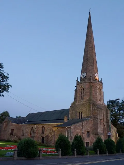
St Mary and St Cuthbert, Chester-le-Street
St Mary and St Cuthbert, Chester-le-Street — church in Chester-le-Street, County Durham, England, UK.
📷 3Memorials & monuments · Scottish Lowlands
To Our Glorious Dead
To Our Glorious Dead is a memorial in the United Kingdom.
📷 3Archaeological sites · Scottish Lowlands
Concangis Fort Officer's Quarters
Concangis Fort Officer's Quarters — a archaeological in scotland-lowlands, United Kingdom.
📷 4Archaeological sites · North East England
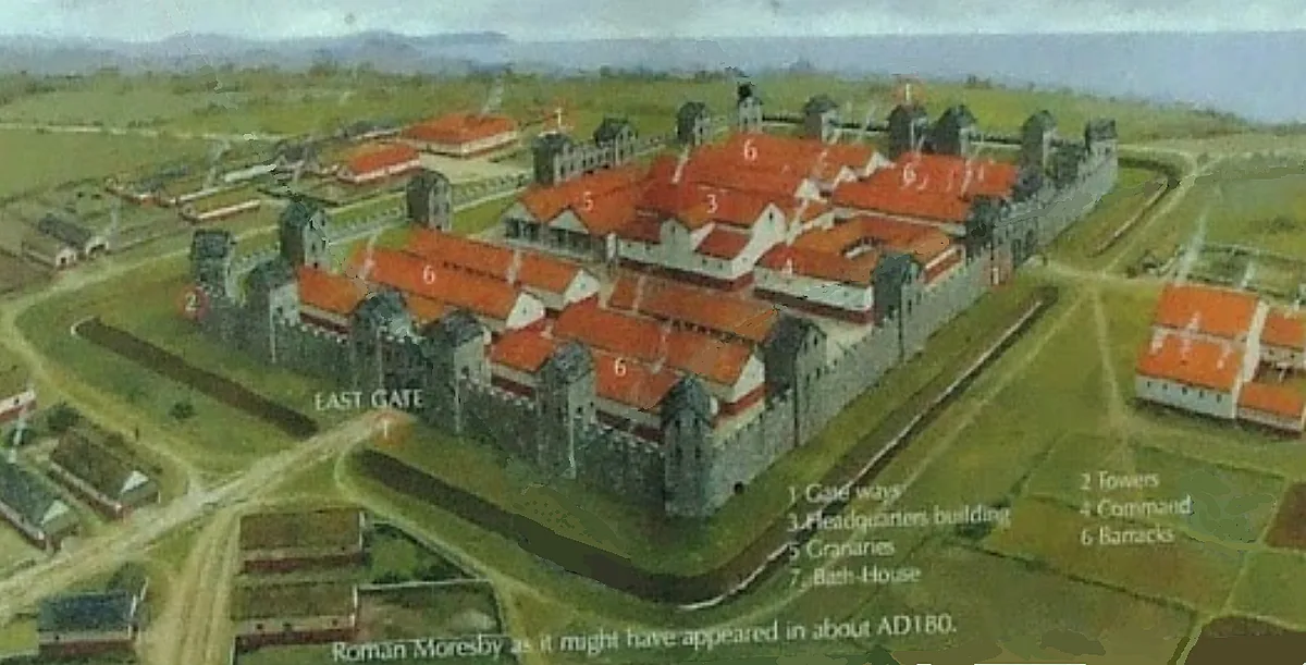
Concangis
Concangis was an auxiliary castra in the Roman province of Lower Britain (Britannia Inferior). Its ruins are located in Chester-le-Street, County Durham, in England, and are now known as Chester-le-St
 📷 4
📷 4Historic churches · North East England
Park View School
Park View School in England North East, United Kingdom.
More archaeological sites in this region
 ★ Iconic📷 4
Archaeological sites · North East England
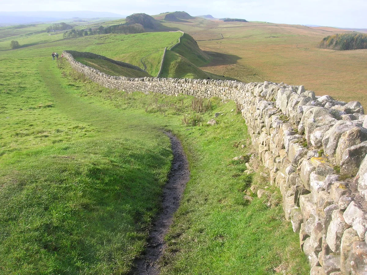
Hadrian's Wall
73-mile UNESCO World Heritage Roman frontier wall — Britain's most extensive Roman monument.
 📷 3
📷 3Archaeological sites · North East England
Force Crag mines and barytes mill and a prehistoric cairnfield
Force Crag mines and barytes mill and a prehistoric cairnfield — archaeological site in Above Derwent, Allerdale, England, UK.
 📷 3
📷 3Archaeological sites · North East England
Gabrosentum Roman Fort
Gabrosentum Roman Fort — Roman fort in Parton, Copeland, England, UK.
 📷 3
📷 3Archaeological sites · North East England
Gisborough Priory Augustinian monastery: late Saxon settlement, cemetery, monastic precinct and dovecote
Gisborough Priory Augustinian monastery: late Saxon settlement, cemetery, monastic precinct and dovecote — archaeological site in Guisborough, Redcar and Cleveland, England, UK.
Frequently asked questions
- Where is Cade's Road?
- Cade's Road is in North East England, in the United Kingdom — coordinates 54.8559°, -1.5720°.
- Is Cade's Road free to visit?
- Yes — admission to Cade's Road is free.