Towns & cities · East of England
Burston
Burston — village in Norfolk, England, UK.

Wikimedia Commons contributors — see linked file page for photographer and licence licence
Plan your visit
- Typical visit
- 3 h–6 h
- Nearest railway station
- Diss · 3.4 km
- Free entry
- Family-friendly
- Dog-friendly
About
Burston is a town, city, village or settlement in the United Kingdom. It covers approximately 9 km². Recent population estimates put it at around 568 people. Address: IP22. Wikidata describes it as: "village in Norfolk, England, UK". Coordinates: 52.4000°, 1.1500°.
Photo gallery
Protected designations
- Area of Outstanding Natural Beauty: Suffolk Coast & Heaths
Designations sourced from Natural England open data under OGL v3.
From the Wikipedia article
Burston is a village in the civil parish of Burston and Shimpling, in the South Norfolk district, in Norfolk, England. It is 2+1⁄2 miles (4.0 km) north-east of Diss and 16 miles (26 km) south-west of Norwich.
Excerpt from Wikipedia under CC BY-SA 4.0. See the source article linked in Sources below.
Background
History
Burston's name is of Anglo-Saxon origin, and in the Domesday Book it is recorded as a settlement of 41 households in the hundred of Diss that waspart of the estates of William the Conqueror and Robert Malet. The local pub, The Crown, dates to the 17th century and still operates. Burston railway station on the Great Eastern Main Line between and London Liverpool Street closed in 1966. On 1 April 1935, the parish of Shimpling was merged with Burston. On 10 July 1983, the new parish was renamed to "Burston and Shimpling". In 1931 the parish of Burston (prior to the merge) had a population of 279. This was the last time separate population statistics for Burston were collected in the census.
Sourced from Wikipedia under CC BY-SA 4.0.
- Coordinates
- 52.4000, 1.1500
- County
- Norfolk
- District
- South Norfolk
- Parish
- Burston and Shimpling
- Postcode
- IP22
- Parliamentary constituency
- Waveney Valley
- Population
- 568
- Nearest railway station
- Diss — 3.4 km
- Official site
- www.neighbourhood.statistics.gov.uk
Sources
- wikidata: Q655332 (CC0)
- wikipedia: Burston, Norfolk (CC BY-SA 4.0)
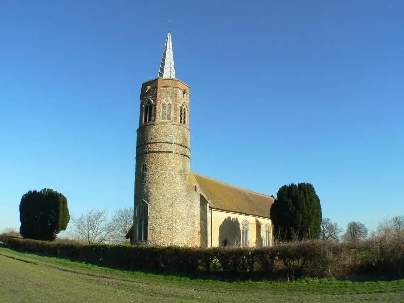
- commons: The church of St Mary in Burston - geograph.org.uk - 1773271.jpg (CC BY-SA 4.0)
Other places nearby
Loading nearby places…
Nearby
 📷 3
📷 3Public art & sculpture · East of England
Burston Crown Village Sign
Burston Crown Village Sign — a public art in england-east, United Kingdom.
 📷 3
📷 3Public art & sculpture · East of England
Burston Village Sign
Burston Village Sign — a public art in england-east, United Kingdom.
 📷 4
📷 4Historic houses · East of England
Burston Strike School
Burston Strike School — a Grade II*-listed historic house in england-east, United Kingdom.
 📷 3
📷 3Public art & sculpture · East of England
Shimpling Village Sign
Shimpling Village Sign — a public art in england-east, United Kingdom.
 📷 3
📷 3Historic churches · East of England
St George's Church, Shimpling
St George's Church, Shimpling — church in Shimpling, Norfolk, England, UK.
 📷 3
📷 3Historic churches · East of England
Church of All Saints
Church of All Saints — Anglican church in Dickleburgh, Norfolk, England, UK.
More towns in this region
 Flagship📷 3
Towns & cities · East of England
Alburgh
Alburgh — village and civil parish in Norfolk, UK.
 Flagship📷 3
Towns & cities · East of England
Aldeby
Aldeby — village and civil parish in Norfolk, UK.
 Flagship📷 5
Towns & cities · East of England
Ashill
Ashill — village and civil parish in the English county of Norfolk.
 Flagship📷 3
Towns & cities · East of England
Aslacton
Aslacton — village and civil parish in Norfolk, UK.
Frequently asked questions
- Where is Burston?
- Burston is in Norfolk, East of England, United Kingdom (postcode IP22), in the parish of Burston and Shimpling.
- Is Burston a protected site?
- Yes — Burston is part of the Suffolk Coast & Heaths National Landscape (AONB).
- Is Burston free to visit?
- Yes, Burston is free to enter.
- How do I get to Burston?
- The nearest railway station is Diss, about 3.4 km away. Drivers can navigate to postcode IP22.