Natural landmarks · North East England
Burnbank Fell
Burnbank Fell — mountain in United Kingdom.

Wikimedia Commons contributors — see linked file page for photographer and licence licence
Plan your visit
- Typical visit
- 1 h–2 h
- Free entry
- Dog-friendly
About
Burnbank Fell is a named natural landmark in the United Kingdom. Wikidata describes it as: "mountain in United Kingdom". Coordinates: 54.5750°, -3.3750°.
Photo gallery
Protected designations
- Site of Special Scientific Interest: River Derwent and Tributaries SSSI
Designations sourced from Natural England open data under OGL v3.
From the Wikipedia article
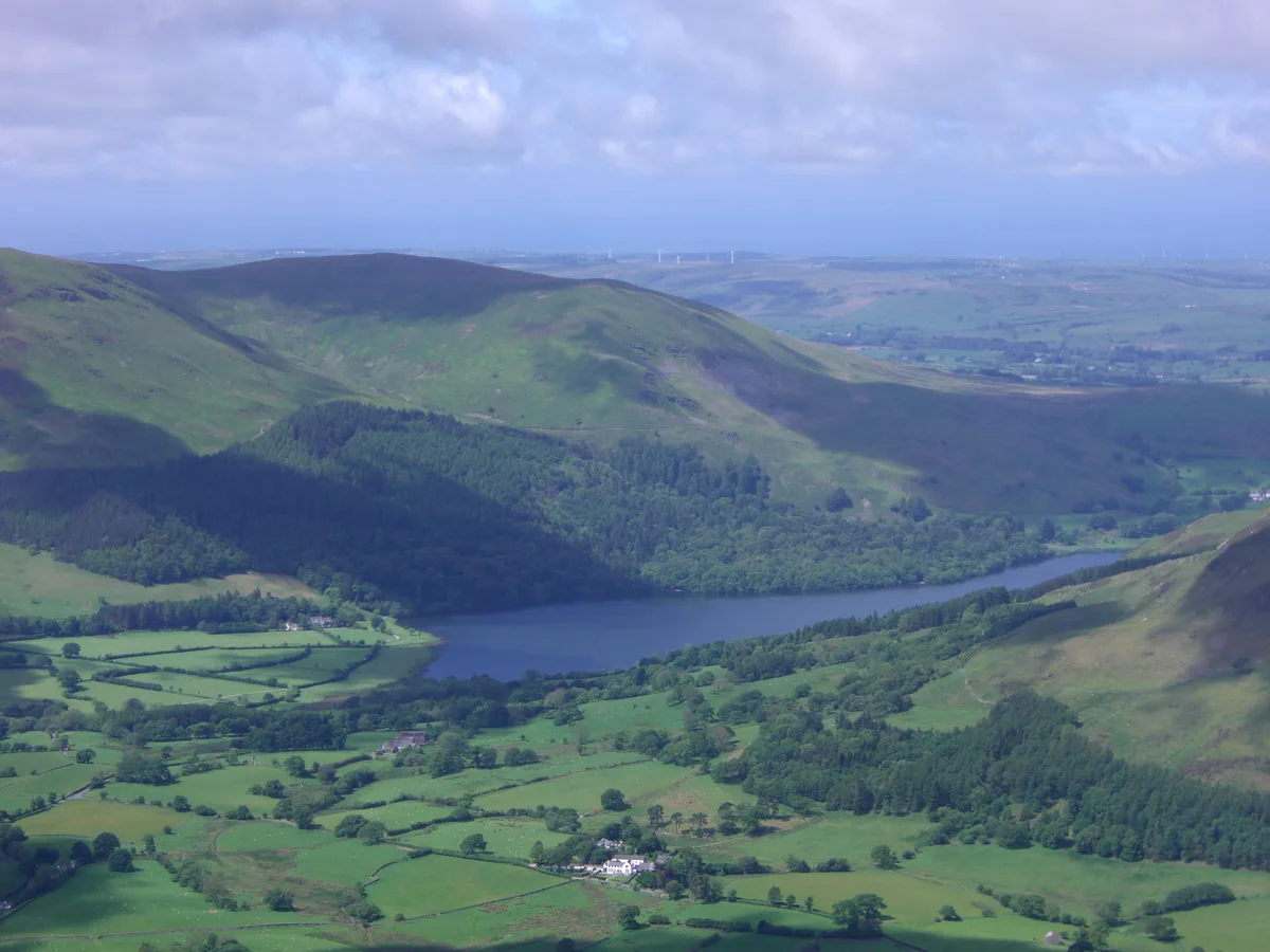
Burnbank Fell is a small hill in the west of the English Lake District. It is the most westerly of the Loweswater Fells, a group of low grassy hills just south of Loweswater. It is predominantly grassy, with sprawling flanks and a broad ridge connecting it to Blake Fell. It can be climbed from Lamplugh in the west, or from Waterend on the lakeshore.
Excerpt from Wikipedia under CC BY-SA 4.0. See the source article linked in Sources below.
- Coordinates
- 54.5750, -3.3750
- District
- Cumberland
- Parish
- Loweswater
- Postcode
- CA13 0SU
- Parliamentary constituency
- Penrith and Solway
Sources
- wikidata: Q4999614 (CC0)
- wikipedia: Burnbank Fell (CC BY-SA 4.0)
- commons: Burnbank Fell and Loweswater from Whiteside.jpg (CC BY-SA 4.0)
Other places nearby
Loading nearby places…
Nearby
 📷 3
📷 3Mountains & hills · North East England
Burnbank Fell
Burnbank Fell — Named summit at 475 m.
 📷 5
📷 5Mountains & hills · North East England
Blake Fell
Blake Fell — Named summit at 572.6 m.
 📷 5
📷 5Natural landmarks · North East England
Blake Fell
Blake Fell — mountain in United Kingdom.
 📷 3
📷 3Natural landmarks · North East England
Loweswater
Loweswater — lake in the United Kingdom.
Hostels · North East England
Swallow Barn
Swallow Barn — a hostel in england north east.
 📷 5
📷 5Reservoirs & lochs · North East England
Cogra Moss
Cogra Moss — reservoir in Cumbria, England, UK.
More natural landmarks in this region
 Flagship📷 5
Natural landmarks · North East England
Brothers Water
Brothers Water — lake in Cumbria, England, UK.
 📷 5
📷 5Natural landmarks · North East England
Angle Tarn
Angle Tarn — lake near Patterdale, Cumbria, England, United Kingdom.
 📷 3
📷 3Natural landmarks · North East England
Angletarn Pikes
Angletarn Pikes — mountain in United Kingdom.
 📷 3
📷 3Natural landmarks · North East England
Ard Crags
Ard Crags — mountain in United Kingdom.
Frequently asked questions
- Where is Burnbank Fell?
- Burnbank Fell is in North-East England, United Kingdom (postcode CA13 0SU), in the parish of Loweswater.
- Is Burnbank Fell a protected site?
- Yes — Burnbank Fell is part of the River Derwent and Tributaries SSSI Site of Special Scientific Interest.
- Is Burnbank Fell free to visit?
- Yes, Burnbank Fell is free to enter.
- How do I get to Burnbank Fell?
- Drivers can navigate to postcode CA13 0SU. It sits within the Penrith and Solway parliamentary constituency.