Mountains & hills · East Midlands
Burbage Edge
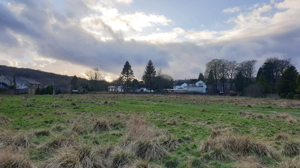
Burbage Edge — Named summit at 500 m.

Wikimedia Commons contributors — see linked file page for photographer and licence licence
Plan your visit
- Typical visit
- 3 h–8 h
- Best time of year
- Late spring – early autumn (May–Oct)
- Nearest railway station
- Buxton Miniature Railway · 2.6 km
- Free entry
- Dog-friendly
About
Burbage Edge is a named summit in the United Kingdom. Wikidata describes it as: "Named summit at 500 m.". Coordinates: 53.2562°, -1.9571°.
Photo gallery
Protected designations
- Site of Special Scientific Interest: Goyt Valley SSSI
Designations sourced from Natural England open data under OGL v3.
From the Wikipedia article
Burbage Edge is a gritstone escarpment overlooking the Burbage district of Buxton in Derbyshire, in the Peak District. The hill's summit (marked by a trig pillar) is 500 metres (1,600 ft) above sea level. The boundary of the Peak District National Park runs along the ridge and across the summit. The ridge of Burbage Edge marks the western gritstone edge of the Derbyshire Dome, extending south as Axe Edge and to the north as Combs Moss. The ridge is the watershed between the River Goyt (Mersey river basin) and the River Wye (Trent river basin). To the west is Goyt's Moss moorland, the Cat and Fiddle Inn and the Upper Goyt Valley. Following the Countryside and Rights of Way Act 2000, the area of the upper ridge and moorland were designated as "Open Access" land for the public. Coal was mined at Goyt's Moss colliery from the early 17th-century until 1893 when the coal deposits had been exhausted. The coal was initially extracted by surface mining, then in the 1700s using shallow shafts (with coal raised using hand winches) and later in the 1800s from deeper shafts using horse-drawn winding gins. Most of the coal produced was supplied to the Duke of Devonshire's limekilns at nearby Grin Low. The site of the colliery's remains is a protected Scheduled Monument. Burbage Edge is part of the Goyt Valley Site of Special Scientific Interest (SSSI). Heather is the main plant but the heathland is habitat for a variety of native grasses, rushes, sedges and shrubs including bilberry, crowberry, cowberry and cross-leaved heath. Hare’s-tail cottongrass and sphagnum moss are common. The area is important for upland breeding birds including a large population of golden plover, as well as red grouse, curlew, lapwing, whinchat, snipe, twite, ring ouzel and merlin. The disused Cromford and High Peak Railway line (which connected the High Peak canal at Whaley Bridge with the River Derwent in Cromford since 1831) ran through a tunnel beneath Burbage Edge. This stretch of the railway line…
Excerpt from Wikipedia under CC BY-SA 4.0. See the source article linked in Sources below.
- Coordinates
- 53.2562, -1.9571
- County
- Derbyshire
- District
- High Peak
- Parish
- High Peak, unparished area
- Postcode
- SK17 6UP
- Parliamentary constituency
- High Peak
- Nearest railway station
- Buxton Miniature Railway — 2.6 km
Sources
- osm: n1333749667 (ODbL)
- wikipedia: Burbage Edge (CC BY-SA 4.0)
- commons: Burbage Edge view from the east.jpg (CC BY-SA 4.0)
Other places nearby
Loading nearby places…
Nearby
 📷 5
📷 5Forts · East Midlands
3 obelisks within the gardens of Edgemoor (Edgemoor not included)
3 obelisks within the gardens of Edgemoor (Edgemoor not included) — a martello broad in england-east-midlands, United Kingdom.
 📷 5
📷 5Forts · East Midlands
Obelisk at Dog Hole Cottage (Dog Hole Cottage not included)
Obelisk at Dog Hole Cottage (Dog Hole Cottage not included) — a martello broad in england-east-midlands, United Kingdom.
 📷 5
📷 5Gardens · South East England
Buxton Pavilion Gardens
Buxton Pavilion Gardens is a Victorian landscaped public park in the spa town of Buxton in Derbyshire. The River Wye flows through the gardens, which are a Grade II* listed public park of Special Hist
Campsites · East Midlands
Cold Springs Farm Campsite
Cold Springs Farm Campsite — a campsite in england east midlands.
 📷 3
📷 3Archaeological sites · East Midlands
Lismore Fields
Lismore Fields — a archaeological in england-east-midlands, United Kingdom.
 📷 3
📷 3Archaeological sites · East Midlands
Lismore Fields Mesolithic and Neolithic settlement
Lismore Fields Mesolithic and Neolithic settlement — archaeological site in Buxton, High Peak, England, UK.
More mountains in this region
 📷 3
📷 3Mountains & hills · East Midlands
Axe Edge Moor
Axe Edge Moor — Named summit at 551 m.
Mountains & hills · East Midlands
Beacon Hill
Beacon Hill — Named summit at 244.5 m.
Mountains & hills · East Midlands
Beacon Hill
Beacon Hill — Named summit at 105 m.
 📷 3
📷 3Mountains & hills · East Midlands
Black Edge - Summit
Black Edge - Summit — Named summit at 506.7 m.
Frequently asked questions
- Where is Burbage Edge?
- Burbage Edge is in Derbyshire, the East Midlands, United Kingdom (postcode SK17 6UP), in the parish of High Peak, unparished area.
- Is Burbage Edge a protected site?
- Yes — Burbage Edge is part of the Goyt Valley SSSI Site of Special Scientific Interest.
- Is Burbage Edge free to visit?
- Yes, Burbage Edge is free to enter.
- How do I get to Burbage Edge?
- The nearest railway station is Buxton Miniature Railway, about 2.6 km away. Drivers can navigate to postcode SK17 6UP.