Forests & woodlands · West Midlands
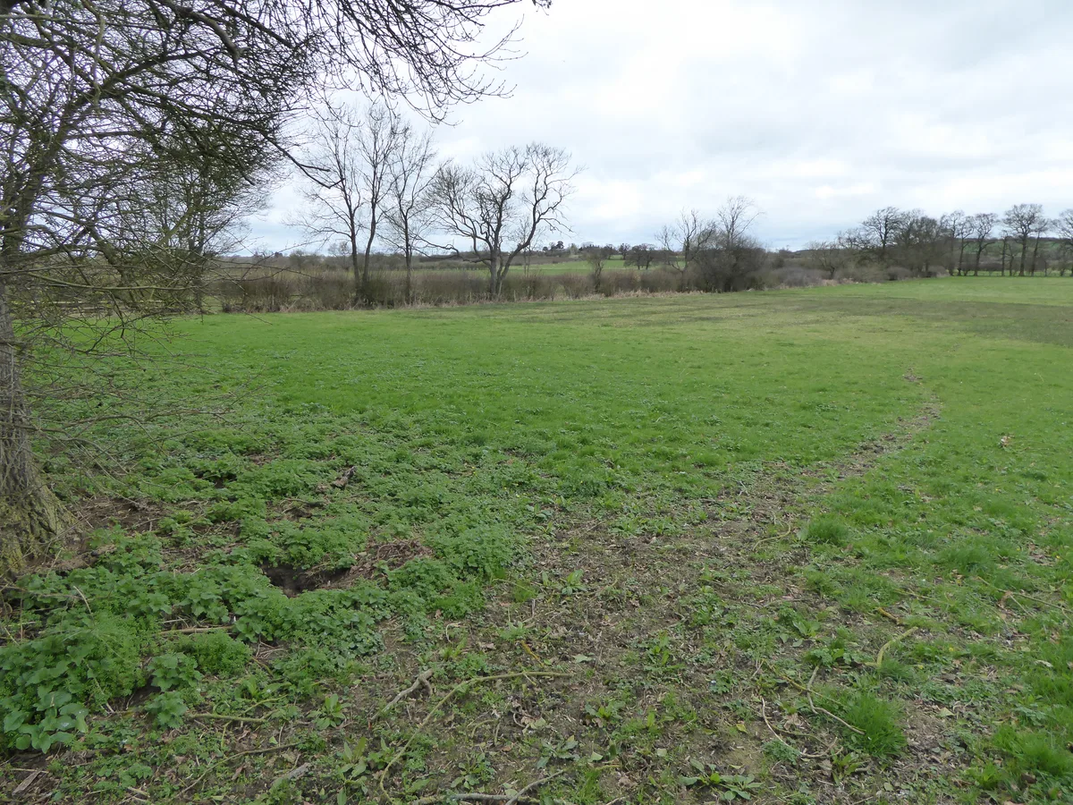
Bugbrooke Meadow
Bugbrooke Meadow is a forest or woodland in the United Kingdom.

Wikimedia Commons contributors — see linked file page for photographer and licence licence
Plan your visit
- Typical visit
- 1 h–3 h
- Nearest railway station
- Northampton · 7.7 km
- Free entry
- Family-friendly
- Dog-friendly
About
Bugbrooke Meadow is a named forest, woodland or nature reserve in the United Kingdom. Coordinates: 52.2226°, -1.0175°. This entry is part of The Great Britain Guide, a free, ad-free, open-data tourist directory.
Photo gallery
Protected designations
- Site of Special Scientific Interest: Bugbrooke Meadows SSSI
Designations sourced from Natural England open data under OGL v3.
From the Wikipedia article
Bugbrooke Meadows is a 10.1-hectare (25-acre) biological Site of Special Scientific Interest east of Nether Heyford in Northamptonshire. One of the fields with an area of 1.7 hectares is managed by the Wildlife Trust for Bedfordshire, Cambridgeshire and Northamptonshire. These meadows on the bank of the River Nene which have not been treated with fertilisers, and they often flood in winter. They are probably unique in the county, and they have very diverse damp grassland flora such as jointed rush and greater pond sedge. There are ancient hedges which are important both historically and as a habitat for wildlife. There is access to the site from the Nene Way between Kislingbury and Nether Heyford, and by a footpath from Bugbrooke.
Excerpt from Wikipedia under CC BY-SA 4.0. See the source article linked in Sources below.
- Coordinates
- 52.2226, -1.0175
- District
- West Northamptonshire
- Parish
- Bugbrooke
- Postcode
- NN7 3QH
- Parliamentary constituency
- South Northamptonshire
- Nearest railway station
- Northampton — 7.7 km
- Official site
- www.wildlifebcn.org
Sources
- osm: w545366961 (ODbL)
- wikipedia: Bugbrooke Meadows (CC BY-SA 4.0)
- commons: Bugbrooke Meadow nature reserve 2.jpg (CC BY-SA 4.0)
Other places nearby
Loading nearby places…
Nearby
 📷 5
📷 5Wildlife reserves · West Midlands
Bugbrooke Meadows
Bugbrooke Meadows — nature reserve in the United Kingdom.
 Flagship📷 3
Towns & cities · West Midlands
Nether Heyford
Nether Heyford — village and civil parish in Northamptonshire, United Kingdom.
 📷 5
📷 5Follies · West Midlands
Roman temple at Harpole Roman villa
Roman temple at Harpole Roman villa — a temple folly in england-west-midlands, United Kingdom.
 📷 3
📷 3Historic bridges · West Midlands
Bridge Number 33
Bridge Number 33 — Grade II listed building-listed bridge in england-west-midlands, United Kingdom.
 📷 3
📷 3Archaeological sites · West Midlands
Iron Furnace
Iron Furnace — a archaeological in england-west-midlands, United Kingdom.
Vineyards · West Midlands
Glassthorpe
Glassthorpe — a UK vineyard in england west midlands, producing English or Welsh wine from cool-climate grape varieties.
More forests in this region
 📷 3
📷 3Forests & woodlands · West Midlands
Abington Meadows Nature Reserve
Abington Meadows Nature Reserve is a forest or woodland in the United Kingdom.
_(geograph_2935627).jpg?width=1200) 📷 3
📷 3Forests & woodlands · West Midlands
Adderbury Lakes
Adderbury Lakes is a forest or woodland in the United Kingdom.
 📷 3
📷 3Forests & woodlands · West Midlands
Alcott Wood
Alcott Wood is a forest or woodland in the United Kingdom.
 📷 3
📷 3Forests & woodlands · West Midlands
Alvecote Meadows Nature Reserve
Alvecote Meadows Nature Reserve is a forest or woodland in the United Kingdom.
Frequently asked questions
- Where is Bugbrooke Meadow?
- Bugbrooke Meadow is in the West Midlands, United Kingdom (postcode NN7 3QH), in the parish of Bugbrooke.
- Is Bugbrooke Meadow a protected site?
- Yes — Bugbrooke Meadow is part of the Bugbrooke Meadows SSSI Site of Special Scientific Interest.
- Is Bugbrooke Meadow free to visit?
- Yes, Bugbrooke Meadow is free to enter.
- How do I get to Bugbrooke Meadow?
- The nearest railway station is Northampton, about 7.7 km away. Drivers can navigate to postcode NN7 3QH.