Museums · London
Buckhurst Hill
Buckhurst Hill is an affluent town and civil parish in the Epping Forest District of Essex, England. It is inside the M25 London orbital motorway but lies just outside the administrative boundary of G

Stephen Craven — CC BY-SA 2.0 via Wikimedia Commons licence
Plan your visit
- Typical visit
- 1.5 h–3 h
- Best time of year
- Year-round
- Family-friendly
- Limited wheelchair access
About
Buckhurst Hill is an affluent town and civil parish in the Epping Forest District of Essex, England. It is inside the M25 London orbital motorway but lies just outside the administrative boundary of Greater London. It is adjacent to the northern boundary of the London Borough of Redbridge and is 11 miles (18 km) north-east of Charing Cross in central London. The area developed following the opening of Buckhurst Hill station in 1856 on what was originally a branch of the Eastern Counties Railway but now forms part of the Central line of the London Underground. At the 2021 census the parish had a population of 11,755.
Photo gallery
From the Wikipedia article
Buckhurst Hill is an affluent town and civil parish in the Epping Forest District of Essex, England. It is inside the M25 London orbital motorway but lies just outside the administrative boundary of Greater London. It is adjacent to the northern boundary of the London Borough of Redbridge and is 11 miles (18 km) north-east of Charing Cross in central London. The area developed following the opening of Buckhurst Hill station in 1856 on what was originally a branch of the Eastern Counties Railway but now forms part of the Central line of the London Underground. At the 2021 census the parish had a population of 11,755.
Excerpt from Wikipedia under CC BY-SA 4.0. See the source article linked in Sources below.
Background
History
The name Buckhurst Hill is Old English and means a hill covered with beech trees. The earliest known mention of the name dates from the 12th century as La Bocherste. In 1135 the "wood of Buckhurt" was granted to Stratford Langthorne Abbey, which then owned it until the abbey's dissolution in 1538. In the 17th and 18th centuries the area was known as Bucket Hill before the name settled on its modern form. In medieval times Buckhurst Hill lay within the bounds of Epping Forest and consisted of only a few scattered houses along the ancient route connecting Woodford to Loughton. This route through the forest was upgraded in the 17th century and became part of stagecoach routes between London…
Sourced from Wikipedia under CC BY-SA 4.0.
- Coordinates
- 51.6320, 0.0360
- County
- Essex
- District
- Epping Forest
- Parish
- Buckhurst Hill
- Postcode
- IG9 5SS
- Parliamentary constituency
- Epping Forest
Sources
- wikipedia: Buckhurst Hill (CC BY-SA 4.0)
Other places nearby
Loading nearby places…
Nearby
 📷 5
📷 5Historic churches · London
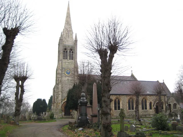
St John the Baptist Church, Buckhurst Hill
St John the Baptist Church, Buckhurst Hill — grade II listed church in Buckhurst Hill, Epping Forest, Essex, England, UK.
 📷 5
📷 5Parks · London
Linder's Field
Linder's Field — park in United Kingdom.
📷 5Forests & woodlands · London
Linder's Field Local Nature Reserve
Linder's Field Local Nature Reserve is a forest or woodland in the United Kingdom.
 📷 5
📷 5Memorials & monuments · London
Buckhurst Hill War Memorial
Buckhurst Hill War Memorial is a memorial in the United Kingdom.
 📷 5
📷 5Memorials & monuments · London
Forest ramblers club centenary
Forest ramblers club centenary — a memorial in england-london, United Kingdom.
 📷 5
📷 5Historic houses · London
Butler's Retreat
Butler's Retreat — a Grade II*-listed historic house in england-london, United Kingdom.
More museums in this region
 Flagship📷 10
Museums · London
Kenwood House
Kenwood House — art museum and historic house in Hampstead, London.
 📷 5
📷 5Museums · London
American Air Museum
American Air Museum — museum at Imperial War Museum Duxford, Cambridgeshire, England, UK.
 📷 5
📷 5Museums · London
Amora London
Amora London — European touring exhibition dedicated to love, relationships and sexual wellbeing.
 📷 5
📷 5Museums · London
Antique Breadboard Museum
Antique Breadboard Museum — small museum in Putney, London, England, UK.
Frequently asked questions
- Where is Buckhurst Hill?
- Buckhurst Hill is in London, in the United Kingdom — coordinates 51.6320°, 0.0360°.
- Is Buckhurst Hill wheelchair accessible?
- Partially — OpenStreetMap notes limited wheelchair access at Buckhurst Hill. Check ahead for specific facilities.