Mountains & hills · North West England
Buckbarrow
Buckbarrow — Named summit at 423 m.

Wikimedia Commons contributors — see linked file page for photographer and licence licence
Plan your visit
- Typical visit
- 3 h–8 h
- Best time of year
- Late spring – early autumn (May–Oct)
- Nearest railway station
- Fisherground Halt · 6.0 km
- Free entry
- Dog-friendly
About
Buckbarrow is a named summit in the United Kingdom. Wikidata describes it as: "Named summit at 423 m.". Coordinates: 54.4432°, -3.3342°.
Photo gallery
From the Wikipedia article
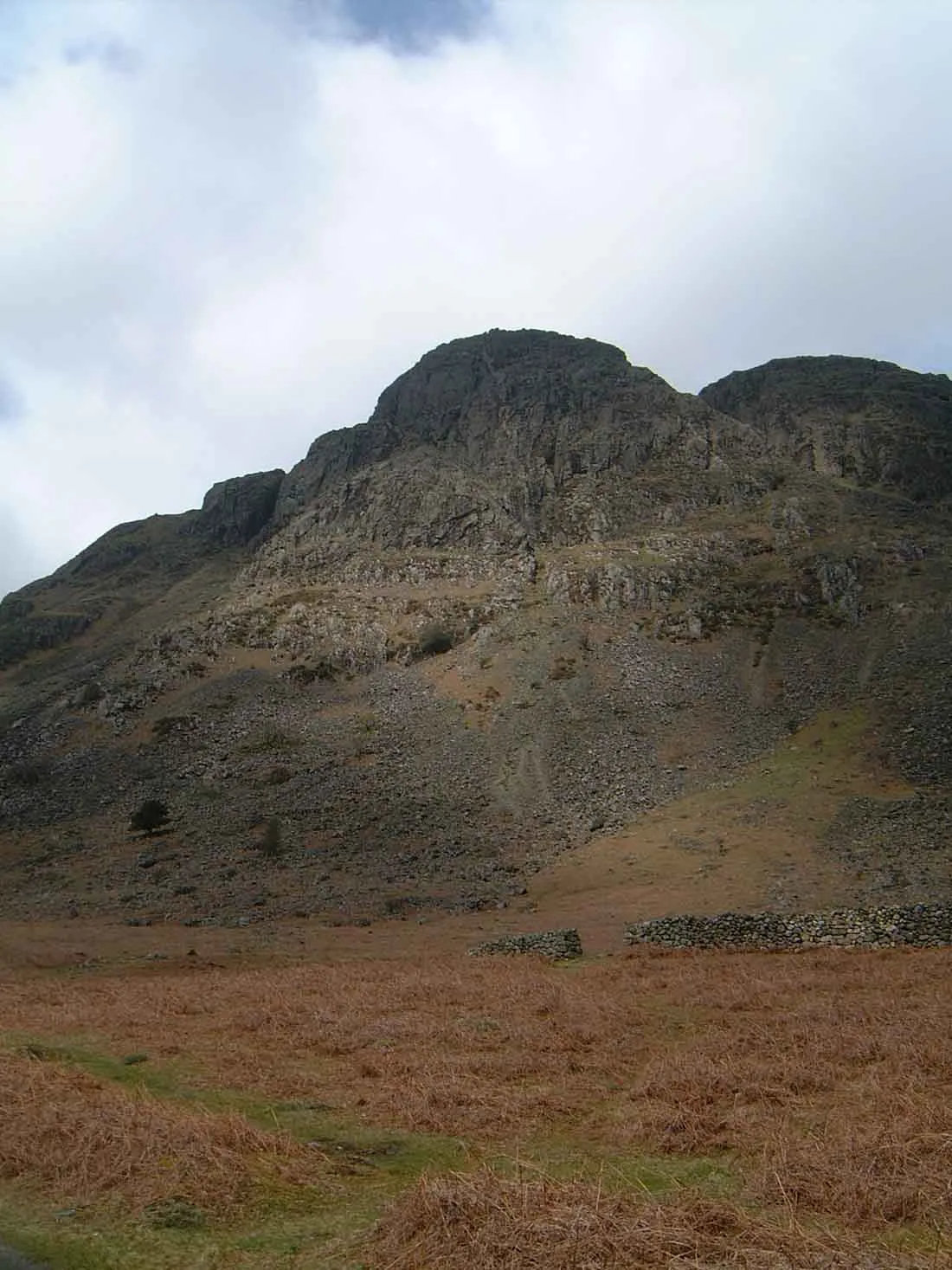
Buckbarrow is a small fell in the English Lake District overlooking the western end of Wastwater. It is featured in Alfred Wainwright’s Pictorial Guide to the Lakeland Fells and is given a height of 1,410 ft approximately; however, the Ordnance Survey and other guidebooks now give an altitude of 423 m (1,388 ft). The fell’s name means ‘The hill of the buck or goat’. It is derived either from the Old English word bucc meaning buck or the Old Norse word bokki meaning a male goat.
Excerpt from Wikipedia under CC BY-SA 4.0. See the source article linked in Sources below.
- Coordinates
- 54.4432, -3.3342
- District
- Cumberland
- Parish
- Wasdale
- Postcode
- CA20 1EU
- Parliamentary constituency
- Whitehaven and Workington
- Nearest railway station
- Fisherground Halt — 6 km
Sources
- osm: n29961859 (ODbL)
- wikipedia: Buckbarrow (CC BY-SA 4.0)
- commons: The cliffs of Buckbarrow.jpg (CC BY-SA 4.0)
Other places nearby
Loading nearby places…
Nearby
 📷 3
📷 3Natural landmarks · North West England
Buckbarrow
Buckbarrow — mountain in United Kingdom.
 📷 3
📷 3Memorials & monuments · North West England
Joss Naylor Cairn
Joss Naylor Cairn is a memorial in the United Kingdom.
 📷 3
📷 3Mountains & hills · North West England
Middle Fell
Middle Fell — Named summit at 582 m.
Hostels · North West England
YHA Wasdale Hall
YHA Wasdale Hall — a hostel in england north west.
Campsites · North West England
Church Stile Farm And Holiday Park
Church Stile Farm And Holiday Park — a campsite in england north west.
 📷 3
📷 3Natural landmarks · North West England
Seatallan
Seatallan — mountain in Cumbria, United Kingdom.
More mountains in this region
 📷 3
📷 3Mountains & hills · North West England
Allen Crags
Allen Crags — Named summit at 785 m.
 📷 3
📷 3Mountains & hills · North West England
Alum Pot
Alum Pot — Open shaft pothole in North Yorkshire.
 📷 3
📷 3Mountains & hills · North West England
Arnside Knott
Arnside Knott — Named summit at 159 m.
 📷 3
📷 3Mountains & hills · North West England
Aye Gill Pike
Aye Gill Pike — Named summit at 556.3 m.
Frequently asked questions
- Where is Buckbarrow?
- Buckbarrow is in North-West England, United Kingdom (postcode CA20 1EU), in the parish of Wasdale.
- Is Buckbarrow free to visit?
- Yes, Buckbarrow is free to enter.
- How do I get to Buckbarrow?
- The nearest railway station is Fisherground Halt, about 6.0 km away. Drivers can navigate to postcode CA20 1EU.