Mountains & hills · North East England
Brock Crag
Brock Crag — Named summit at 562 m.

Wikimedia Commons contributors — see linked file page for photographer and licence licence
Plan your visit
- Typical visit
- 3 h–8 h
- Best time of year
- Late spring – early autumn (May–Oct)
- Free entry
- Dog-friendly
About
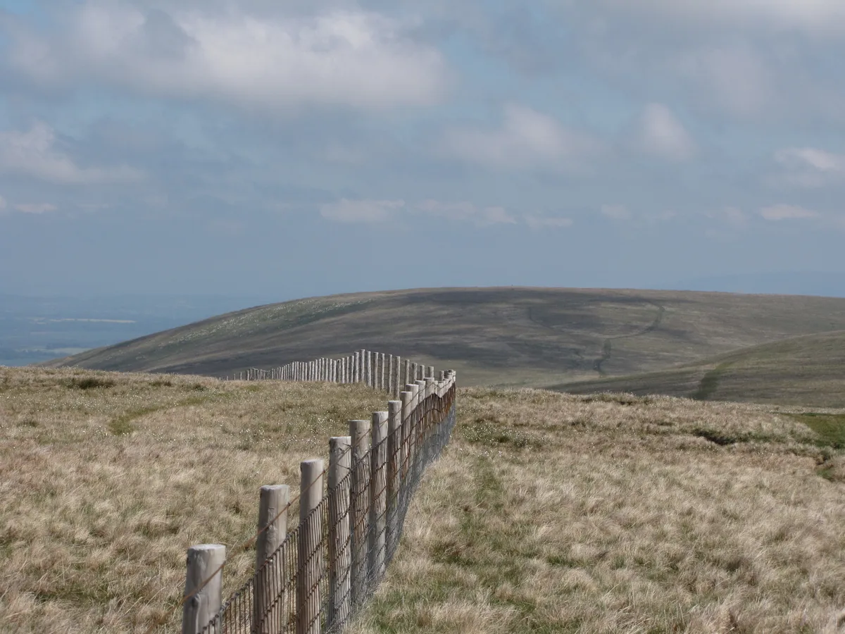
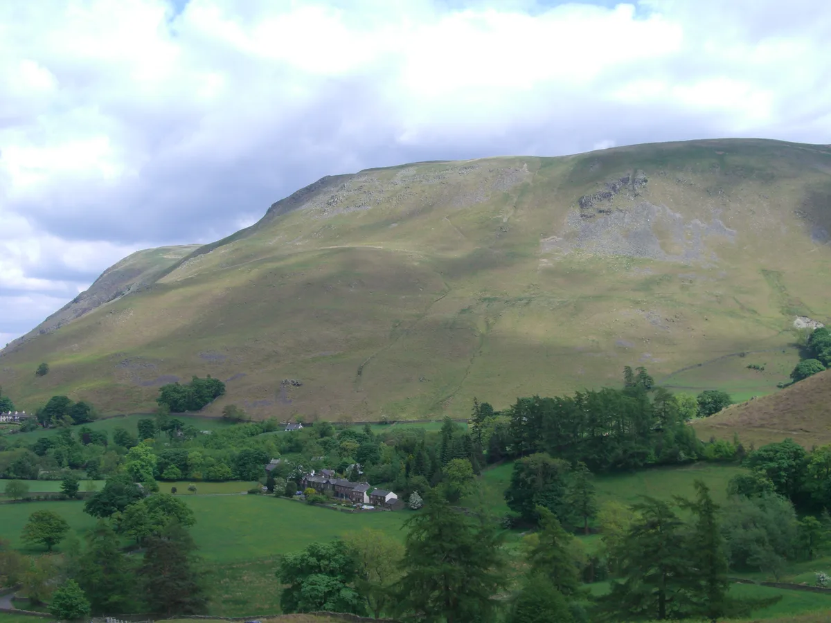
Brock Crag is a named summit in the United Kingdom. Wikidata describes it as: "Named summit at 562 m.". Coordinates: 54.5626°, -2.8478°.
Photo gallery
Protected designations
- Site of Special Scientific Interest: River Eden and Tributaries SSSI
Designations sourced from Natural England open data under OGL v3.
From the Wikipedia article
Brock Crags is a fell in the English Lake District, standing above Hartsop in the Far Eastern Fells. It forms part of the perimeter of Martindale, lying on the long ridge from Rampsgill Head to Place Fell.
Excerpt from Wikipedia under CC BY-SA 4.0. See the source article linked in Sources below.
- Coordinates
- 54.5626, -2.8478
- District
- Westmorland and Furness
- Parish
- Martindale
- Postcode
- CA10 2ND
- Parliamentary constituency
- Westmorland and Lonsdale
Sources
- osm: n676847378 (ODbL)
- wikipedia: Brock Crags (CC BY-SA 4.0)
- commons: Brock Crags and Angle Tarn Pikes.jpg (CC BY-SA 4.0)
Other places nearby
Loading nearby places…
Nearby
 📷 3
📷 3Stone circles · North East England
Swarth Fell Stone Circle
Swarth Fell Stone Circle — a stone circle in england-north-east, United Kingdom.
 📷 3
📷 3Natural landmarks · North East England
Loadpot Hill
Loadpot Hill — mountain in United Kingdom.
 📷 3
📷 3Mountains & hills · North East England
Loadpot Hill
Loadpot Hill — Named summit at 672 m.
 📷 3
📷 3Mountains & hills · North East England
Bonscale Pike
Bonscale Pike — Named summit at 524 m.
 📷 3
📷 3Natural landmarks · North East England
Bonscale Pike
Bonscale Pike — mountain in United Kingdom.
 📷 3
📷 3Historic houses · North East England
Howtown Hotel
Howtown Hotel — historic hotel in Howtown, Cumbria, England.
More mountains in this region
 📷 3
📷 3Mountains & hills · North East England
Angletarn Pikes
Angletarn Pikes — Named summit at 566 m.
 📷 3
📷 3Mountains & hills · North East England
Angletarn Pikes South Top
Angletarn Pikes South Top — Named summit at 563.6 m.
 📷 3
📷 3Mountains & hills · North East England
Ard Crags
Ard Crags — Named summit at 581 m.
 📷 3
📷 3Mountains & hills · North East England
Arnison Crag
Arnison Crag — Named summit at 433 m.
Frequently asked questions
- Where is Brock Crag?
- Brock Crag is in North-East England, United Kingdom (postcode CA10 2ND), in the parish of Martindale.
- Is Brock Crag a protected site?
- Yes — Brock Crag is part of the River Eden and Tributaries SSSI Site of Special Scientific Interest.
- Is Brock Crag free to visit?
- Yes, Brock Crag is free to enter.
- How do I get to Brock Crag?
- Drivers can navigate to postcode CA10 2ND. It sits within the Westmorland and Lonsdale parliamentary constituency.