Towns & cities · South East England
Brixton Deverill
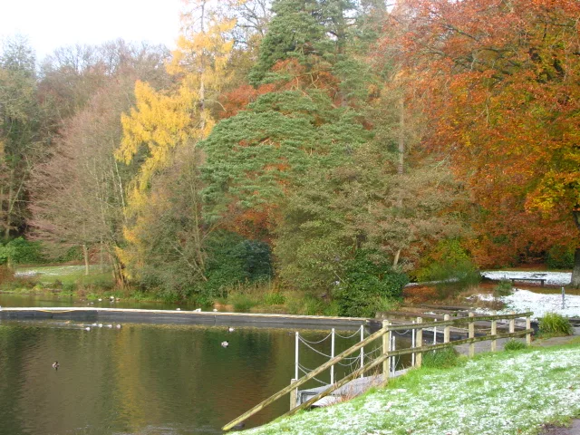
Brixton Deverill — village and civil parish in Wiltshire, England, UK.

Wikimedia Commons contributors — see linked file page for photographer and licence licence
Plan your visit
- Typical visit
- 3 h–6 h
- Nearest railway station
- Warminster · 6.7 km
- Free entry
- Family-friendly
- Dog-friendly
About
Brixton Deverill is a town, city, village or settlement in the United Kingdom. Recent population estimates put it at around 70 people. Address: BA12. Wikidata describes it as: "village and civil parish in Wiltshire, England, UK". Coordinates: 51.1480°, -2.1980°.
Photo gallery
Protected designations
- Area of Outstanding Natural Beauty: Cranborne Chase & West Wiltshire Downs
Designations sourced from Natural England open data under OGL v3.
From the Wikipedia article
Brixton Deverill is a small village and civil parish about 4 miles (6.4 km) south of Warminster in Wiltshire, England. The parish is in the Deverill Valley which carries the upper waters of the River Wylye. The six villages of the valley – Kingston Deverill, Monkton Deverill, Brixton, Hill Deverill, Longbridge Deverill and Crockerton – are known as the Deverills.
Excerpt from Wikipedia under CC BY-SA 4.0. See the source article linked in Sources below.
Background
History
There was a Roman road on Pertwood Down, about 2 km south-east of the village. The remains of a large Roman villa were discovered during the laying of a cable in a garden in the village in 2015. Subsequent excavations by archaeologists from Historic England and The Salisbury Museum found a mosaic floor from the mid-4th century, belonging to a grand villa arranged around three sides of a courtyard. In 1086, Domesday Book recorded a settlement called Devrel with 25 households, a church and a mill, on land held by the Abbey of Bec-Hellouin, Normandy. The lord in 1068 had been the Saxon Brictric, resulting in the 'Brixton' prefix to the placename. The abbey lost control of the estate during the…
Sourced from Wikipedia under CC BY-SA 4.0.
- Coordinates
- 51.1480, -2.1980
- District
- Wiltshire
- Parish
- Brixton Deverill
- Postcode
- BA12
- Parliamentary constituency
- South West Wiltshire
- Population
- 70
- Nearest railway station
- Warminster — 6.7 km
- Official site
- www.upperdeverills.co.uk
Sources
- wikidata: Q1812343 (CC0)
- wikipedia: Brixton Deverill (CC BY-SA 4.0)
- commons: Brixton Deverill.JPG (CC BY-SA 4.0)
Other places nearby
Loading nearby places…
Nearby
 📷 5
📷 5Memorials & monuments · South East England
Whiting Monument In The Churchyard, About 5 Metres South Of Tower Of Church Of St Alfred The Great
Whiting Monument In The Churchyard, About 5 Metres South Of Tower Of Church Of St Alfred The Great — Grade II listed building-listed memorial in england-south-east, United Kingdom.
 📷 4
📷 4Memorials & monuments · South East England
Unidentified Monument In The Churchyard About 1 Metre North Of Chancel Of Church Of The Assumption
Unidentified Monument In The Churchyard About 1 Metre North Of Chancel Of Church Of The Assumption — Grade II listed building-listed memorial in england-south-east, United Kingdom.
 📷 5
📷 5Towns & cities · South East England
Kingston Deverill
Kingston Deverill — village and civil parish in Wiltshire, England.
 📷 5
📷 5Memorials & monuments · South East England
Kingston Deverill War Memorial
Kingston Deverill War Memorial — Grade II listed building-listed memorial in england-south-east, United Kingdom.
Vineyards · South East England
Iron Age settlement on Cow Down, 990m north west of Haycombe Hill Farm
Iron Age settlement on Cow Down, 990m north west of Haycombe Hill Farm — a UK vineyard in england south east, producing English or Welsh wine from cool-climate grape varieties.
 📷 5
📷 5Natural landmarks · South East England
Shearwater
Shearwater — lake in the United Kingdom.
More towns in this region
 Flagship📷 10
Towns & cities · South East England
Aldermaston
Aldermaston — village and civil parish in West Berkshire in England, UK.
 Flagship📷 10
Towns & cities · South East England
Aldingbourne
Aldingbourne — village and civil parish in Arun, West Sussex, UK.
 Flagship📷 10
Towns & cities · South East England
Aldington
Aldington — village and civil parish in the Ashford District of Kent, England.
 Flagship📷 10
Towns & cities · South East England
Aldworth
Aldworth — village and civil parish in the English county of Berkshire.
Frequently asked questions
- Where is Brixton Deverill?
- Brixton Deverill is in South-East England, United Kingdom (postcode BA12), in the parish of Brixton Deverill.
- Is Brixton Deverill a protected site?
- Yes — Brixton Deverill is part of the Cranborne Chase & West Wiltshire Downs National Landscape (AONB).
- Is Brixton Deverill free to visit?
- Yes, Brixton Deverill is free to enter.
- How do I get to Brixton Deverill?
- The nearest railway station is Warminster, about 6.7 km away. Drivers can navigate to postcode BA12.