Towns & cities · South East England
Bredgar
Bredgar — village and civil parish in Kent, England, UK.

Wikimedia Commons contributors — see linked file page for photographer and licence licence
Plan your visit
- Typical visit
- 3 h–6 h
- Nearest railway station
- Warren Wood · 1.1 km
- Free entry
- Family-friendly
- Dog-friendly
About
Bredgar is a town, city, village or settlement in the United Kingdom. Recent population estimates put it at around 622 people. Wikidata describes it as: "village and civil parish in Kent, England, UK". Coordinates: 51.3000°, 0.7000°.
Photo gallery
Protected designations
- Area of Outstanding Natural Beauty: Kent Downs
Designations sourced from Natural England open data under OGL v3.
From the Wikipedia article
Bredgar is a village and civil parish in the Borough of Swale, Kent, England.
Excerpt from Wikipedia under CC BY-SA 4.0. See the source article linked in Sources below.
Background
History
A hoard of 34 Roman gold aurei was discovered in the parish in 1957. It is thought to be related to the Claudian invasion, possibly buried by a soldier before the Battle of the Medway. In the reign of King Henry III (12th century), Robert de Bredgar, resided here and his name appears in an ancient roll of the benefactors to the monastery of Davington (in Faversham). The village was then named after this family.
Description
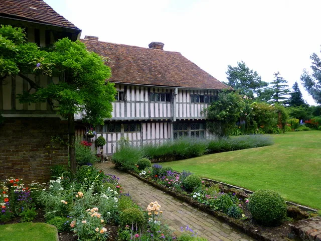
The parish includes several Grade II listed buildings. These include Swanton Court, a 16th-century house, and the 15th century Mann's Place. Bredgar House is in the centre of the village, and was constructed in the 18th century. A war memorial was constructed in the village centre by the pond in 1920, to commemorate soldiers fallen in World War I, and later updated for World War II. It was Grade II listed in 2007. The parish also has its own church, St John The Baptist Church, which is in the diocese of Canterbury, and the deanery of Sittingbourne. King Henry III gave out alms from this church to the leprous women of the hospital of St. James, (alias St. Jacob), near Thanington, near…
Sourced from Wikipedia under CC BY-SA 4.0.
- Coordinates
- 51.3000, 0.7000
- County
- Kent
- District
- Swale
- Parish
- Bredgar
- Postcode
- ME9 8GE
- Parliamentary constituency
- Faversham and Mid Kent
- Population
- 622
- Nearest railway station
- Warren Wood — 1.1 km
- Official site
- www.neighbourhood.statistics.gov.uk
Sources
- wikidata: Q595600 (CC0)
- wikipedia: Bredgar (CC BY-SA 4.0)
- commons: War memorial and Bredgar House - geograph.org.uk - 130790.jpg (CC BY-SA 4.0)
Other places nearby
Loading nearby places…
Nearby
 Flagship📷 5
Stately homes · South East England
Bexon Manor
Bexon Manor — manor house in Bredgar, Kent, England, UK.
 📷 5
📷 5Museums · South East England
Bredgar and Wormshill Light Railway
The Bredgar and Wormshill Light Railway (BWLR) is located near the villages of Wormshill and Bredgar in Kent, just south of Sittingbourne. It is a 2 ft (610 mm) narrow gauge railway about three-quart
 📷 5
📷 5Historic houses · South East England
Chantry House
Chantry House — Grade II* listed building in Bredgar, Kent, England, UK.
Campsites · South East England
Bexon Lane Scout Campsite
Bexon Lane Scout Campsite — a campsite in england south east.
 📷 5
📷 5Historic churches · South East England
St Giles, Wormshill
St Giles, Wormshill — a Grade II*-listed church in england-south-east, United Kingdom.
 📷 5
📷 5Memorials & monuments · South East England
War Memorial to the Third Battalion of the Gloucestershire Regiment
War Memorial to the Third Battalion of the Gloucestershire Regiment — Grade II listed building-listed memorial in england-south-east, United Kingdom.
More towns in this region
 Flagship📷 10
Towns & cities · South East England
Aldermaston
Aldermaston — village and civil parish in West Berkshire in England, UK.
 Flagship📷 10
Towns & cities · South East England
Aldingbourne
Aldingbourne — village and civil parish in Arun, West Sussex, UK.
 Flagship📷 10
Towns & cities · South East England
Aldington
Aldington — village and civil parish in the Ashford District of Kent, England.
 Flagship📷 10
Towns & cities · South East England
Aldworth
Aldworth — village and civil parish in the English county of Berkshire.
Frequently asked questions
- Where is Bredgar?
- Bredgar is in Kent, South-East England, United Kingdom (postcode ME9 8GE), in the parish of Bredgar.
- Is Bredgar a protected site?
- Yes — Bredgar is part of the Kent Downs National Landscape (AONB).
- Is Bredgar free to visit?
- Yes, Bredgar is free to enter.
- How do I get to Bredgar?
- The nearest railway station is Warren Wood, about 1.1 km away. Drivers can navigate to postcode ME9 8GE.