Viewpoints · South West England
Brea Hill
Also known as: Bre
Brea Hill is a viewpoint in the United Kingdom.

Wikimedia Commons contributors — see linked file page for photographer and licence licence
Plan your visit
- Typical visit
- 20 min–45 min
- Best time of year
- Clear days year-round
- Free entry
- Dog-friendly
About
Brea Hill is a named viewpoint in the United Kingdom. Also known as: Bre. Coordinates: 50.5572°, -4.9260°. This entry is part of The Great Britain Guide, a free, ad-free, open-data tourist directory.
Photo gallery
Protected designations
- Site of Special Scientific Interest: Rock Dunes SSSI
- Area of Outstanding Natural Beauty: Cornwall
Designations sourced from Natural England open data under OGL v3.
From the Wikipedia article
Brea Hill (Cornish: Bre, meaning hill), pronounced "Bray Hill" is a round hill beside the River Camel estuary in north Cornwall, England, United Kingdom The hill is 62 metres (203 ft) high and there are Bronze Age tumuli (burial mounds) at the summit. The underlying geology in this area of Cornwall is Devonian slates. Brea Hill is situated at the south end of Daymer Bay between the settlements of Trebetherick and Rock in the civil parish of St Minver Lowlands. approximately five miles northwest of Wadebridge On the west side, Brea Hill rises straight from the foreshore; on the north and south it rises from low sand dunes. To the east, the dunes give way to a golf course and grassland with St Enodoc's Church (where the poet Sir John Betjeman is buried) just below the hill. Brea Hill is within the Rock Dunes SSSI (Site of Special Scientific Interest). The reason that Brea Hill is such a positive feature in the landscape is that the centre of the hill, west to east, is a dolerite dyke, well-seen from the beach on the west and in the quarry on the east slope and in both exposures soft-sediment deformation is seen implying the intrusion followed shortly after deposition of the material which later became slate during the Variscan Orogeny. The dyke is shown on the British Geological Survey map Sheets 335 and 336, and memoir, for the Geology around Trevose Head and Camelford. The South West Coast Path follows the west flank of the hill with an alternative route passing to the east. Brea Hill is grassed and treeless (except for a small wooded area low on the south flank) with rough footpaths leading to the summit and burial mounds.
Excerpt from Wikipedia under CC BY-SA 4.0. See the source article linked in Sources below.
- Coordinates
- 50.5572, -4.9260
- District
- Cornwall
- Parish
- St. Minver Lowlands
- Postcode
- PL27 6SH
- Parliamentary constituency
- North Cornwall
Sources
- osm: n1290854413 (ODbL)
- wikipedia: Brea Hill (CC BY-SA 4.0)
- commons: Brea Hill, Trebetherick - geograph.org.uk - 29595.jpg (CC BY-SA 4.0)
Other places nearby
Loading nearby places…
Nearby
 📷 5
📷 5Historic churches · South West England
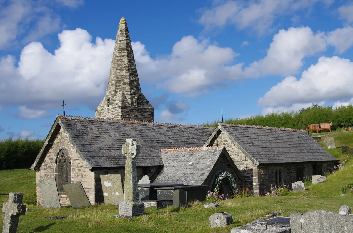
St Enodoc's Church, Trebetherick
St Enodoc's Church, Trebetherick — church in Cornwall, England, UK.
 📷 5
📷 5Mountains & hills · South West England
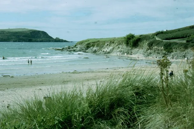
Daymer Bay
Daymer Bay — bay in Cornwall, England, UK.
 📷 5
📷 5Beaches · South West England
Daymer Bay
Daymer Bay is a beach in the United Kingdom.
 📷 5
📷 5Beaches · South West England
Jutty
Jutty is a beach in the United Kingdom.
 📷 5
📷 5Beaches · South West England
Gully
Gully is a beach in the United Kingdom.
 📷 5
📷 5Historic churches · South West England
Trebetherick
Trebetherick — a church in england-south-west, United Kingdom.
More viewpoints in this region
 📷 5
📷 5Viewpoints · South West England
199
199 — Named viewpoint at 69.099976 m elevation.
 📷 5
📷 5Viewpoints · South West England
Artists Chair
Artists Chair is a viewpoint in the United Kingdom.
 📷 5
📷 5Viewpoints · South West England
Bass Point
Bass Point is a viewpoint in the United Kingdom.
 📷 5
📷 5Viewpoints · South West England
Beacon
Beacon is a viewpoint in the United Kingdom.
Frequently asked questions
- Where is Brea Hill?
- Brea Hill is in South-West England, United Kingdom (postcode PL27 6SH), in the parish of St. Minver Lowlands.
- Is Brea Hill a protected site?
- Yes — Brea Hill is part of the Rock Dunes SSSI Site of Special Scientific Interest and the Cornwall National Landscape (AONB).
- Is Brea Hill free to visit?
- Yes, Brea Hill is free to enter.
- How do I get to Brea Hill?
- Drivers can navigate to postcode PL27 6SH. It sits within the North Cornwall parliamentary constituency.