Beaches · South West England
Bovisand Beach
Bovisand Beach is a beach in the United Kingdom.

Wikimedia Commons licence
Plan your visit
- Typical visit
- 1 h–3 h
- Best time of year
- Summer (Jun–Aug)
- Nearest railway station
- Plymouth · 5.0 km
- Free entry
- Family-friendly
- Dog-friendly
About
Bovisand Beach is a named beach on the United Kingdom coastline. Coordinates: 50.3357°, -4.1199°. This entry is part of The Great Britain Guide, a free, ad-free, open-data tourist directory.
Photo gallery
Protected designations
- Site of Special Scientific Interest: Plymouth Sound Shores and Cliffs SSSI
- Area of Outstanding Natural Beauty: South Devon
Designations sourced from Natural England open data under OGL v3.
From the Wikipedia article
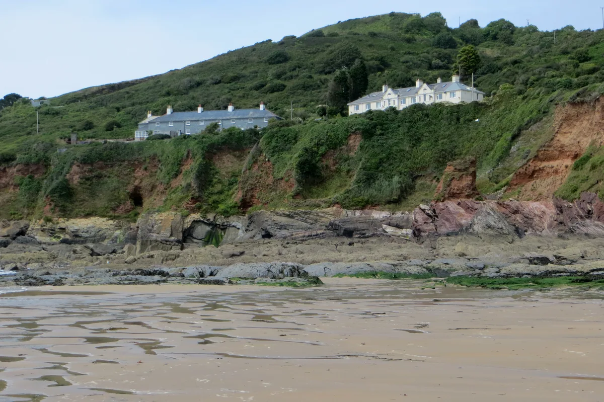
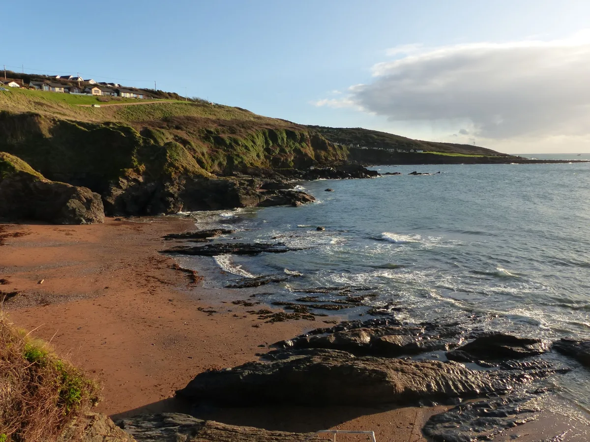
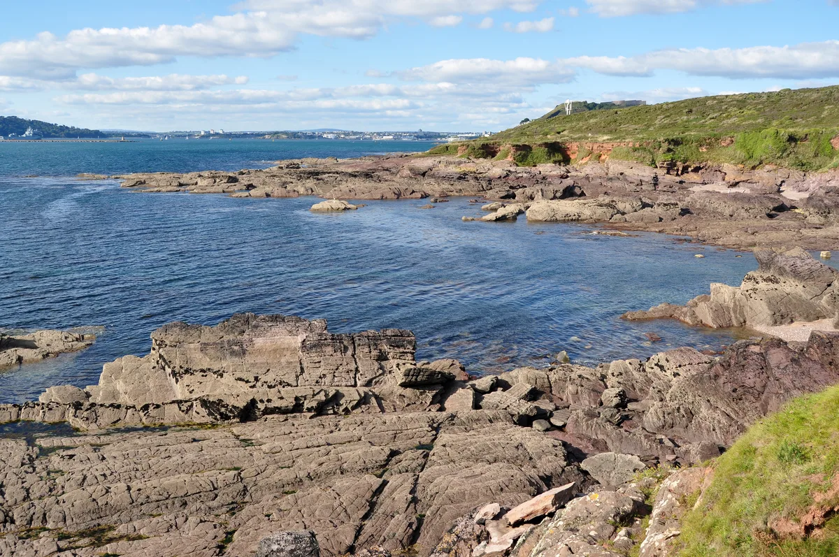
Bovisand is a natural coastline on the east side of Plymouth Sound in Devon, England. Despite the steep cliff paths and rocky surrounding, Bovisand features two beaches, a holiday park, privately owned bungalows and a diving centre at Fort Bovisand. The area, in the vicinity of Plymouth and Wembury, is used predominantly by locals, while tourists prefer the larger and better-known beaches elsewhere. It is often referred to as simply Bovi by locals. It lies just outside the boundaries of the city of Plymouth, within the district of South Hams, and is within the South Devon Area of Outstanding Natural Beauty. There are two beaches at Bovisand, the first named Bovisand Bay is the northernmost separated from the southernmost, Crownhill Bay, by rocks and a grass bank, commonly known as "Grassy". Both beaches are accessible only by steps, and are served by a cafe and a small tourist shop, but have no lifeguards. Plymouth Council provide a bus direct to the bay from the city centre of Plymouth between May and August. The view from Bovisands includes Plymouth Breakwater, Mount Edgcumbe in Cornwall just across Plymouth Sound, and the English Channel. Bovisand Pier (which was built between 1816 and 1824) and the harbour area are listed at grade II with Historic England.
Excerpt from Wikipedia under CC BY-SA 4.0. See the source article linked in Sources below.
- Coordinates
- 50.3357, -4.1199
- County
- Devon
- District
- South Hams
- Parish
- Wembury
- Postcode
- PL9 0AD
- Parliamentary constituency
- South West Devon
- Nearest railway station
- Plymouth — 5 km
Sources
- osm: w314327703 (ODbL)
- wikipedia: Bovisand (CC BY-SA 4.0)
Other places nearby
Loading nearby places…
Nearby
 📷 5
📷 5Mountains & hills · South West England
Bovisand Bay
Bovisand Bay — bay in the United Kingdom.
 📷 3
📷 3Castles · South West England
Bovisand
Bovisand — a castle in england-south-west, United Kingdom.
 📷 5
📷 5Forts · South West England
Bovisand Fort
Bovisand Fort is a fort in the United Kingdom.
 📷 5
📷 5Mountains & hills · South West England
Crownhill Bay
Crownhill Bay — bay in the United Kingdom.
Campsites · South West England
Plymouth Sound
Plymouth Sound — a campsite in england south west.
 📷 3
📷 3Mountains & hills · South West England
Westlake Bay
Westlake Bay is a mountain or hill in the United Kingdom.
More beaches in this region
 📷 5
📷 5Beaches · South West England
Amy's Cove
Amy's Cove is a beach in the United Kingdom.
 📷 5
📷 5Beaches · South West England
Arlo Porth
Arlo Porth is a beach in the United Kingdom.
 📷 5
📷 5Beaches · South West England
Arthur's Beach (Sunny Cove)
Arthur's Beach (Sunny Cove) is a beach in the United Kingdom.
 📷 5
📷 5Beaches · South West England
Ayrmer Cove
Ayrmer Cove is a beach in the United Kingdom.
Frequently asked questions
- Where is Bovisand Beach?
- Bovisand Beach is in Devon, South-West England, United Kingdom (postcode PL9 0AD), in the parish of Wembury.
- Is Bovisand Beach a protected site?
- Yes — Bovisand Beach is part of the Plymouth Sound Shores and Cliffs SSSI Site of Special Scientific Interest and the South Devon National Landscape (AONB).
- Is Bovisand Beach free to visit?
- Yes, Bovisand Beach is free to enter.
- How do I get to Bovisand Beach?
- The nearest railway station is Plymouth, about 5.0 km away. Drivers can navigate to postcode PL9 0AD.