Castles · North East England
Bournmoor
Bournmoor in England North East, United Kingdom.

Robert Graham — CC BY-SA 2.0 via Wikimedia Commons licence
Plan your visit
- Typical visit
- 1.5 h–3 h
- Family-friendly
- Limited wheelchair access
About
Bournmoor is a place of interest in England North East, United Kingdom — drawn from open-data sources for visitor reference. See the linked Wikipedia article for the full description.
Photo gallery
From the Wikipedia article
Bournmoor ( or ) is a village in County Durham, England, and is situated a short distance from Chester-le-Street. It contains St Barnabas' Church, which houses the Frostley Angel. Originally part of the Lambton Castle estate, the village developed from 1783 onwards with the sinking of the first of seven local coal mines that were to make up Lambton Colliery. For much of the 20th century, "Bournmoor" was known as "Burnmoor", taking its name from the Moorsburn (an alternative name for Hutton Burn which runs through the village.) The local primary school is called Bournmoor Primary School, although the local scout group, formed early in the 20th century, still carries the name "Burnmoor" in its title. The mid-19th century Ordnance Survey map shows the old core of the village (the staff housing for the Lambton estate) as "Wapping", with the open country to the south of the Sunderland road and north west of Herrington Burn shown as "Bourn Moor" and the colliery complex which was later known as Lambton is shown as Bourn Moor Colliery. The end-19th century map shows the settlement as "Bournmoor". Maps produced after the development of the 'Flowers' estate, dated between 1920 and 1960 show both as "Burnmoor" but they reverted to "Bournmoor" in later maps. In 1913, the parish councils of "Bourn Moor" and "Morton Grange" complained to the Board of Trade about the poor facilities available to passengers at Fencehouses railway station. Sporting facilities in the village include cricket, football and tennis clubs situated near to the church.
Excerpt from Wikipedia under CC BY-SA 4.0. See the source article linked in Sources below.
- Coordinates
- 54.8580, -1.5140
- District
- County Durham
- Parish
- Bournmoor
- Postcode
- DH4 6EY
- Parliamentary constituency
- North Durham
- Official site
- www.neighbourhood.statistics.gov.uk
Sources
Other places nearby
Loading nearby places…
Nearby
 📷 3
📷 3Other places · North East England
New Lambton
New Lambton in England North East, United Kingdom.
📷 4Other places · North East England
Leamside Line
Leamside Line in England North East, United Kingdom.
 📷 3
📷 3Memorials & monuments · Scottish Lowlands
Fencehouses War Memorial
Fencehouses War Memorial — a memorial in scotland-lowlands, United Kingdom.
📷 3Memorials & monuments · Scottish Lowlands
Fence Houses War Memorial including wall, piers and railings
Fence Houses War Memorial including wall, piers and railings — Grade II listed building-listed memorial in scotland-lowlands, United Kingdom.
 📷 3
📷 3Historic houses · Scottish Lowlands
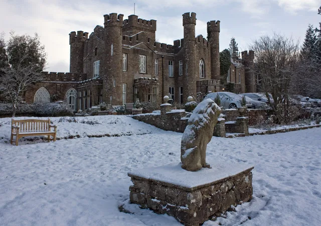
Biddick Hall
Biddick Hall — Grade I listed building in County Durham, England, UK.
 📷 3
📷 3Towns & cities · Scottish Lowlands
Woodstone
Woodstone — village in County Durham, United Kingdom.
More castles in this region
 📷 5
📷 5Castles · North East England
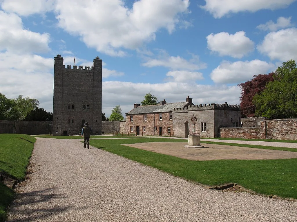
Appleby Castle
Appleby Castle — Grade I listed English country house in Appleby-in-Westmorland, United Kingdom.
 📷 3
📷 3Castles · North East England
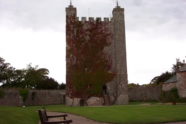
Appleby Castle, uninhabited portions
Appleby Castle, uninhabited portions — castle in Appleby-in-Westmorland, Cumbria, England, UK.
 📷 3
📷 3Castles · North East England
Augill Castle
Augill Castle — castle in Stainmore, Westmorland and Furness, Cumbria, England, UK.
 📷 5
📷 5Castles · North East England
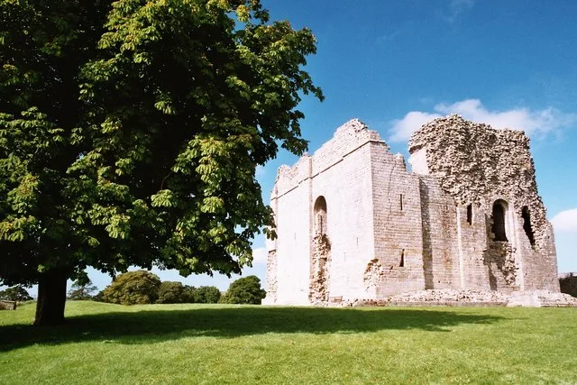
Bowes Castle
Bowes Castle — castle in County Durham, England, UK.
Frequently asked questions
- Where is Bournmoor?
- Bournmoor is in North-East England, United Kingdom (postcode DH4 6EY), in the parish of Bournmoor.
- Does Bournmoor charge admission?
- Bournmoor typically charges admission. Check the official site for current ticket prices and opening hours.
- How do I get to Bournmoor?
- Drivers can navigate to postcode DH4 6EY. It sits within the North Durham parliamentary constituency.